 |
|
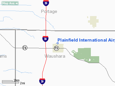
Location & QuickFacts
| FAA Information Effective: | 2008-09-25 |
| Airport Identifier: | 5WI2 |
| Airport Status: | Operational |
| Longitude/Latitude: | 089-29-43.4370W/44-13-20.9010N
-89.495399/44.222473 (Estimated) |
| Elevation: | 1110 ft / 338.33 m (Estimated) |
| Land: | 10 acres |
| From nearest city: | 0 nautical miles N of Plainfield, WI |
| Location: | Waushara County, WI |
| Magnetic Variation: | 01W (1995) |
Owner & Manager
| Ownership: | Privately owned |
| Owner: | John Carlson |
| Address: | N6729 6th Drive
Plainfield, WI 54966 |
| Phone number: | 715-335-4312 |
| Manager: | John Carlson |
| Address: | N6729 6th Drive
Plainfield, WI 54966 |
| Phone number: | 715-335-4312 |
Airport Operations and Facilities
| Airport Use: | Private |
| Wind indicator: | Yes |
| Segmented Circle: | No |
| Control Tower: | No |
| Sectional chart: | Green Bay |
| Region: | AGL - Great Lakes |
| Boundary ARTCC: | ZMP - Minneapolis |
| Tie-in FSS: | GRB - Green Bay |
| FSS on Airport: | No |
| FSS Toll Free: | 1-800-WX-BRIEF |
Runway Information
Runway 09/27
| Dimension: | 1070 x 50 ft / 326.1 x 15.2 m |
| Surface: | TURF, Good Condition |
| |
Runway 09 |
Runway 27 |
| Traffic Pattern: | Left | Left |
| Obstruction: | 10 ft road, 1200.0 ft from runway | 10 ft road, 300.0 ft from runway |
|
Radio Navigation Aids
| ID |
Type |
Name |
Ch |
Freq |
Var |
Dist |
| ISW | NDB | Wisconsin Rapids | | 215.00 | 01W | 17.1 nm |
| PCZ | NDB | Waupaca | | 382.00 | 01W | 21.6 nm |
| MFI | NDB | Marshfield | | 391.00 | 00E | 38.9 nm |
| CLI | NDB | Clintonville | | 209.00 | 02W | 40.5 nm |
| FZK | NDB | Wausau | | 243.00 | 01E | 42.8 nm |
| AQ | NDB | Kooky | | 407.00 | 02W | 47.2 nm |
| VIQ | NDB | Neillsville | | 368.00 | 01W | 48.2 nm |
| HBW | NDB | Kickapoo | | 251.00 | 03E | 49.8 nm |
| VOK | TACAN | Volk | 041X | | 00E | 37.0 nm |
| STE | VORTAC | Stevens Point | 043X | 110.60 | 01W | 19.3 nm |
| AUW | VORTAC | Wausau | 053X | 111.60 | 02E | 37.7 nm |
| DLL | VORTAC | Dells | 117X | 117.00 | 03E | 42.0 nm |
| OSH | VORTAC | Oshkosh | 055X | 111.80 | 02E | 42.9 nm |
Remarks
- (E111-1) REAGE SPRAYING SERVICE ARPT AGREES IN WRITING TO CONTINUE TO USE TFC PATS AS PREVIOUSLY STATED; UNNAMED LANDING STRIP 4000 FT TO SW REMAINS ABNDD.
- PRVDD OBSTNS LOWERED/REMOVED OR THLDS DSPLCD TO PROVIDE CLEAR 20:1 APCH; AREA 125 FT EITHER SIDE OF CNTRLN & 200 FT OFF RY ENDS ARE CLEAR OF OBSTNS; AREA 60 FT EITHER SIDE OF RY CNTRLN& 240 FT OFF RY ENDS ARE FREE OF RUTS.
Images and information placed above are from
http://www.airport-data.com/airport/5WI2/
We thank them for the data!
| General Info
|
| Country |
United States
|
| State |
WISCONSIN
|
| FAA ID |
5WI2
|
| Latitude |
44-13-20.901N
|
| Longitude |
089-29-43.437W
|
| Elevation |
1110 feet
|
| Near City |
PLAINFIELD
|
We don't guarantee the information is fresh and accurate. The data may
be wrong or outdated.
For more up-to-date information please refer to other sources.
|
|


