 |
|
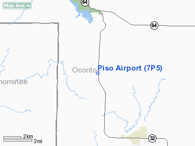
Location & QuickFacts
| FAA Information Effective: | 2008-09-25 |
| Airport Identifier: | 7P5 |
| Airport Status: | Operational |
| Longitude/Latitude: | 088-25-35.3730W/45-03-54.9390N
-88.426493/45.065261 (Estimated) |
| Elevation: | 891 ft / 271.58 m (Surveyed) |
| Land: | 55 acres |
| From nearest city: | 4 nautical miles NW of Suring, WI |
| Location: | Oconto County, WI |
| Magnetic Variation: | 01E (1995) |
Owner & Manager
| Ownership: | Privately owned |
| Owner: | Nickolas Piso |
| Address: | 4021 S 76th St
Milwaukee, WI 53220 |
| Phone number: | 414-543-4780 |
| Manager: | Nickolas Piso |
| Address: | 4021 S 76th St
Milwaukee, WI 53220 |
| Phone number: | 414-543-4780 |
Airport Operations and Facilities
| Airport Use: | Open to public |
| Wind indicator: | Yes |
| Segmented Circle: | No |
| Control Tower: | No |
| Landing fee charge: | No |
| Sectional chart: | Green Bay |
| Region: | AGL - Great Lakes |
| Traffic Pattern Alt: | 500 ft |
| Boundary ARTCC: | ZMP - Minneapolis |
| Tie-in FSS: | GRB - Green Bay |
| FSS on Airport: | No |
| FSS Toll Free: | 1-800-WX-BRIEF |
| NOTAMs Facility: | GRB (NOTAM-d service avaliable) |
Airport Communications
Airport Services
| Fuel available: | MOGAS
FUEL AVBL & LOCAL FULL SERVICE GAS STATION N END OF FIELD DURG DALGT HRS. |
| Airframe Repair: | NONE |
| Power Plant Repair: | NONE |
| Bottled Oxygen: | NONE |
| Bulk Oxygen: | NONE |
Runway Information
Runway 01/19
| Dimension: | 2080 x 55 ft / 634.0 x 16.8 m |
| Surface: | TURF, Fair Condition |
| |
Runway 01 |
Runway 19 |
| Traffic Pattern: | Left | Left |
| Obstruction: | 62 ft trees, 100 ft left of centerline | 20 ft trees, 0.0 ft from runway, 100 ft right of centerline |
|
Radio Navigation Aids
| ID |
Type |
Name |
Ch |
Freq |
Var |
Dist |
| OCQ | NDB | Oconto | | 388.00 | 03W | 24.6 nm |
| AIG | NDB | Antigo | | 347.00 | 02W | 29.7 nm |
| CLI | NDB | Clintonville | | 209.00 | 02W | 29.8 nm |
| SG | NDB | Depre | | 332.00 | 02W | 42.0 nm |
| SUE | NDB | Sturgeon Bay | | 414.00 | 03W | 44.9 nm |
| MNM | VOR/DME | Menominee | 033X | 109.60 | 00E | 33.8 nm |
| IMT | VOR/DME | Iron Mountain | 049X | 111.20 | 02W | 47.0 nm |
| GRB | VORTAC | Green Bay | 102X | 115.50 | 01E | 32.2 nm |
Remarks
- RYS NOT PLOWED & ARPT CLSD NOV 15 THRU MAR 31.
Images and information placed above are from
http://www.airport-data.com/airport/7P5/
We thank them for the data!
| General Info
|
| Country |
United States
|
| State |
WISCONSIN
|
| FAA ID |
7P5
|
| Latitude |
45-03-54.939N
|
| Longitude |
088-25-35.373W
|
| Elevation |
891 feet
|
| Near City |
SURING
|
We don't guarantee the information is fresh and accurate. The data may
be wrong or outdated.
For more up-to-date information please refer to other sources.
|
|


