 |
|
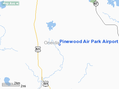
Pinewood Air Park Airport |
Location & QuickFacts
| FAA Information Effective: | 2008-09-25 |
| Airport Identifier: | WS39 |
| Airport Status: | Operational |
| Longitude/Latitude: | 089-39-44.5090W/45-41-57.8440N
-89.662364/45.699401 (Estimated) |
| Elevation: | 1560 ft / 475.49 m (Estimated) |
| Land: | 24 acres |
| From nearest city: | 1 nautical miles NE of Goodnow, WI |
| Location: | Oneida County, WI |
| Magnetic Variation: | 00W (1985) |
Owner & Manager
| Ownership: | Privately owned |
| Owner: | A. H. Bromann |
| Address: | 4705 Lakewood Rd
Goodnow, WI 54529 |
| Phone number: | 715-282-5500 |
| Manager: | A. H. Bromann |
| Address: | 4705 Lakewood Rd
Goodnow, WI 54529 |
| Phone number: | 715-282-5500 |
Airport Operations and Facilities
| Airport Use: | Private |
| Wind indicator: | Yes |
| Segmented Circle: | No |
| Control Tower: | No |
| Sectional chart: | Green Bay |
| Region: | AGL - Great Lakes |
| Boundary ARTCC: | ZMP - Minneapolis |
| Tie-in FSS: | GRB - Green Bay |
| FSS Toll Free: | 1-800-WX-BRIEF |
Runway Information
Runway 15/33
| Dimension: | 2722 x 70 ft / 829.7 x 21.3 m |
| Surface: | TURF, |
| |
Runway 15 |
Runway 33 |
| Traffic Pattern: | Left | Left |
| Displaced threshold: | 800.00 ft | 0.00 ft |
|
Radio Navigation Aids
| ID |
Type |
Name |
Ch |
Freq |
Var |
Dist |
| DO | NDB | Dougy | | 236.00 | 01W | 8.6 nm |
| ARV | NDB | Arbor Vitae | | 221.00 | 01W | 13.9 nm |
| EGV | NDB | Eagle River | | 341.00 | 02W | 21.8 nm |
| BDJ | NDB | Boulder Junction | | 206.00 | 02E | 26.1 nm |
| MHA | NDB | Manitowish | | 364.00 | 01W | 27.1 nm |
| RRL | NDB | Merrill | | 257.00 | 01W | 30.2 nm |
| PBH | NDB | Phillips | | 263.00 | 00E | 31.5 nm |
| LNL | NDB | Land O Lakes | | 396.00 | 02W | 33.0 nm |
| PKF | NDB | Park Falls | | 371.00 | 01W | 35.4 nm |
| RXW | NDB | Watersmeet | | 407.00 | 01E | 38.9 nm |
| AIG | NDB | Antigo | | 347.00 | 02W | 39.9 nm |
| MDZ | NDB | Medford | | 335.00 | 00E | 44.9 nm |
| FZK | NDB | Wausau | | 243.00 | 01E | 46.4 nm |
| RHI | VORTAC | Rhinelander | 029X | 109.20 | 02E | 9.5 nm |
Remarks
- AIRPORT PLOWED WINTER MONTHS.
- PRVDD OBS ARE REMOVED/LOWERED OR THR DSPLCD TO PRVD 20:1 CLNC.
Images and information placed above are from
http://www.airport-data.com/airport/WS39/
We thank them for the data!
| General Info
|
| Country |
United States
|
| State |
WISCONSIN
|
| FAA ID |
WS39
|
| Latitude |
45-41-57.844N
|
| Longitude |
089-39-44.509W
|
| Elevation |
1560 feet
|
| Near City |
GOODNOW
|
We don't guarantee the information is fresh and accurate. The data may
be wrong or outdated.
For more up-to-date information please refer to other sources.
|
|


