 |
|
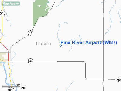
Location & QuickFacts
| FAA Information Effective: | 2008-09-25 |
| Airport Identifier: | WI87 |
| Airport Status: | Operational |
| Longitude/Latitude: | 089-31-28.0000W/45-12-12.0000N
-89.524444/45.203333 (Estimated) |
| Elevation: | 1370 ft / 417.58 m (Estimated) |
| Land: | 53 acres |
| From nearest city: | 8 nautical miles E of Merrill, WI |
| Location: | Lincoln County, WI |
| Magnetic Variation: | 01W (1990) |
Owner & Manager
| Ownership: | Privately owned |
| Owner: | Kevin & Brian Neitzel |
| Address: | W 2021 Townline Rd
Merrill, WI 54452 |
| Phone number: | 715-536-7394 |
| Manager: | Kevin Neitzel |
| Address: | W 2021 Townline Rd
Merrill, WI 54452 |
| Phone number: | 414-771-4068 |
Airport Operations and Facilities
| Airport Use: | Private |
| Wind indicator: | Yes |
| Segmented Circle: | No |
| Control Tower: | No |
| Sectional chart: | Green Bay |
| Region: | AGL - Great Lakes |
| Boundary ARTCC: | ZMP - Minneapolis |
| Tie-in FSS: | GRB - Green Bay |
| FSS on Airport: | No |
| FSS Toll Free: | 1-800-WX-BRIEF |
Runway Information
Runway 09/27
| Dimension: | 1550 x 80 ft / 472.4 x 24.4 m |
| Surface: | TURF, Good Condition |
| |
Runway 09 |
Runway 27 |
| Traffic Pattern: | Left | Left |
| Obstruction: | 50 ft trees, 1090.0 ft from runway | 20 ft trees, 400.0 ft from runway |
|
Radio Navigation Aids
| ID |
Type |
Name |
Ch |
Freq |
Var |
Dist |
| RRL | NDB | Merrill | | 257.00 | 01W | 7.6 nm |
| FZK | NDB | Wausau | | 243.00 | 01E | 17.1 nm |
| AIG | NDB | Antigo | | 347.00 | 02W | 17.6 nm |
| MDZ | NDB | Medford | | 335.00 | 00E | 33.8 nm |
| DO | NDB | Dougy | | 236.00 | 01W | 38.9 nm |
| MFI | NDB | Marshfield | | 391.00 | 00E | 44.0 nm |
| ARV | NDB | Arbor Vitae | | 221.00 | 01W | 44.3 nm |
| EGV | NDB | Eagle River | | 341.00 | 02W | 45.2 nm |
| PBH | NDB | Phillips | | 263.00 | 00E | 48.0 nm |
| CLI | NDB | Clintonville | | 209.00 | 02W | 48.7 nm |
| AUW | VORTAC | Wausau | 053X | 111.60 | 02E | 21.6 nm |
| RHI | VORTAC | Rhinelander | 029X | 109.20 | 02E | 26.0 nm |
| STE | VORTAC | Stevens Point | 043X | 110.60 | 01W | 39.7 nm |
Remarks
- PRVDD OBSTN ARE LOWERED OR REMOVED OR THE THLD DSPLCD; AREA AROUND RYS ARE CLEAR OF OBSTNS.
Images and information placed above are from
http://www.airport-data.com/airport/WI87/
We thank them for the data!
| General Info
|
| Country |
United States
|
| State |
WISCONSIN
|
| FAA ID |
WI87
|
| Latitude |
44-38-27.865N
|
| Longitude |
091-30-45.572W
|
| Elevation |
990 feet
|
| Near City |
ELEVA
|
We don't guarantee the information is fresh and accurate. The data may
be wrong or outdated.
For more up-to-date information please refer to other sources.
|
|


