 |
|
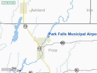
Location & QuickFacts
| FAA Information Effective: | 2008-09-25 |
| Airport Identifier: | PKF |
| Airport Status: | Operational |
| Longitude/Latitude: | 090-25-27.9050W/45-57-18.0850N
-90.424418/45.955024 (Estimated) |
| Elevation: | 1500 ft / 457.20 m (Surveyed) |
| Land: | 72 acres |
| From nearest city: | 2 nautical miles NE of Park Falls, WI |
| Location: | Price County, WI |
| Magnetic Variation: | 01W (2000) |
Owner & Manager
| Ownership: | Publicly owned |
| Owner: | City Of Park Falls |
| Address: | City Hall 400 4th Ave South
Park Falls, WI 54552 |
| Phone number: | 715-762-2436 |
| Manager: | Brian Ernst |
| Address: | 7198 City Wells Rd
Park Falls, WI 54552 |
| Phone number: | 715-762-3971 |
Airport Operations and Facilities
| Airport Use: | Open to public |
| Wind indicator: | Yes |
| Segmented Circle: | Yes |
| Control Tower: | No |
| Lighting Schedule: | DUSK-DAWN
OTS INDEFLY. |
| Beacon Color: | Clear-Green (lighted land airport) |
| Landing fee charge: | No |
| Sectional chart: | Green Bay |
| Region: | AGL - Great Lakes |
| Boundary ARTCC: | ZMP - Minneapolis |
| Tie-in FSS: | GRB - Green Bay |
| FSS on Airport: | No |
| FSS Toll Free: | 1-800-WX-BRIEF |
| NOTAMs Facility: | GRB (NOTAM-d service avaliable) |
| Federal Agreements: | NGY |
Airport Communications
Airport Services
| Fuel available: | 100LLMOGAS
FOR FUEL CALL 715-762-3971. |
| Bottled Oxygen: | NONE |
| Bulk Oxygen: | NONE |
Runway Information
Runway 18/36
| Dimension: | 3200 x 60 ft / 975.4 x 18.3 m |
| Surface: | ASPH, Good Condition |
| Weight Limit: | Single wheel: 20000 lbs. |
| Edge Lights: | Medium |
| |
Runway 18 |
Runway 36 |
| Longitude: | 090-25-26.7500W | 090-25-29.0600W |
| Latitude: | 45-57-33.8600N | 45-57-02.3100N |
| Elevation: | 1492.00 ft | 1500.00 ft |
| Alignment: | 127 | 3 |
| Traffic Pattern: | Left | Left |
| Markings: | Non-precision instrument, Good Condition | Non-precision instrument, Good Condition |
| Crossing Height: | 29.00 ft | 29.00 ft |
| VASI: | 2-light PAPI on left side | 2-light PAPI on left side |
| Visual Glide Angle: | 3.00° | 3.00° |
| Runway End Identifier: | No | No |
| Centerline Lights: | No | No |
| Touchdown Lights: | No | No |
| Obstruction: | 95 ft trees, 2200.0 ft from runway, 350 ft left of centerline, 21:1 slope to clear | 25 ft trees, 500.0 ft from runway, 200 ft left of centerline, 12:1 slope to clear |
|
Radio Navigation Aids
| ID |
Type |
Name |
Ch |
Freq |
Var |
Dist |
| PKF | NDB | Park Falls | | 371.00 | 01W | 0.1 nm |
| PBH | NDB | Phillips | | 263.00 | 00E | 15.2 nm |
| MHA | NDB | Manitowish | | 364.00 | 01W | 24.8 nm |
| ARV | NDB | Arbor Vitae | | 221.00 | 01W | 29.1 nm |
| DO | NDB | Dougy | | 236.00 | 01W | 29.9 nm |
| BDJ | NDB | Boulder Junction | | 206.00 | 02E | 33.8 nm |
| RCX | NDB | Rusk County | | 356.00 | 00W | 36.4 nm |
| SLY | NDB | Seeley | | 344.00 | 01E | 41.2 nm |
| ENY | NDB | Kennedy | | 254.00 | 02E | 41.3 nm |
| EGV | NDB | Eagle River | | 341.00 | 02W | 48.6 nm |
| ASX | VOR/DME | Ashland | 039X | 110.20 | 02E | 41.2 nm |
| HYR | VOR/DME | Hayward | 081X | 113.40 | 03E | 42.9 nm |
| IWD | VORTAC | Ironwood | 025X | 108.80 | 01E | 36.8 nm |
| RHI | VORTAC | Rhinelander | 029X | 109.20 | 02E | 44.9 nm |
Remarks
- RY 18/36 HAS LOOSE SNOW OVER THIN PACKED SNOW UNTIL SPRING.
- PAEW ON & ADJ TO ARPT SFCS.
Images and information placed above are from
http://www.airport-data.com/airport/PKF/
We thank them for the data!
| General Info
|
| Country |
United States
|
| State |
WISCONSIN
|
| FAA ID |
PKF
|
| Latitude |
45-57-18.085N
|
| Longitude |
090-25-27.905W
|
| Elevation |
1500 feet
|
| Near City |
PARK FALLS
|
We don't guarantee the information is fresh and accurate. The data may
be wrong or outdated.
For more up-to-date information please refer to other sources.
|
|


