 |
|
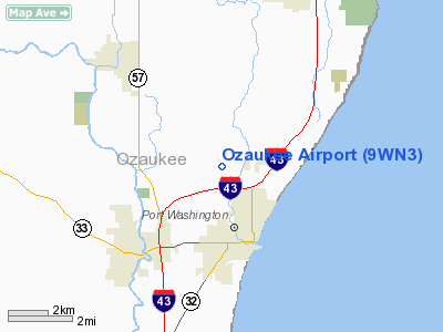
Location & QuickFacts
| FAA Information Effective: | 2008-09-25 |
| Airport Identifier: | 9WN3 |
| Airport Status: | Operational |
| Longitude/Latitude: | 087-53-20.3200W/43-25-17.0040N
-87.888978/43.421390 (Estimated) |
| Elevation: | 800 ft / 243.84 m (Estimated) |
| Land: | 0 acres |
| From nearest city: | 2 nautical miles NW of Port Washington, WI |
| Location: | Ozaukee County, WI |
| Magnetic Variation: | 01W (1985) |
Owner & Manager
| Ownership: | Privately owned |
| Owner: | Ray Karrels |
| Address: | Hwy B
Port Washington, WI 53074 |
| Phone number: | 414-284-5911 |
| Manager: | Ray Karrels |
| Address: | Hwy B
Port Washington, WI 53074 |
| Phone number: | 414-284-5911 |
Airport Operations and Facilities
| Airport Use: | Private |
| Wind indicator: | Yes |
| Segmented Circle: | No |
| Control Tower: | No |
| Landing fee charge: | No |
| Sectional chart: | Chicago |
| Region: | AGL - Great Lakes |
| Traffic Pattern Alt: | 1000 ft |
| Boundary ARTCC: | ZAU - Chicago |
| Tie-in FSS: | GRB - Green Bay |
| FSS on Airport: | No |
| FSS Toll Free: | 1-800-WX-BRIEF
OR LOCAL CALL 481-1060. |
Airport Services
| Airframe Repair: | NONE |
| Power Plant Repair: | NONE |
| Bottled Oxygen: | NONE |
| Bulk Oxygen: | NONE |
Runway Information
Runway 09/27
| Dimension: | 1900 x 175 ft / 579.1 x 53.3 m |
| Surface: | TURF, Poor Condition |
| |
Runway 09 |
Runway 27 |
| Traffic Pattern: | Left | Left |
| Runway End Identifier: | No | No |
| Centerline Lights: | No | No |
| Touchdown Lights: | No | No |
|
Runway 18/36
| Dimension: | 1700 x 295 ft / 518.2 x 89.9 m |
| Surface: | TURF, Fair Condition |
| |
Runway 18 |
Runway 36 |
| Traffic Pattern: | Left | Left |
| Runway End Identifier: | No | No |
| Centerline Lights: | No | No |
| Touchdown Lights: | No | No |
|
Radio Navigation Aids
| ID |
Type |
Name |
Ch |
Freq |
Var |
Dist |
| LLE | NDB | Kettle Moraine | | 329.00 | 01W | 10.4 nm |
| BL | NDB | Yanks | | 260.00 | 02W | 21.7 nm |
| HXF | NDB | Hartford | | 200.00 | 00E | 22.6 nm |
| UES | NDB | Waukesha | | 359.00 | 01W | 27.3 nm |
| GM | NDB | Teels | | 242.00 | 02W | 31.5 nm |
| UNU | NDB | Juneau | | 344.00 | 01W | 35.5 nm |
| RYV | NDB | Rock River | | 371.00 | 01W | 39.5 nm |
| RA | NDB | Paser | | 206.00 | 00E | 44.4 nm |
| BJB | VOR | West Bend | | 109.80 | 01W | 10.3 nm |
| LJT | VOR/DME | Timmerman | 072X | 112.50 | 02W | 19.8 nm |
| FAH | VOR/DME | Falls | 37X | 110.00 | 02W | 21.0 nm |
| HRK | VOR/DME | Horlick | 124X | 117.70 | 02W | 39.8 nm |
| MTW | VOR/DME | Manitowoc | 047X | 111.00 | 02W | 43.5 nm |
| BUU | VOR/DME | Burbun | 092X | 114.50 | 01W | 47.6 nm |
| ENW | VOR/DME | Kenosha | 029X | 109.20 | 02W | 49.5 nm |
| BAE | VORTAC | Badger | 111X | 116.40 | 02E | 25.2 nm |
| OSH | VORTAC | Oshkosh | 055X | 111.80 | 02E | 44.8 nm |
| MKE | VOT | Milwaukee | | 109.00 | | 28.5 nm |
Remarks
- RY 27 GROUND RISES 15' AT THR.
Images and information placed above are from
http://www.airport-data.com/airport/9WN3/
We thank them for the data!
| General Info
|
| Country |
United States
|
| State |
WISCONSIN
|
| FAA ID |
9WN3
|
| Latitude |
43-25-17.004N
|
| Longitude |
087-53-20.320W
|
| Elevation |
800 feet
|
| Near City |
PORT WASHINGTON
|
We don't guarantee the information is fresh and accurate. The data may
be wrong or outdated.
For more up-to-date information please refer to other sources.
|
|


