 |
|
Location & QuickFacts
| FAA Information Effective: | 2008-09-25 |
| Airport Identifier: | WS42 |
| Airport Status: | Operational |
| Longitude/Latitude: | 090-36-00.4870W/44-56-59.8860N
-90.600135/44.949968 (Estimated) |
| Elevation: | 1286 ft / 391.97 m (Estimated) |
| Land: | 0 acres |
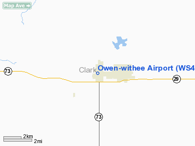
| From nearest city: | 1 nautical miles S of Withee, WI |
| Location: | Clark County, WI |
| Magnetic Variation: | 01E (1985) |
Owner & Manager
| Ownership: | Privately owned |
| Owner: | Roland Misfeldt |
| Address: | W5799 Oak Rd
Withee, WI 54498 |
| Phone number: | 715-229-4482 |
| Address: |
|
| Phone number: | 715-229-4160 |
Airport Operations and Facilities
| Airport Use: | Private |
| Wind indicator: | Yes |
| Segmented Circle: | No |
| Control Tower: | No |
| Landing fee charge: | No |
| Sectional chart: | Green Bay |
| Region: | AGL - Great Lakes |
| Boundary ARTCC: | ZMP - Minneapolis |
| Tie-in FSS: | GRB - Green Bay |
| FSS on Airport: | No |
| FSS Toll Free: | 1-800-WX-BRIEF |
Airport Services
| Airframe Repair: | NONE |
| Power Plant Repair: | NONE |
Runway Information
Runway E/W
| Dimension: | 2600 x 100 ft / 792.5 x 30.5 m |
| Surface: | TURF, |
| |
Runway E |
Runway W |
| Traffic Pattern: | Left | Left |
|
Radio Navigation Aids
| ID |
Type |
Name |
Ch |
Freq |
Var |
Dist |
| MDZ | NDB | Medford | | 335.00 | 00E | 15.5 nm |
| VIQ | NDB | Neillsville | | 368.00 | 01W | 23.9 nm |
| MFI | NDB | Marshfield | | 391.00 | 00E | 25.6 nm |
| RCX | NDB | Rusk County | | 356.00 | 00W | 37.3 nm |
| RRL | NDB | Merrill | | 257.00 | 01W | 40.9 nm |
| FZK | NDB | Wausau | | 243.00 | 01E | 41.5 nm |
| BCK | NDB | Black River Falls | | 362.00 | 00E | 43.1 nm |
| PBH | NDB | Phillips | | 263.00 | 00E | 45.9 nm |
| ISW | NDB | Wisconsin Rapids | | 215.00 | 01W | 47.9 nm |
| EAU | VORTAC | Eau Claire | 076X | 112.90 | 04E | 37.5 nm |
| AUW | VORTAC | Wausau | 053X | 111.60 | 02E | 43.6 nm |
Remarks
- OWNER DESIRES ARPT NOT BE CHARTED.
Images and information placed above are from
http://www.airport-data.com/airport/WS42/
We thank them for the data!
| General Info
|
| Country |
United States
|
| State |
WISCONSIN
|
| FAA ID |
WS42
|
| Latitude |
44-56-59.886N
|
| Longitude |
090-36-00.487W
|
| Elevation |
1286 feet
|
| Near City |
WITHEE
|
We don't guarantee the information is fresh and accurate. The data may
be wrong or outdated.
For more up-to-date information please refer to other sources.
|
|


