|
|
Outagamie County Rgnl Airport |
| Outagamie County Regional Airport |
 |
| IATA: ATW – ICAO: KATW – FAA LID: ATW |
| Summary |
| Airport type |
Public |
| Owner |
Outagamie County |
| Serves |
Appleton, Wisconsin |
| Location |
Greenville, Wisconsin |
| Elevation AMSL |
918 ft / 280 m |
| Coordinates |
44°15′29″N 088°31′09″W / 44.25806°N 88.51917°W / 44.25806; -88.51917 |
| Website |
www.ATWairport.com |
| Runways |
| Direction |
Length |
Surface |
| ft |
m |
| 3/21 |
8,002 |
2,439 |
Concrete |
| 11/29 |
6,501 |
1,982 |
Concrete |
| Statistics (2007) |
| Aircraft operations |
49,710 |
| Based aircraft |
69 |
| Source: Federal Aviation Administration |
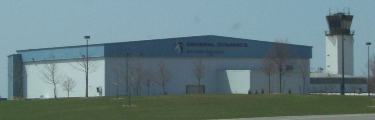
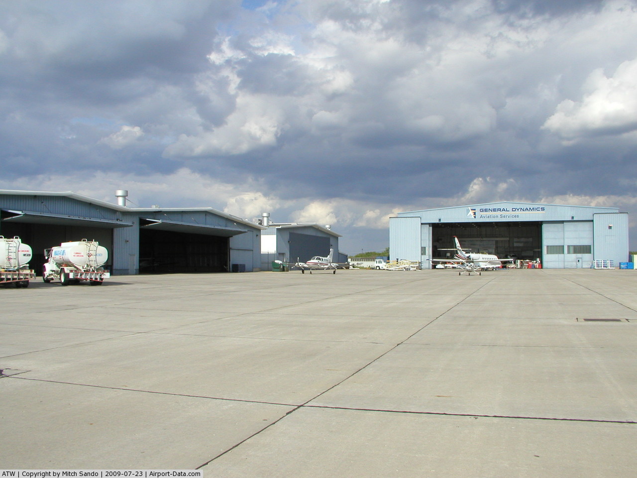
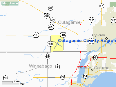
Outagamie County Regional Airport (IATA: ATW, ICAO: KATW, FAA LID: ATW) is a county-owned, public-use airport in Outagamie County, Wisconsin, United States. It is located three nautical miles (6 km) west of the central business district of Appleton, in the town of Greenville.
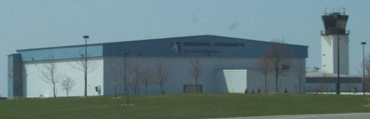
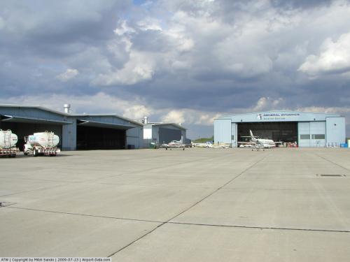
It is the main base of privately-owned regional airline Air Wisconsin and was the original home of Midwest Airlines. Midwest Airlines grew out of Kimberly-Clark subsidiary K-C Aviation. K-C Aviation is now part of Gulfstream Aerospace. Facilities and aircraft
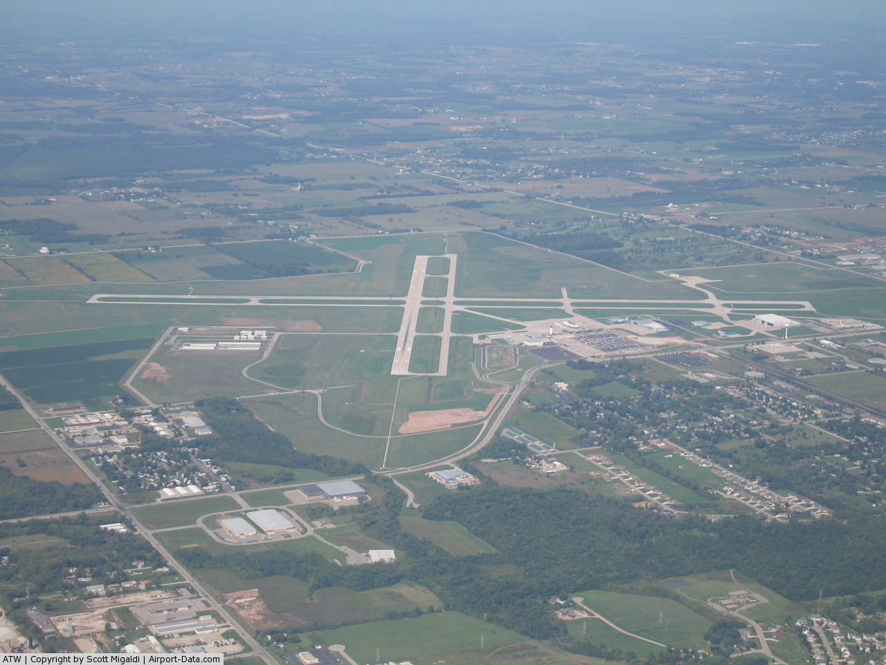
Outagamie County Regional Airport covers an area of 1,638 acres (663 ha) at an elevation of 918 feet (280 m) above mean sea level. It has two runways with concrete surfaces: 3/21 is 8,002 by 150 feet and 12/30 is 6,501 by 150 feet (1,982 x 46 m).
For the 12-month period ending December 31, 2007, the airport had 49,710 aircraft operations, an average of 136 per day: 55% general aviation, 34% air taxi, 11% scheduled commercial and <1% military. At that time there were 69 aircraft based at this airport: 75% single-engine, 19% multi-engine and 6% jet.
 |
Outagamie County
Regional Airport
Route Map
|
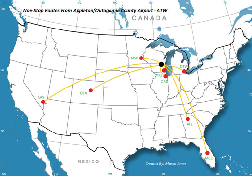
Airlines and destinations
| Airlines |
Destinations |
| Allegiant Air |
Las Vegas, Orlando-Sanford |
| Delta Connection operated by Atlantic Southeast Airlines |
Atlanta |
| Delta Connection operated by Chautauqua Airlines |
Detroit |
| Delta Connection operated by Mesaba Airlines |
Detroit, Minneapolis/St. Paul |
| Delta Connection operated by Pinnacle Airlines |
Detroit, Minneapolis/St. Paul |
| Midwest Connect/Frontier Airlines operated by Chautauqua Airlines |
Milwaukee |
| United Express operated by ExpressJet Airlines |
Chicago-O'Hare |
| United Express operated by Mesa Airlines |
Chicago-O'Hare |
| United Express operated by SkyWest Airlines |
Chicago-O'Hare, Denver |
The above content comes from Wikipedia and is published under free licenses – click here to read more.
 |
(Click on the photo to enlarge) |
 |
(Click on the photo to enlarge) |
 |
(Click on the photo to enlarge) |
 |
(Click on the photo to enlarge) |
Location & QuickFacts
| FAA Information Effective: | 2008-09-25 |
| Airport Identifier: | ATW |
| Airport Status: | Operational |
| Longitude/Latitude: | 088-31-08.6455W/44-15-29.1529N
-88.519068/44.258098 (Estimated) |
| Elevation: | 918 ft / 279.81 m (Surveyed) |
| Land: | 1638 acres |
| From nearest city: | 3 nautical miles W of Appleton, WI |
| Location: | Outagamie County, WI |
| Magnetic Variation: | 02W (1995) |
Owner & Manager
| Ownership: | Publicly owned |
| Owner: | Outagamie County |
| Address: | W6390 Challenger Dr-suite 201
Appleton, WI 54915 |
| Phone number: | 920-832-5267 |
| Manager: | Martin P. Lenss |
| Address: | W6390 Challenger Dr-suite 201
Appleton, WI 54914-9119 |
| Phone number: | 920-832-5267 |
Airport Operations and Facilities
| Airport Use: | Open to public |
| Wind indicator: | Yes |
| Segmented Circle: | No |
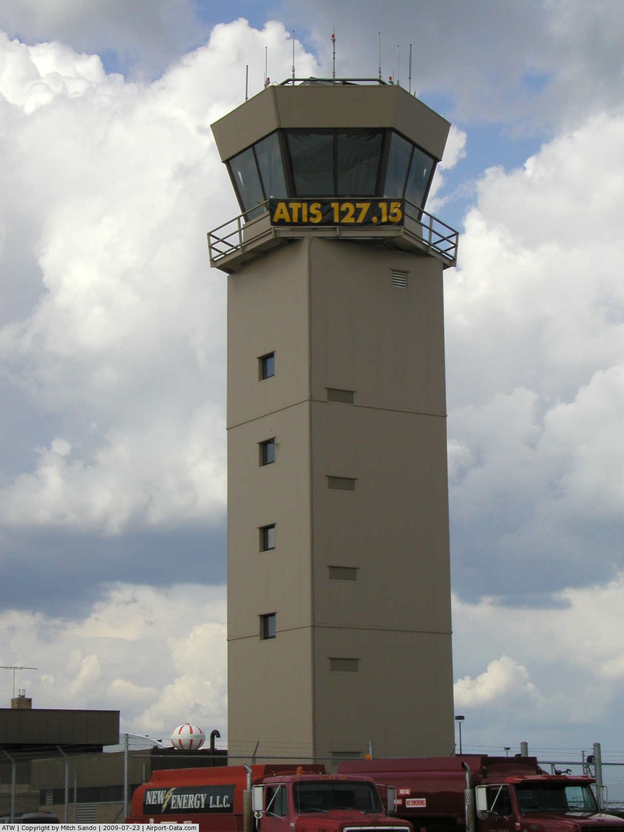
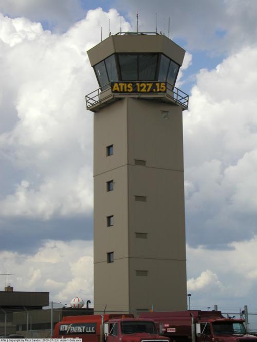
| Control Tower: | Yes |
| Lighting Schedule: | DUSK-DAWN
WHEN ATCT CLSD HIRL RY 03/21 PRESET ON LOW INTST; TO INCR INTST & ACTVT HIRL RY 11/29; MALSR RYS 03 & 29; REIL RYS 11 & 21 - CTAF. PAPI RYS 03, 21 & 29 & VASI RYS 11 OPER 24 HRS. |
| Beacon Color: | Clear-Green (lighted land airport) |
| Landing fee charge: | No |
| Sectional chart: | Green Bay |
| Region: | AGL - Great Lakes |
| Boundary ARTCC: | ZAU - Chicago |
| Responsible ARTCC: | ZMP - Minneapolis |
| Tie-in FSS: | GRB - Green Bay |
| FSS on Airport: | No |
| FSS Toll Free: | 1-800-WX-BRIEF |
| NOTAMs Facility: | ATW (NOTAM-d service avaliable) |
| Certification type/date: | I B S 11/1974 |
| Federal Agreements: | NGY |
Airport Communications
| CTAF: | 119.600 |
| Unicom: | 122.950 |
Airport Services
| Fuel available: | 100LLA1+ MOGAS |
| Airframe Repair: | MAJOR |
| Power Plant Repair: | MAJOR |
| Bottled Oxygen: | NONE |
| Bulk Oxygen: | HIGH/LOW |
Runway Information
Runway 03/21
| Dimension: | 8002 x 150 ft / 2439.0 x 45.7 m |
| Surface: | CONC, Good Condition |
| Surface Treatment: | Saw-cut or plastic Grooved |
| Weight Limit: | Single wheel: 75000 lbs.
Dual wheel: 160000 lbs.
Dual tandem wheel: 320000 lbs. |
| Edge Lights: | High |
| |
Runway 03 |
Runway 21 |
| Longitude: | 088-31-34.2500W | 088-30-45.8440W |
| Latitude: | 44-14-56.1500N | 44-16-07.0960N |
| Elevation: | 888.00 ft | 878.00 ft |
| Alignment: | 26 | 127 |
| ILS Type: | ILS/DME
| |
| Traffic Pattern: | Left | Left |
| Markings: | Precision instrument, Good Condition | Precision instrument, Good Condition |
| Crossing Height: | 47.00 ft | 47.00 ft |
| VASI: | 4-light PAPI on left side | 4-light PAPI on left side
PAPI RESTRICTED BYD 8.5 DEG RGT OF COURSE. |
| Visual Glide Angle: | 3.00° | 3.00° |
| RVR Equipment: | touchdown | |
| Approach lights: | MALSR | |
| Runway End Identifier: | No | Yes |
| Centerline Lights: | No | No |
| Touchdown Lights: | No | No |
| Obstruction: | 56 ft tree, 2400.0 ft from runway, 200 ft left of centerline, 39:1 slope to clear | 62 ft tree, 2600.0 ft from runway, 350 ft left of centerline, 38:1 slope to clear |
|
Runway 11/29
| Dimension: | 6501 x 150 ft / 1981.5 x 45.7 m |
| Surface: | CONC, Good Condition |
| Surface Treatment: | Saw-cut or plastic Grooved |
| Weight Limit: | Single wheel: 75000 lbs.
Dual wheel: 160000 lbs.
Dual tandem wheel: 320000 lbs. |
| Edge Lights: | High |
| |
Runway 11 |
Runway 29 |
| Longitude: | 088-31-47.0170W | 088-30-26.8240W |
| Latitude: | 44-15-40.2410N | 44-15-11.9840N |
| Elevation: | 918.00 ft | 858.00 ft |
| Alignment: | 116 | 127 |
| ILS Type: | | ILS/DME
|
| Traffic Pattern: | Left | Left |
| Markings: | Precision instrument, Good Condition | Precision instrument, Good Condition |
| Crossing Height: | 35.00 ft | 61.00 ft |
| VASI: | 4-box on left side | 4-light PAPI on left side |
| Visual Glide Angle: | 3.00° | 3.00° |
| Approach lights: | | MALSR |
| Runway End Identifier: | Yes | |
| Centerline Lights: | No | No |
| Touchdown Lights: | No | No |
| Obstruction: | 57 ft tree, 2800.0 ft from runway, 35 ft right of centerline, 45:1 slope to clear | , 50:1 slope to clear |
|
Radio Navigation Aids
| ID |
Type |
Name |
Ch |
Freq |
Var |
Dist |
| AQ | NDB | Kooky | | 407.00 | 02W | 5.8 nm |
| SG | NDB | Depre | | 332.00 | 02W | 18.6 nm |
| PCZ | NDB | Waupaca | | 382.00 | 01W | 21.8 nm |
| CLI | NDB | Clintonville | | 209.00 | 02W | 23.5 nm |
| OCQ | NDB | Oconto | | 388.00 | 03W | 45.3 nm |
| MTW | VOR/DME | Manitowoc | 047X | 111.00 | 02W | 37.0 nm |
| FAH | VOR/DME | Falls | 37X | 110.00 | 02W | 41.3 nm |
| OSH | VORTAC | Oshkosh | 055X | 111.80 | 02E | 16.2 nm |
| GRB | VORTAC | Green Bay | 102X | 115.50 | 01E | 22.6 nm |
| STE | VORTAC | Stevens Point | 043X | 110.60 | 01W | 46.7 nm |
Remarks
- BIRDS & MIGRATORY WATERFOWL ON & INVOF ARPT.
- SNOW REMOVAL OPNS IN PROGRESS WINTER MONTHS. VEHICLE OPERATORS WILL BE MONITORING CTAF; ACFT LNDG/DEP APPLETON SHOULD USE CTAF WHEN ATCT CLSD.
Images and information placed above are from
http://www.airport-data.com/airport/ATW/
We thank them for the data!
|
|