 |
|
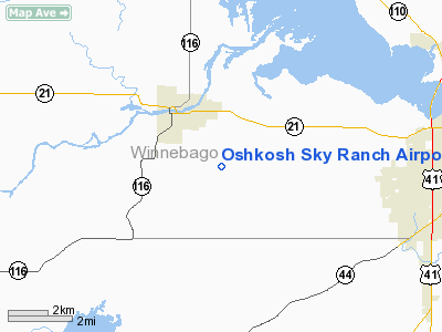
Oshkosh Sky Ranch Airport |
Location & QuickFacts
| FAA Information Effective: | 2008-09-25 |
| Airport Identifier: | 2WN8 |
| Airport Status: | Operational |
| Longitude/Latitude: | 088-42-51.3700W/44-00-54.8200N
-88.714269/44.015228 (Estimated) |
| Elevation: | 770 ft / 234.70 m (Estimated) |
| Land: | 0 acres |
| From nearest city: | 2 nautical miles SE of Omro, WI |
| Location: | Winnebago County, WI |
| Magnetic Variation: | () |
Owner & Manager
| Ownership: | Privately owned |
| Owner: | Noel K. Marshall |
| Address: | 8619 Edgewater Ridge
Omro, WI 54963 |
| Phone number: | 920-685-0301 |
| Manager: | Robert T. Warner |
| Address: | 8619 Edgewater Ridge
Omro, WI 54963 |
| Phone number: | 920-418-4862 |
Airport Operations and Facilities
| Airport Use: | Private |
| Wind indicator: | Yes |
| Control Tower: | No |
| Sectional chart: | Chicago |
| Region: | AGL - Great Lakes |
| Boundary ARTCC: | ZAU - Chicago |
| Tie-in FSS: | GRB - Green Bay |
| FSS Toll Free: | 1-800-WX-BRIEF |
Runway Information
Runway 09/27
| Dimension: | 3000 x 125 ft / 914.4 x 38.1 m |
| Surface: | TURF, |
| |
Runway 09 |
Runway 27 |
| Traffic Pattern: | Left | Left |
| Obstruction: | | 51 ft bldg, 500.0 ft from runway |
|
Radio Navigation Aids
| ID |
Type |
Name |
Ch |
Freq |
Var |
Dist |
| AQ | NDB | Kooky | | 407.00 | 02W | 18.2 nm |
| PCZ | NDB | Waupaca | | 382.00 | 01W | 23.1 nm |
| SG | NDB | Depre | | 332.00 | 02W | 34.0 nm |
| UNU | NDB | Juneau | | 344.00 | 01W | 35.2 nm |
| CLI | NDB | Clintonville | | 209.00 | 02W | 36.3 nm |
| HXF | NDB | Hartford | | 200.00 | 00E | 42.4 nm |
| LLE | NDB | Kettle Moraine | | 329.00 | 01W | 43.7 nm |
| BJB | VOR | West Bend | | 109.80 | 01W | 43.9 nm |
| FAH | VOR/DME | Falls | 37X | 110.00 | 02W | 40.3 nm |
| MTW | VOR/DME | Manitowoc | 047X | 111.00 | 02W | 45.2 nm |
| OSH | VORTAC | Oshkosh | 055X | 111.80 | 02E | 7.0 nm |
| GRB | VORTAC | Green Bay | 102X | 115.50 | 01E | 39.4 nm |
| STE | VORTAC | Stevens Point | 043X | 110.60 | 01W | 47.3 nm |
Remarks
- 240 FT CELL TWR 2.3 NM ENE AND 319 FT CELL TWR 3.3 NM NNW OF RY.
- PRVDD VFR OPNS & PVT USE.
Images and information placed above are from
http://www.airport-data.com/airport/2WN8/
We thank them for the data!
| General Info
|
| Country |
United States
|
| State |
WISCONSIN
|
| FAA ID |
2WN8
|
| Latitude |
45-09-55.880N
|
| Longitude |
091-06-20.510W
|
| Elevation |
1154 feet
|
| Near City |
CORNELL
|
We don't guarantee the information is fresh and accurate. The data may
be wrong or outdated.
For more up-to-date information please refer to other sources.
|
|


