 |
|
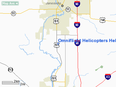
Omniflight Helicopters Heliport |
Location & QuickFacts
| FAA Information Effective: | 2008-09-25 |
| Airport Identifier: | WI85 |
| Airport Status: | Operational |
| Longitude/Latitude: | 089-01-40.3980W/42-37-12.0430N
-89.027888/42.620012 (Estimated) |
| Elevation: | 808 ft / 246.28 m (Estimated) |
| Land: | 0 acres |
| From nearest city: | 2 nautical miles N of Janesville, WI |
| Location: | Rock County, WI |
| Magnetic Variation: | 00W (1985) |
Owner & Manager
| Ownership: | Privately owned |
| Owner: | Whilden R. Hughes |
| Address: | 4031 Hwy 51 South
Janesville, WI 53546 |
| Phone number: | 608-756-3567 |
| Address: |
|
Airport Operations and Facilities
| Airport Use: | Private |
| Wind indicator: | Yes |
| Segmented Circle: | No |
| Control Tower: | No |
| Landing fee charge: | No |
| Sectional chart: | Chicago |
| Region: | AGL - Great Lakes |
| Boundary ARTCC: | ZAU - Chicago |
| Tie-in FSS: | GRB - Green Bay |
| FSS on Airport: | No |
| FSS Toll Free: | 1-800-WX-BRIEF |
Airport Services
| Fuel available: | 100LL |
| Airframe Repair: | MAJOR |
| Power Plant Repair: | MAJOR |
Runway Information
Helipad H1
| Dimension: | 100 x 60 ft / 30.5 x 18.3 m |
| Surface: | ASPH, |
| |
Runway H1 |
Runway |
| Traffic Pattern: | Left | Left |
|
Radio Navigation Aids
| ID |
Type |
Name |
Ch |
Freq |
Var |
Dist |
| JVL | NDB | Janesville | | 375.00 | 03E | 0.7 nm |
| LVV | NDB | Lake Lawn | | 404.00 | 00W | 19.8 nm |
| MS | NDB | Monah | | 400.00 | 00E | 30.1 nm |
| FEP | NDB | Freeport | | 335.00 | 00E | 33.5 nm |
| RYV | NDB | Rock River | | 371.00 | 01W | 35.8 nm |
| UES | NDB | Waukesha | | 359.00 | 01W | 43.3 nm |
| DKB | NDB | Dekalb | | 209.00 | 02W | 43.6 nm |
| GM | NDB | Teels | | 242.00 | 02W | 46.9 nm |
| JVL | VOR/DME | Janesville | 090X | 114.30 | 03E | 5.1 nm |
| RFD | VOR/DME | Rockford | 045X | 110.80 | 01E | 24.9 nm |
| BUU | VOR/DME | Burbun | 092X | 114.50 | 01W | 32.4 nm |
| PLL | VOR/DME | Polo | 049X | 111.20 | 03E | 45.1 nm |
| ENW | VOR/DME | Kenosha | 029X | 109.20 | 02W | 48.5 nm |
| MSN | VORTAC | Madison | 023X | 108.60 | 03E | 34.4 nm |
| BAE | VORTAC | Badger | 111X | 116.40 | 02E | 44.3 nm |
Remarks
- INGRESS/EGRESS RSTRCTD TO E & W ONLY; ALL OPS MAINTAIN RDO CTC WITH JANESVILLE ATCT; ALL OPS IN VFR CONDS ONLY.
Images and information placed above are from
http://www.airport-data.com/airport/WI85/
We thank them for the data!
| General Info
|
| Country |
United States
|
| State |
WISCONSIN
|
| FAA ID |
WI85
|
| Latitude |
42-37-12.043N
|
| Longitude |
089-01-40.398W
|
| Elevation |
808 feet
|
| Near City |
JANESVILLE
|
We don't guarantee the information is fresh and accurate. The data may
be wrong or outdated.
For more up-to-date information please refer to other sources.
|
|


