 |
|
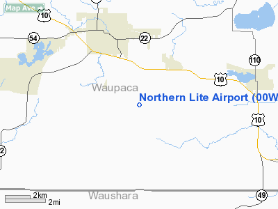
Location & QuickFacts
| FAA Information Effective: | 2008-09-25 |
| Airport Identifier: | 00WI |
| Airport Status: | Operational |
| Longitude/Latitude: | 089-03-00.4090W/44-18-15.4260N
-89.050114/44.304285 (Estimated) |
| Elevation: | 860 ft / 262.13 m (Estimated) |
| Land: | 0 acres |
| From nearest city: | 5 nautical miles NN of Waupaca, WI |
| Location: | Waupaca County, WI |
| Magnetic Variation: | 01W (1995) |
Owner & Manager
| Ownership: | Privately owned |
| Owner: | Northern Lite Aviation Inc |
| Address: | N1757 County Hwy A
Waupaca, WI 54981 |
| Phone number: | 715-258-3403 |
| Manager: | Ron Brooks |
| Address: | N1757 County Hwy A
Waupaca, WI 54981 |
| Phone number: | 715-258-3403 |
Airport Operations and Facilities
| Airport Use: | Private |
| Segmented Circle: | No |
| Control Tower: | No |
| Sectional chart: | Green Bay |
| Region: | AGL - Great Lakes |
| Boundary ARTCC: | ZMP - Minneapolis |
| Tie-in FSS: | GRB - Green Bay |
| FSS Toll Free: | 1-800-WX-BRIEF |
Runway Information
Runway 09/27
| Dimension: | 1000 x 60 ft / 304.8 x 18.3 m |
| Surface: | TURF, |
| |
Runway 09 |
Runway 27 |
| Traffic Pattern: | Left | Left |
| Displaced threshold: | 0.00 ft | 200.00 ft
RY 27 DSPLCD THLD MKD WITH WHITE BARRELS. |
| Obstruction: | | 20 ft pline, 100.0 ft from runway |
|
Radio Navigation Aids
| ID |
Type |
Name |
Ch |
Freq |
Var |
Dist |
| PCZ | NDB | Waupaca | | 382.00 | 01W | 2.2 nm |
| CLI | NDB | Clintonville | | 209.00 | 02W | 23.3 nm |
| AQ | NDB | Kooky | | 407.00 | 02W | 28.5 nm |
| ISW | NDB | Wisconsin Rapids | | 215.00 | 01W | 34.1 nm |
| SG | NDB | Depre | | 332.00 | 02W | 39.8 nm |
| FZK | NDB | Wausau | | 243.00 | 01E | 44.8 nm |
| STE | VORTAC | Stevens Point | 043X | 110.60 | 01W | 25.1 nm |
| OSH | VORTAC | Oshkosh | 055X | 111.80 | 02E | 28.5 nm |
| GRB | VORTAC | Green Bay | 102X | 115.50 | 01E | 39.7 nm |
| AUW | VORTAC | Wausau | 053X | 111.60 | 02E | 39.9 nm |
Remarks
- PRVDD CLEAR 20:1 APCH, OBSTACLE FREE ZONE & CLEAR RY SAFETY AREA.
Images and information placed above are from
http://www.airport-data.com/airport/00WI/
We thank them for the data!
| General Info
|
| Country |
United States
|
| State |
WISCONSIN
|
| FAA ID |
00WI
|
| Latitude |
44-18-15.426N
|
| Longitude |
089-03-00.409W
|
| Elevation |
860 feet
|
| Near City |
WAUPACA
|
We don't guarantee the information is fresh and accurate. The data may
be wrong or outdated.
For more up-to-date information please refer to other sources.
|
|


