|
|
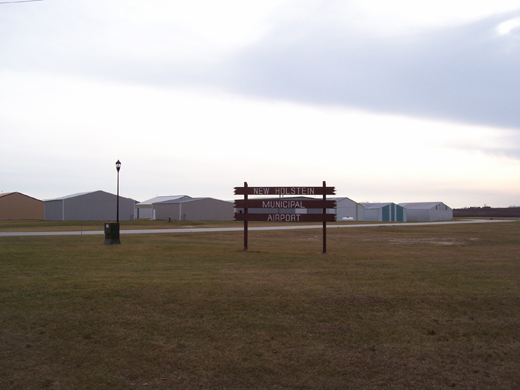
New Holstein Muni Airport |
| New Holstein Municipal Airport |
 |
| IATA: none – ICAO: none – FAA LID: 8D1 |
| Summary |
| Airport type |
Public |
| Owner/Operator |
City of New Holstein |
| Location |
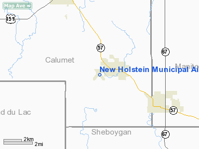
New Holstein, Wisconsin |
| Elevation AMSL |
992 ft / 302.4 m |
| Coordinates |
43°56.654′N 088°06.809′W / 43.944233°N 88.113483°W / 43.944233; -88.113483Coordinates: 43°56.654′N 088°06.809′W / 43.944233°N 88.113483°W / 43.944233; -88.113483 |
| Runways |
| Direction |
Length |
Surface |
| ft |
m |
| 14/32 |
3,600 |
1,097 |
asphalt |
| 4/22 |
2,970 |
905 |
turf |
| Statistics (2008) |
| Operations |
7,900 |
| Based A/C |
22 |
| Stats for 12 months ending May 21, 2008 |
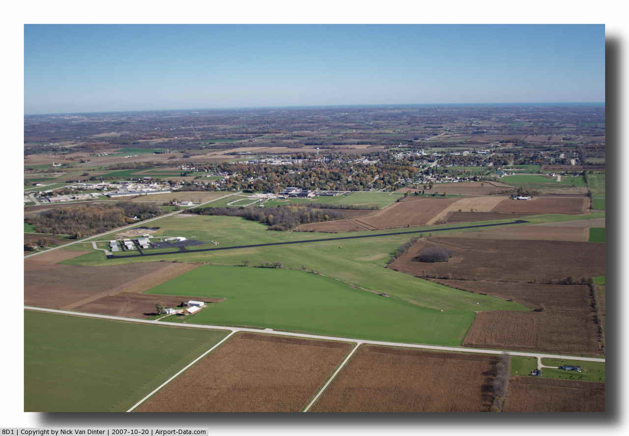
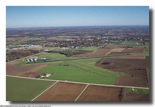
New Holstein Municipal Airport (FAA LID: 8D1) is a public airport located New Holstein, Wisconsin. It is located on the west edge of the city on County Highway H. Facilities
The main runway was paved in 1958.
- Runway 14/32 3,600 x 75 ft. (1,097 x 23 m), asphalt
- Runway 4/22 2,970 x 250 ft. (905 x 76 m), turf
- Drath Aircraft Services is the fixed base operator
The above content comes from Wikipedia and is published under free licenses – click here to read more.
 |
(Click on the photo to enlarge) |
Location & QuickFacts
| FAA Information Effective: | 2008-09-25 |
| Airport Identifier: | 8D1 |
| Airport Status: | Operational |
| Longitude/Latitude: | 088-06-48.5190W/43-56-39.2680N
-88.113477/43.944241 (Estimated) |
| Elevation: | 992 ft / 302.36 m (Surveyed) |
| Land: | 267 acres |
| From nearest city: | 1 nautical miles W of New Holstein, WI |
| Location: | Calumet County, WI |
| Magnetic Variation: | 01W (1985) |
Owner & Manager
| Ownership: | Publicly owned |
| Owner: | City Of New Holstein |
| Address: | 2110 Washington St
New Holstein, WI 53061 |
| Phone number: | 920-898-5766 |
| Manager: | Mark Drath |
| Address: | 3015 Wisconsin Ave.
New Holstein, WI 53061 |
| Phone number: | 920-898-5211 |
Airport Operations and Facilities
| Airport Use: | Open to public |
| Wind indicator: | Yes |
| Segmented Circle: | Yes |
| Control Tower: | No |
| Lighting Schedule: | DUSK-DAWN
ACTVT MIRL RY 14/32 & REILS RYS 14 & 32 - CTAF. |
| Beacon Color: | Clear-Green (lighted land airport) |
| Landing fee charge: | No |
| Sectional chart: | Chicago |
| Region: | AGL - Great Lakes |
| Traffic Pattern Alt: | 800 ft |
| Boundary ARTCC: | ZAU - Chicago |
| Tie-in FSS: | GRB - Green Bay |
| FSS on Airport: | No |
| FSS Toll Free: | 1-800-WX-BRIEF |
| NOTAMs Facility: | GRB (NOTAM-d service avaliable) |
| Federal Agreements: | NGY |
Airport Communications
| CTAF: | 123.000 |
| Unicom: | 123.000 |
Airport Services
| Fuel available: | 100LL |
| Airframe Repair: | MAJOR |
| Power Plant Repair: | MAJOR |
Runway Information
Runway 04/22
| Dimension: | 2970 x 250 ft / 905.3 x 76.2 m |
| Surface: | TURF, Good Condition |
| |
Runway 04 |
Runway 22 |
| Longitude: | 088-07-12.3540W | 088-06-46.8540W |
| Latitude: | 43-56-26.4720N | 43-56-49.4720N |
| Traffic Pattern: | Left | Right |
| Markings: | None, | None, |
| Runway End Identifier: | No | No |
| Centerline Lights: | No | No |
| Touchdown Lights: | No | No |
| Obstruction: | 71 ft tree, 1430.0 ft from runway, 20:1 slope to clear | 54 ft trees, 1300.0 ft from runway, 150 ft left of centerline, 24:1 slope to clear |
|
Runway 14/32
| Dimension: | 3600 x 75 ft / 1097.3 x 22.9 m |
| Surface: | ASPH, Good Condition |
| Weight Limit: | Single wheel: 20000 lbs. |
| Edge Lights: | Medium |
| |
Runway 14 |
Runway 32 |
| Longitude: | 088-07-03.8560W | 088-06-33.1840W |
| Latitude: | 43-56-53.1470N | 43-56-25.3880N |
| Elevation: | 976.00 ft | 976.00 ft |
| Alignment: | 127 | 127 |
| Traffic Pattern: | Left | Left |
| Markings: | Non-precision instrument, Good Condition | Non-precision instrument, Good Condition |
| Runway End Identifier: | Yes | Yes |
| Centerline Lights: | No | No |
| Touchdown Lights: | No | No |
| Obstruction: | 19 ft road, 660.0 ft from runway, 170 ft left of centerline, 24:1 slope to clear | 5 ft gnd, 350.0 ft from runway, 125 ft right of centerline, 30:1 slope to clear
+7' TERRAIN 140' RIGHT OF CNTRLN. |
|
Radio Navigation Aids
| ID |
Type |
Name |
Ch |
Freq |
Var |
Dist |
| AQ | NDB | Kooky | | 407.00 | 02W | 20.5 nm |
| SG | NDB | Depre | | 332.00 | 02W | 27.3 nm |
| LLE | NDB | Kettle Moraine | | 329.00 | 01W | 31.2 nm |
| HXF | NDB | Hartford | | 200.00 | 00E | 37.9 nm |
| UNU | NDB | Juneau | | 344.00 | 01W | 40.2 nm |
| PCZ | NDB | Waupaca | | 382.00 | 01W | 45.4 nm |
| CLI | NDB | Clintonville | | 209.00 | 02W | 48.5 nm |
| BJB | VOR | West Bend | | 109.80 | 01W | 31.4 nm |
| FAH | VOR/DME | Falls | 37X | 110.00 | 02W | 15.6 nm |
| MTW | VOR/DME | Manitowoc | 047X | 111.00 | 02W | 21.8 nm |
| OSH | VORTAC | Oshkosh | 055X | 111.80 | 02E | 19.3 nm |
| GRB | VORTAC | Green Bay | 102X | 115.50 | 01E | 36.9 nm |
Remarks
- NUMEROUS BIRDS INVOF ARPT.
- RY 04/22 CLSD NOV 1 THRU MAY 1.
Images and information placed above are from
http://www.airport-data.com/airport/8D1/
We thank them for the data!
| General Info
|
| Country |
United States
|
| State |
WISCONSIN
|
| FAA ID |
8D1
|
| Latitude |
43-56-39.268N
|
| Longitude |
088-06-48.519W
|
| Elevation |
992 feet
|
| Near City |
NEW HOLSTEIN
|
We don't guarantee the information is fresh and accurate. The data may
be wrong or outdated.
For more up-to-date information please refer to other sources.
|
|