 |
|
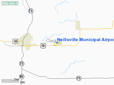
Location & QuickFacts
| FAA Information Effective: | 2008-09-25 |
| Airport Identifier: | VIQ |
| Airport Status: | Operational |
| Longitude/Latitude: | 090-30-44.0890W/44-33-29.2630N
-90.512247/44.558129 (Estimated) |
| Elevation: | 1237 ft / 377.04 m (Surveyed) |
| Land: | 169 acres |
| From nearest city: | 3 nautical miles E of Neillsville, WI |
| Location: | Clark County, WI |
| Magnetic Variation: | 01W (2000) |
Owner & Manager
| Ownership: | Publicly owned |
| Owner: | City Of Neillsville |
| Address: | City Hall
Neillsville, WI 54456 |
| Phone number: | 715-743-2105 |
| Manager: | Harold Gaier |
| Address: | N3770 Miller Ave
Neillsville, WI 54456 |
| Phone number: | 715-743-4400 |
Airport Operations and Facilities
| Airport Use: | Open to public |
| Wind indicator: | Yes |
| Segmented Circle: | Yes |
| Control Tower: | No |
| Lighting Schedule: | DUSK-DAWN
LIRL RY 09/27 OPERS LOW INTST; TO INCR INTST & ACTVT VASIS RY 09 & 27 - CTAF. |
| Beacon Color: | Clear-Green (lighted land airport)
ROTG BCN OTS INDEFLY. |
| Landing fee charge: | No |
| Sectional chart: | Green Bay |
| Region: | AGL - Great Lakes |
| Boundary ARTCC: | ZMP - Minneapolis |
| Tie-in FSS: | GRB - Green Bay |
| FSS on Airport: | No |
| FSS Toll Free: | 1-800-WX-BRIEF |
| NOTAMs Facility: | GRB (NOTAM-d service avaliable) |
| Federal Agreements: | NGY |
Airport Communications
| CTAF: | 122.800 |
| Unicom: | 122.800 |
Airport Services
| Fuel available: | 100LLMOGAS
FUEL AVBL PPR CALL 715-743-4400. |
| Airframe Repair: | MINOR |
| Power Plant Repair: | MINOR |
| Bottled Oxygen: | NONE |
| Bulk Oxygen: | NONE |
Runway Information
Runway 09/27
| Dimension: | 3400 x 60 ft / 1036.3 x 18.3 m |
| Surface: | ASPH, Fair Condition |
| Weight Limit: | Single wheel: 12000 lbs. |
| Edge Lights: | Low |
| |
Runway 09 |
Runway 27 |
| Longitude: | 090-31-07.4570W | 090-30-20.7300W |
| Latitude: | 44-33-30.8990N | 44-33-27.5880N |
| Elevation: | 1208.00 ft | 1237.00 ft |
| Alignment: | 96 | 127 |
| Traffic Pattern: | Left | Left |
| Markings: | Non-precision instrument, Fair Condition | Non-precision instrument, Fair Condition |
| Crossing Height: | 31.00 ft | 25.00 ft |
| VASI: | 2-box on left side | 2-box on left side |
| Visual Glide Angle: | 3.00° | 3.50° |
| Centerline Lights: | No | No |
| Touchdown Lights: | No | No |
| Obstruction: | 30 ft tree, 950.0 ft from runway, 90 ft left of centerline, 25:1 slope to clear | 100 ft tree, 2800.0 ft from runway, 26:1 slope to clear |
|
Radio Navigation Aids
| ID |
Type |
Name |
Ch |
Freq |
Var |
Dist |
| VIQ | NDB | Neillsville | | 368.00 | 01W | 0.1 nm |
| MFI | NDB | Marshfield | | 391.00 | 00E | 14.8 nm |
| BCK | NDB | Black River Falls | | 362.00 | 00E | 23.3 nm |
| ISW | NDB | Wisconsin Rapids | | 215.00 | 01W | 31.1 nm |
| MDZ | NDB | Medford | | 335.00 | 00E | 34.0 nm |
| CMY | NDB | Mccoy | | 412.00 | 00E | 37.7 nm |
| FZK | NDB | Wausau | | 243.00 | 01E | 43.9 nm |
| VOK | TACAN | Volk | 041X | | 00E | 38.6 nm |
| STE | VORTAC | Stevens Point | 043X | 110.60 | 01W | 42.1 nm |
| AUW | VORTAC | Wausau | 053X | 111.60 | 02E | 43.2 nm |
| EAU | VORTAC | Eau Claire | 076X | 112.90 | 04E | 46.0 nm |
Images and information placed above are from
http://www.airport-data.com/airport/VIQ/
We thank them for the data!
| General Info
|
| Country |
United States
|
| State |
WISCONSIN
|
| FAA ID |
VIQ
|
| Latitude |
44-33-29.263N
|
| Longitude |
090-30-44.089W
|
| Elevation |
1237 feet
|
| Near City |
NEILLSVILLE
|
We don't guarantee the information is fresh and accurate. The data may
be wrong or outdated.
For more up-to-date information please refer to other sources.
|
|


