 |
|
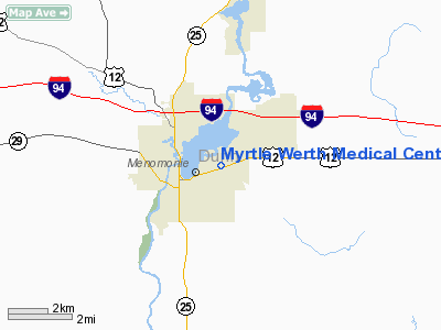
Myrtle Werth Medical Center Heliport |
Location & QuickFacts
| FAA Information Effective: | 2008-09-25 |
| Airport Identifier: | WN25 |
| Airport Status: | Operational |
| Longitude/Latitude: | 091-54-09.6300W/44-52-58.8650N
-91.902675/44.883018 (Estimated) |
| Elevation: | 880 ft / 268.22 m (Estimated) |
| Land: | 0 acres |
| From nearest city: | 0 nautical miles N of Menomonie, WI |
| Location: | Dunn County, WI |
| Magnetic Variation: | 02E (1985) |
Owner & Manager
| Ownership: | Privately owned |
| Owner: | Mayo Health System |
| Address: | 2321 Stout Road
Menomonie, WI 54751 |
| Phone number: | 715-233-7777 |
| Manager: | Lindsey Geissler |
| Address: | 2321 Stout Road
Menomonie, WI 54751 |
| Phone number: | 715-233-7774 |
Airport Operations and Facilities
| Airport Use: | Private
MEDICAL |
| Wind indicator: | Yes |
| Segmented Circle: | No |
| Control Tower: | No |
| Sectional chart: | Green Bay |
| Region: | AGL - Great Lakes |
| Boundary ARTCC: | ZMP - Minneapolis |
| Tie-in FSS: | GRB - Green Bay |
| FSS Toll Free: | 1-800-WX-BRIEF |
Runway Information
Helipad H1
| Dimension: | 30 x 30 ft / 9.1 x 9.1 m |
| Surface: | ASPH, |
| |
Runway H1 |
Runway |
| Traffic Pattern: | Left | Left |
|
Radio Navigation Aids
| ID |
Type |
Name |
Ch |
Freq |
Var |
Dist |
| AHH | NDB | Ameron | | 278.00 | 01E | 31.1 nm |
| RNH | NDB | New Richmond | | 257.00 | 02E | 31.2 nm |
| UBE | NDB | Cumberland | | 375.00 | 01E | 37.8 nm |
| OEO | NDB | Osceola | | 233.00 | 01E | 42.1 nm |
| PPI | NDB | Hopey | | 400.00 | 03E | 44.3 nm |
| RPD | VOR/DME | Rice Lake | 037X | 110.00 | 01E | 32.4 nm |
| ONA | VOR/DME | Winona | 051X | 111.40 | 01E | 49.2 nm |
| EAU | VORTAC | Eau Claire | 076X | 112.90 | 04E | 18.1 nm |
| STP | VOT | St Paul | | 114.40 | | 49.4 nm |
Remarks
- FILED FOR RECORD PURPOSES ONLY.
Images and information placed above are from
http://www.airport-data.com/airport/WN25/
We thank them for the data!
| General Info
|
| Country |
United States
|
| State |
WISCONSIN
|
| FAA ID |
WN25
|
| Latitude |
44-52-58.865N
|
| Longitude |
091-54-09.630W
|
| Elevation |
880 feet
|
| Near City |
MENOMONIE
|
We don't guarantee the information is fresh and accurate. The data may
be wrong or outdated.
For more up-to-date information please refer to other sources.
|
|


