 |
|
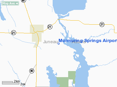
Murmuring Springs Airport |
Location & QuickFacts
| FAA Information Effective: | 2008-09-25 |
| Airport Identifier: | 2WN5 |
| Airport Status: | Operational |
| Longitude/Latitude: | 090-01-09.2600W/44-00-22.8800N
-90.019239/44.006356 (Estimated) |
| Elevation: | 910 ft / 277.37 m (Estimated) |
| Land: | 0 acres |
| From nearest city: | 5 nautical miles SE of Necedah, WI |
| Location: | Juneau County, WI |
| Magnetic Variation: | 01W () |
Owner & Manager
| Ownership: | Privately owned |
| Owner: | James P. Wicker |
| Address: | 426 Old Country Way
Wauconda, IL 60084 |
| Phone number: | 847-487-4697 |
| Manager: | James P. Wicker |
| Address: | 426 Old Country Way
Wauconda, IL 60084 |
| Phone number: | 847-487-4697 |
Airport Operations and Facilities
| Airport Use: | Private |
| Wind indicator: | Yes |
| Segmented Circle: | No |
| Control Tower: | No |
| Sectional chart: | Chicago |
| Region: | AGL - Great Lakes |
| Boundary ARTCC: | ZAU - Chicago |
| Tie-in FSS: | GRB - Green Bay |
| FSS Toll Free: | 1-800-WX-BRIEF |
Runway Information
Runway 11/29
| Dimension: | 2500 x 100 ft / 762.0 x 30.5 m |
| Surface: | TURF, |
| |
Runway 11 |
Runway 29 |
| Traffic Pattern: | Left | Left |
|
Radio Navigation Aids
| ID |
Type |
Name |
Ch |
Freq |
Var |
Dist |
| ISW | NDB | Wisconsin Rapids | | 215.00 | 01W | 22.8 nm |
| HBW | NDB | Kickapoo | | 251.00 | 03E | 25.1 nm |
| CMY | NDB | Mccoy | | 412.00 | 00E | 27.2 nm |
| BCK | NDB | Black River Falls | | 362.00 | 00E | 38.8 nm |
| MFI | NDB | Marshfield | | 391.00 | 00E | 38.8 nm |
| VIQ | NDB | Neillsville | | 368.00 | 01W | 39.4 nm |
| PCZ | NDB | Waupaca | | 382.00 | 01W | 47.5 nm |
| VOK | TACAN | Volk | 041X | | 00E | 11.1 nm |
| LNR | VOR/DME | Lone Rock | 075X | 112.80 | 00E | 43.1 nm |
| DLL | VORTAC | Dells | 117X | 117.00 | 03E | 29.5 nm |
| STE | VORTAC | Stevens Point | 043X | 110.60 | 01W | 38.5 nm |
Remarks
- OCNL ULTRALIGHT ACTIVITY INVOF ARPT.
- WILD GAME INVOF ARPT.
- PRVDD CLEAR 20:1 APCHS, CLEAR OBSTACLE FREE ZONE, AND CLEAR RY SAFETY AREA.
Images and information placed above are from
http://www.airport-data.com/airport/2WN5/
We thank them for the data!
| General Info
|
| Country |
United States
|
| State |
WISCONSIN
|
| FAA ID |
2WN5
|
| Latitude |
44-00-22.880N
|
| Longitude |
090-01-09.260W
|
| Elevation |
910 feet
|
| Near City |
NECEDAH
|
We don't guarantee the information is fresh and accurate. The data may
be wrong or outdated.
For more up-to-date information please refer to other sources.
|
|


