 |
|
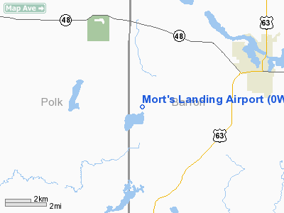
Location & QuickFacts
| FAA Information Effective: | 2008-09-25 |
| Airport Identifier: | 0WI1 |
| Airport Status: | Operational |
| Longitude/Latitude: | 092-08-30.6640W/45-30-25.8380N
-92.141851/45.507177 (Estimated) |
| Elevation: | 1255 ft / 382.52 m (Estimated) |
| Land: | 320 acres |
| From nearest city: | 4 nautical miles NW of Comstock, WI |
| Location: | Barron County, WI |
| Magnetic Variation: | 03E (1985) |
Owner & Manager
| Ownership: | Privately owned |
| Owner: | Larry & Victoria Mortenson |
| Address: | Rt 1 Box 12
Comstock, WI 54826 |
| Phone number: | 715-822-4908 |
| Address: |
|
Airport Operations and Facilities
| Airport Use: | Private |
| Segmented Circle: | No |
| Control Tower: | No |
| Sectional chart: | Green Bay |
| Region: | AGL - Great Lakes |
| Boundary ARTCC: | ZMP - Minneapolis |
| Tie-in FSS: | GRB - Green Bay |
| FSS Toll Free: | 1-800-WX-BRIEF |
Runway Information
Runway 03W/21W
| Dimension: | 10000 x 4000 ft / 3048.0 x 1219.2 m |
| Surface: | WATER, |
| |
Runway 03W |
Runway 21W |
| Traffic Pattern: | Left | Left |
|
Runway 04/22
| Dimension: | 3200 x 40 ft / 975.4 x 12.2 m |
| Surface: | ASPH, |
| |
Runway 04 |
Runway 22 |
| Traffic Pattern: | Left | Left |
|
Radio Navigation Aids
| ID |
Type |
Name |
Ch |
Freq |
Var |
Dist |
| UBE | NDB | Cumberland | | 375.00 | 01E | 7.0 nm |
| SSQ | NDB | Shell Lake | | 212.00 | 01E | 16.2 nm |
| AHH | NDB | Ameron | | 278.00 | 01E | 16.7 nm |
| BXR | NDB | Big Doctor | | 203.00 | 02E | 21.1 nm |
| OEO | NDB | Osceola | | 233.00 | 01E | 25.9 nm |
| RNH | NDB | New Richmond | | 257.00 | 02E | 27.2 nm |
| ROS | NDB | Rush City | | 282.00 | 02E | 36.1 nm |
| CBG | NDB | Cambridge | | 350.00 | 03E | 47.3 nm |
| RCX | NDB | Rusk County | | 356.00 | 00W | 48.1 nm |
| SLY | NDB | Seeley | | 344.00 | 01E | 48.3 nm |
| RPD | VOR/DME | Rice Lake | 037X | 110.00 | 01E | 16.3 nm |
| RZN | VOR/DME | Siren | 031X | 109.40 | 02E | 21.2 nm |
| HYR | VOR/DME | Hayward | 081X | 113.40 | 03E | 42.4 nm |
| EAU | VORTAC | Eau Claire | 076X | 112.90 | 04E | 46.2 nm |
Images and information placed above are from
http://www.airport-data.com/airport/0WI1/
We thank them for the data!
| General Info
|
| Country |
United States
|
| State |
WISCONSIN
|
| FAA ID |
0WI1
|
| Latitude |
45-30-25.838N
|
| Longitude |
092-08-30.664W
|
| Elevation |
1255 feet
|
| Near City |
COMSTOCK
|
We don't guarantee the information is fresh and accurate. The data may
be wrong or outdated.
For more up-to-date information please refer to other sources.
|
|


