 |
|
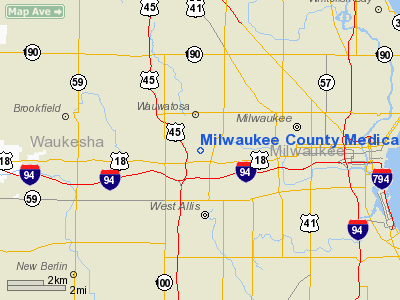
Milwaukee County Medical Complex Heliport |
Location & QuickFacts
| FAA Information Effective: | 2008-09-25 |
| Airport Identifier: | 2WI3 |
| Airport Status: | Operational |
| Longitude/Latitude: | 088-01-23.1590W/43-02-29.5460N
-88.023100/43.041541 (Estimated) |
| Elevation: | 835 ft / 254.51 m (Estimated) |
| Land: | 0 acres |
| From nearest city: | 0 nautical miles N of Wauwatosa, WI |
| Location: | Milwaukee County, WI |
| Magnetic Variation: | 01W (1985) |
Owner & Manager
| Ownership: | Publicly owned |
| Owner: | Milwaukee County |
| Address: | W. Wisconsin Ave
Milwaukee, WI 53226 |
| Phone number: | 414-475-1000 |
| Manager: | James Ryan |
| Address: | 1000 N. 92 Nd St.
Milwaukee, WI 53226 |
| Phone number: | 414-778-4570 |
Airport Operations and Facilities
| Airport Use: | Private
MEDICAL USE. |
| Wind indicator: | Yes |
| Segmented Circle: | No |
| Control Tower: | No |
| Lighting Schedule: | DUSK-DAWN |
| Beacon Color: | Clear-Green-Yellow (heliport) |
| Sectional chart: | Chicago |
| Region: | AGL - Great Lakes |
| Boundary ARTCC: | ZAU - Chicago |
| Tie-in FSS: | GRB - Green Bay |
| FSS Toll Free: | 1-800-WX-BRIEF |
Airport Communications
Airport Services
Runway Information
Helipad H1
| Dimension: | 120 x 90 ft / 36.6 x 27.4 m |
| Surface: | ASPH, |
| |
Runway H1 |
Runway |
| Traffic Pattern: | Left | Left |
|
Radio Navigation Aids
| ID |
Type |
Name |
Ch |
Freq |
Var |
Dist |
| BL | NDB | Yanks | | 260.00 | 02W | 6.5 nm |
| GM | NDB | Teels | | 242.00 | 02W | 8.0 nm |
| UES | NDB | Waukesha | | 359.00 | 01W | 9.3 nm |
| RA | NDB | Paser | | 206.00 | 00E | 22.3 nm |
| LLE | NDB | Kettle Moraine | | 329.00 | 01W | 23.5 nm |
| HXF | NDB | Hartford | | 200.00 | 00E | 24.6 nm |
| RYV | NDB | Rock River | | 371.00 | 01W | 31.8 nm |
| LVV | NDB | Lake Lawn | | 404.00 | 00W | 32.5 nm |
| UNU | NDB | Juneau | | 344.00 | 01W | 37.8 nm |
| BJB | VOR | West Bend | | 109.80 | 01W | 23.3 nm |
| LJT | VOR/DME | Timmerman | 072X | 112.50 | 02W | 4.1 nm |
| HRK | VOR/DME | Horlick | 124X | 117.70 | 02W | 19.2 nm |
| BUU | VOR/DME | Burbun | 092X | 114.50 | 01W | 24.5 nm |
| ENW | VOR/DME | Kenosha | 029X | 109.20 | 02W | 26.9 nm |
| FAH | VOR/DME | Falls | 37X | 110.00 | 02W | 44.4 nm |
| OBK | VOR/DME | Northbrook | 077X | 113.00 | 02W | 49.4 nm |
| BAE | VORTAC | Badger | 111X | 116.40 | 02E | 12.3 nm |
| MKE | VOT | Milwaukee | | 109.00 | | 7.9 nm |
Remarks
- PRVDD APCH/DEP OPS 010 - 240 DEG, TKOF/LDG AREA APRXLY MKD, NON-OBST WIND INDCR MAINTD.
Images and information placed above are from
http://www.airport-data.com/airport/2WI3/
We thank them for the data!
| General Info
|
| Country |
United States
|
| State |
WISCONSIN
|
| FAA ID |
2WI3
|
| Latitude |
43-02-29.546N
|
| Longitude |
088-01-23.159W
|
| Elevation |
835 feet
|
| Near City |
WAUWATOSA
|
We don't guarantee the information is fresh and accurate. The data may
be wrong or outdated.
For more up-to-date information please refer to other sources.
|
|


