 |
|
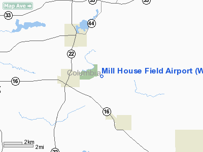
Location & QuickFacts
| FAA Information Effective: | 2008-09-25 |
| Airport Identifier: | WS15 |
| Airport Status: | Operational |
| Longitude/Latitude: | 089-15-55.4200W/43-29-42.6930N
-89.265394/43.495193 (Estimated) |
| Elevation: | 820 ft / 249.94 m (Estimated) |
| Land: | 0 acres |
| From nearest city: | 2 nautical miles E of Wyocena, WI |
| Location: | Columbia County, WI |
| Magnetic Variation: | 01W (1995) |
Owner & Manager
| Ownership: | Privately owned |
| Owner: | Blayde Elert |
| Address: | 5308 Highway G
Rio, WI 53960 |
| Phone number: | 608-546-2550 |
| Manager: | Blayde Elert |
| Address: | 5308 Highway G
Rio, WI 53960 |
| Phone number: | 608-546-2550 |
Airport Operations and Facilities
| Airport Use: | Private |
| Wind indicator: | Yes |
| Segmented Circle: | No |
| Control Tower: | No |
| Sectional chart: | Chicago |
| Region: | AGL - Great Lakes |
| Boundary ARTCC: | ZAU - Chicago |
| Tie-in FSS: | GRB - Green Bay |
| FSS on Airport: | No |
| FSS Toll Free: | 1-800-WX-BRIEF |
Runway Information
Runway 08/26
| Dimension: | 2000 x 150 ft / 609.6 x 45.7 m |
| Surface: | TURF, Good Condition |
| |
Runway 08 |
Runway 26 |
| Traffic Pattern: | Left | Left |
|
Radio Navigation Aids
| ID |
Type |
Name |
Ch |
Freq |
Var |
Dist |
| UNU | NDB | Juneau | | 344.00 | 01W | 24.9 nm |
| MS | NDB | Monah | | 400.00 | 00E | 26.2 nm |
| RYV | NDB | Rock River | | 371.00 | 01W | 30.5 nm |
| HXF | NDB | Hartford | | 200.00 | 00E | 39.0 nm |
| HBW | NDB | Kickapoo | | 251.00 | 03E | 47.5 nm |
| LLE | NDB | Kettle Moraine | | 329.00 | 01W | 49.8 nm |
| BJB | VOR | West Bend | | 109.80 | 01W | 49.9 nm |
| LNR | VOR/DME | Lone Rock | 075X | 112.80 | 00E | 39.8 nm |
| MSN | VORTAC | Madison | 023X | 108.60 | 03E | 21.3 nm |
| DLL | VORTAC | Dells | 117X | 117.00 | 03E | 22.0 nm |
| OSH | VORTAC | Oshkosh | 055X | 111.80 | 02E | 42.8 nm |
| BAE | VORTAC | Badger | 111X | 116.40 | 02E | 48.6 nm |
Remarks
- PRVDD OBSTNS LOWERED/REMOVED OR THLDS DSPLCD TO PROVIDE CLEAR 20:1 APCH; AREA 125 FT EITHER SIDE OF CNTRLN & 200 FT OFF RY ENDS ARE CLEAR OF OBSTNS; AREA 60 FT EITHER SIDE OF CNTRLN & 240 FT OFF RY ENDS ARE CLEAR OF RUTS.
Images and information placed above are from
http://www.airport-data.com/airport/WS15/
We thank them for the data!
| General Info
|
| Country |
United States
|
| State |
WISCONSIN
|
| FAA ID |
WS15
|
| Latitude |
43-29-42.693N
|
| Longitude |
089-15-55.420W
|
| Elevation |
820 feet
|
| Near City |
WYOCENA
|
We don't guarantee the information is fresh and accurate. The data may
be wrong or outdated.
For more up-to-date information please refer to other sources.
|
|


