|
|
Middleton Muni - Morey Field Airport |
Coordinates: 43°06′51″N 089°31′53″W / 43.11417°N 89.53139°W / 43.11417; -89.53139
Middleton Municipal Airport
Morey Field Airport |
 |
| IATA: none – ICAO: none – FAA LID: C29 |
| Summary |
| Airport type |
Public |
| Owner |
City of Middleton |
| Operator |
Morey Airplane Co. |
| Serves |
Middleton, Wisconsin |
| Elevation AMSL |
928 ft / 282 m |
| Website |
Middleton Municipal Airport |
| Runways |
| Direction |
Length |
Surface |
| ft |
m |
| 10/28 |
4,000 |
1,219 |
Asphalt |
| 1/19 |
2,000 |
609 |
Turf |
| Statistics (2005) |
| Aircraft operations |
111 |
| Based aircraft |
63 |
| Sources: FBO web site Morey Airplane Co., FAA and AirNav.com |
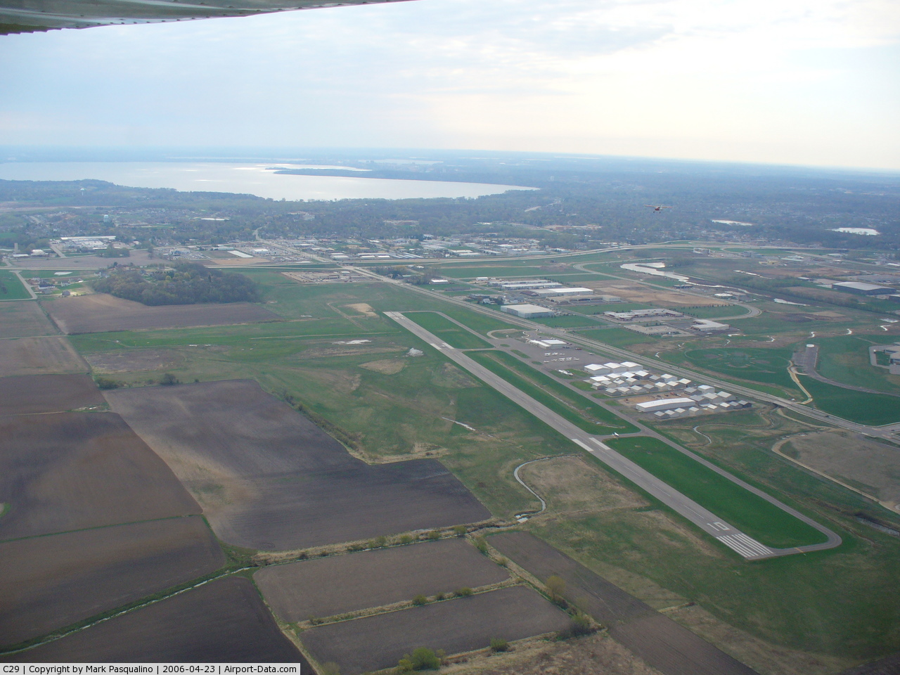
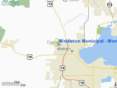
Middleton Municipal Airport (FAA LID: C29), also known as Morey Field, is a General aviation airport located five miles (8 km) northwest of Middleton, a city in Dane County, Wisconsin, United States. It has two runways.
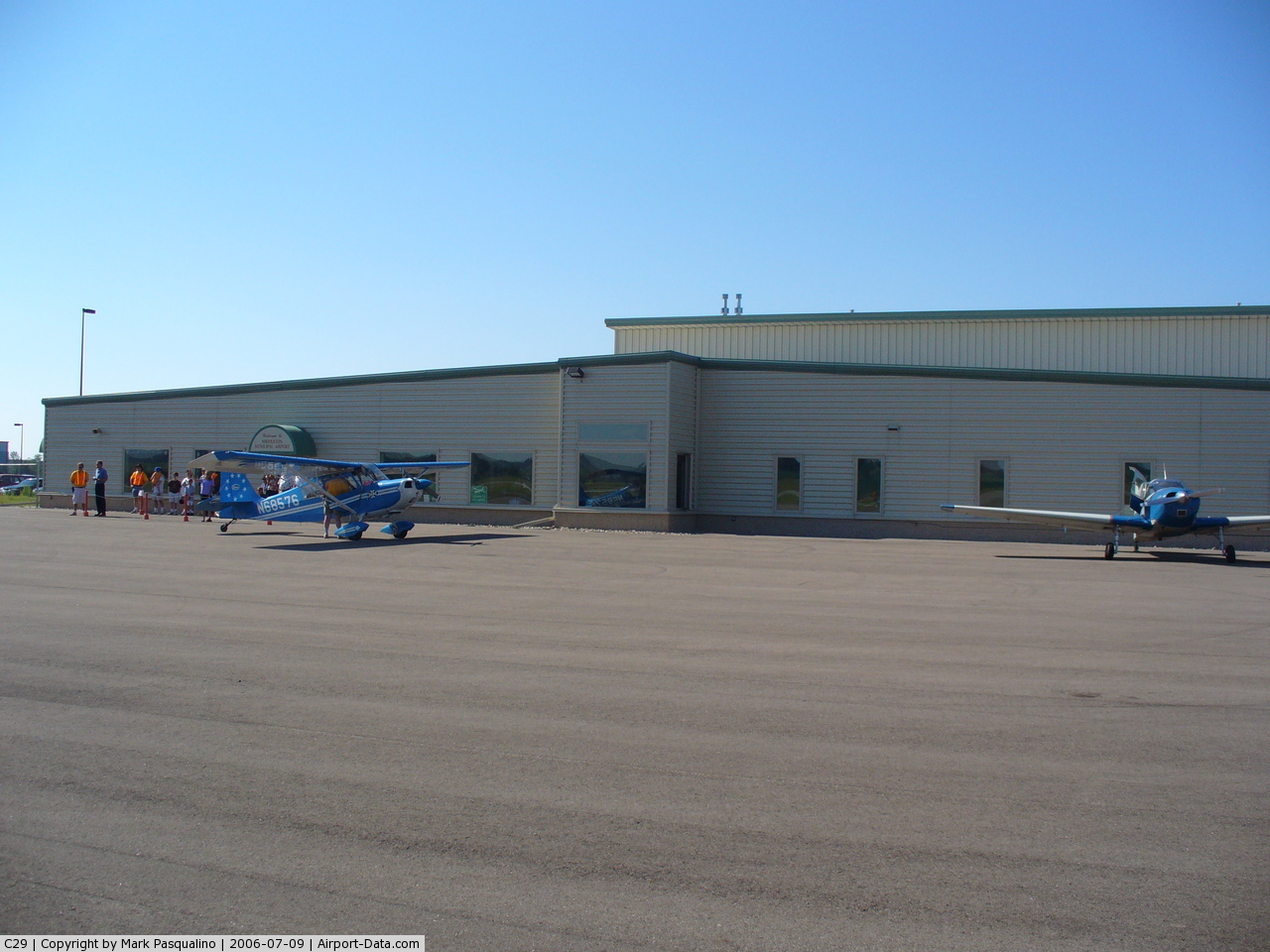
Morey Field was named after founder Howard Morey who started the Middleton airport in 1942. After management of the airport changed hands to Field Morey, the son of Howard and then to Richard Morey, the son of Field. The airport was sold to the city of Middleton in 1998 and changed its name from Morey Field to Middleton Municipal Airport - Morey Field. Although the airport was sold to the city, Richard Morey still manages the FBO which provides services to airport users.
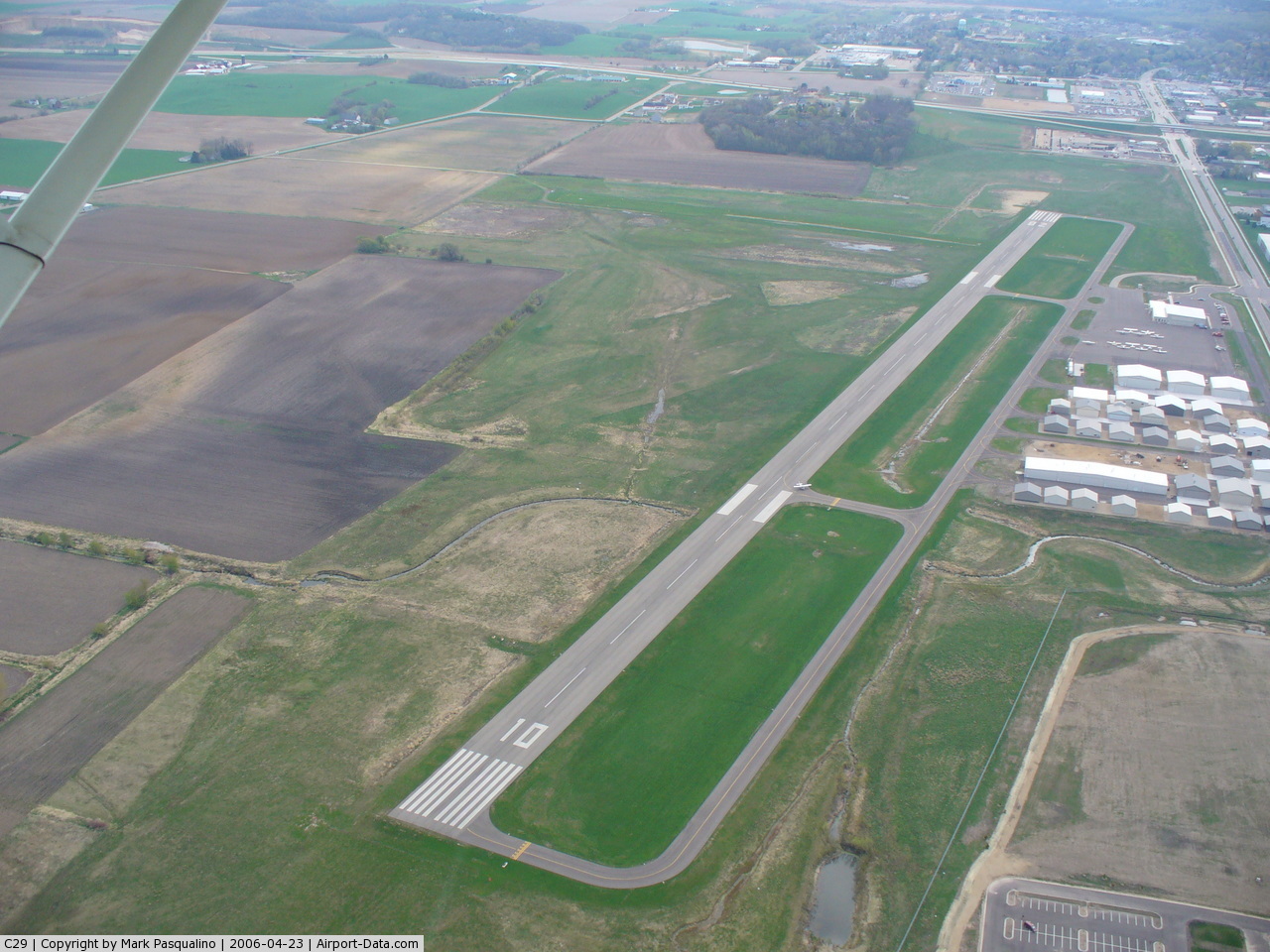
In July 2005 the city of Middleton completed a $7 million renovation of the airport including land acquisition and construction. The renovation consisted of a new terminal building and a new 4,000-foot (1,200 m) long by 100-foot (30 m) wide asphalt runway (10/28), as well as a 2,000-foot (610 m) long by 120-foot (37 m) wide crosswind turf runway (1/19).
Morey Airplane Co. is the airport's fixed base operator (FBO).
Facilities and aircraft
Middleton Municipal Airport - Morey Field covers an area of 160 acres (64.75 ha) and has two runways:
- 10/28: 4,000 x 100 ft (1,219 x 60 m), surface: asphalt
- 1/19: 2,000 x 120 ft (612 x 37 m), surface: turf
This airport is served by the following IAPs - Instrument Approach Procedures
- RNAV (GPS) RWY 10
- RNAV (GPS) RWY 28
- LOC/DME RWY 10
- VOR RWY 10
- VOR RWY 28
NOTE: Special Take-Off Minimums apply
Free Instrument Approach Plates available at AirNav.com/
For the 12-month period ending August 24, 2005, the airport had 40,515 aircraft operations, an average of 111 per day: 62% local general aviation, 32% transient general aviation, 6% air taxi, and 1% military.
There are 63 aircraft based at this airport: 52 single-engine, 7 multi-engine, 1 jet, 3 helicopter
The above content comes from Wikipedia and is published under free licenses – click here to read more.
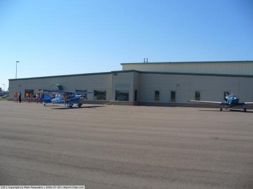 |
(Click on the photo to enlarge) |
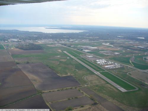 |
(Click on the photo to enlarge) |
 |
(Click on the photo to enlarge) |
Location & QuickFacts
| FAA Information Effective: | 2008-09-25 |
| Airport Identifier: | C29 |
| Airport Status: | Operational |
| Longitude/Latitude: | 089-31-53.5209W/43-06-51.3716N
-89.531534/43.114270 (Estimated) |
| Elevation: | 928 ft / 282.85 m (Surveyed) |
| Land: | 258 acres |
| From nearest city: | 5 nautical miles NW of Middleton, WI |
| Location: | Dane County, WI |
| Magnetic Variation: | 01W (2000) |
Owner & Manager
| Ownership: | Publicly owned |
| Owner: | City Of Middleton |
| Address: | 7426 Hubbard Avenue
Middleton, WI 53562 |
| Phone number: | 608-827-1050 |
| Manager: | Richard Morey |
| Address: | 8300 Airport Road, 7426 Hubbard Ave
Middleton, WI 53562 |
| Phone number: | 608-836-1711 |
Airport Operations and Facilities
| Airport Use: | Open to public |
| Wind indicator: | Yes |
| Segmented Circle: | No |
| Control Tower: | No |
| Lighting Schedule: | DUSK-DAWN
ACTVT MIRL RY 10/28 & REIL RYS 10/28 - CTAF. |
| Beacon Color: | Clear-Green (lighted land airport) |
| Landing fee charge: | No |
| Sectional chart: | Chicago |
| Region: | AGL - Great Lakes |
| Traffic Pattern Alt: | 1000 ft |
| Boundary ARTCC: | ZAU - Chicago |
| Tie-in FSS: | GRB - Green Bay |
| FSS on Airport: | No |
| FSS Toll Free: | 1-800-WX-BRIEF |
| NOTAMs Facility: | GRB (NOTAM-d service avaliable) |
| Federal Agreements: | N |
Airport Communications
| CTAF: | 123.000 |
| Unicom: | 123.000 |
Airport Services
| Fuel available: | 100LLA |
| Airframe Repair: | MAJOR |
| Power Plant Repair: | MAJOR |
| Bottled Oxygen: | NONE |
| Bulk Oxygen: | NONE |
Runway Information
Runway 01/19
| Dimension: | 2000 x 120 ft / 609.6 x 36.6 m |
| Surface: | TURF, |
| |
Runway 01 |
Runway 19 |
| Longitude: | 089-31-42.8120W | 089-31-39.3110W |
| Latitude: | 43-06-43.9120N | 43-07-03.4970N |
| Elevation: | 925.00 ft | 928.00 ft |
| Alignment: | 7 | 127 |
| Traffic Pattern: | Left | Left |
|
Runway 10/28
| Dimension: | 4000 x 100 ft / 1219.2 x 30.5 m |
| Surface: | ASPH, |
| Edge Lights: | Medium |
| |
Runway 10 |
Runway 28 |
| Longitude: | 089-32-26.3355W | 089-31-33.1657W |
| Latitude: | 43-06-53.5117N | 43-06-46.8985N |
| Elevation: | 928.00 ft | 927.00 ft |
| Alignment: | 100 | 127 |
| ILS Type: | LOC/DME | |
| Traffic Pattern: | Left | Left |
| Markings: | Non-precision instrument, Good Condition | Non-precision instrument, Good Condition |
| Crossing Height: | 32.00 ft | 36.00 ft |
| VASI: | 2-light PAPI on left side | 2-light PAPI on left side |
| Visual Glide Angle: | 4.00° | 4.00° |
| Runway End Identifier: | Yes | Yes |
| Obstruction: | 84 ft trees, 2400.0 ft from runway, 500 ft right of centerline, 26:1 slope to clear | 51 ft pole, 2150.0 ft from runway, 100 ft left of centerline, 38:1 slope to clear |
|
Radio Navigation Aids
| ID |
Type |
Name |
Ch |
Freq |
Var |
Dist |
| MS | NDB | Monah | | 400.00 | 00E | 8.7 nm |
| MRJ | NDB | Mineral Point | | 365.00 | 00W | 33.4 nm |
| RYV | NDB | Rock River | | 371.00 | 01W | 35.5 nm |
| JVL | NDB | Janesville | | 375.00 | 03E | 37.0 nm |
| UNU | NDB | Juneau | | 344.00 | 01W | 40.9 nm |
| PVB | NDB | Platteville | | 203.00 | 01E | 47.4 nm |
| HBW | NDB | Kickapoo | | 251.00 | 03E | 47.8 nm |
| LVV | NDB | Lake Lawn | | 404.00 | 00W | 48.3 nm |
| LNR | VOR/DME | Lone Rock | 075X | 112.80 | 00E | 28.5 nm |
| JVL | VOR/DME | Janesville | 090X | 114.30 | 03E | 38.4 nm |
| MSN | VORTAC | Madison | 023X | 108.60 | 03E | 8.6 nm |
| DLL | VORTAC | Dells | 117X | 117.00 | 03E | 28.1 nm |
Remarks
- BIRDS ON & INVOF ARPT; ESPECIALLY DURING RAINY PERIODS.
- AVOID NOISE SENSITIVE AREA 1 MILE SW. CTC AMGR AT 608-836-1711 FOR NOISE ABATEMENT PROCEDURES.
- 135 FT CRANE 1/4 M EAST 1300-2200, 240 FT CRANE 1/2 M FM AER 28 SR/SS, 230 FT CRANE 1 MI SE AER 28 & 240 FT CRANE2.2 MI SW.
- CRANE 80 AGL 1/4 SM E AER 28, UNLGTD/FLAGGED.
- GCO AVBL ON FREQ 121.725 THRU FLIGHT SVC AND MADISON APCH CTL.
- EXISTED PRIOR TO 1959.
Images and information placed above are from
http://www.airport-data.com/airport/C29/
We thank them for the data!
| General Info
|
| Country |
United States
|
| State |
WISCONSIN
|
| FAA ID |
C29
|
| Latitude |
43-06-51.200N
|
| Longitude |
089-31-50.900W
|
| Elevation |
926 feet
|
| Near City |
MIDDLETON
|
We don't guarantee the information is fresh and accurate. The data may
be wrong or outdated.
For more up-to-date information please refer to other sources.
|
|