 |
|
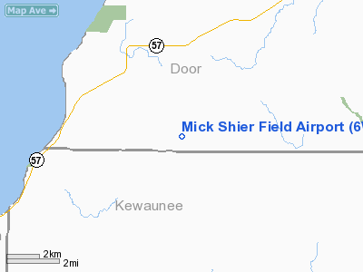
Location & QuickFacts
| FAA Information Effective: | 2008-09-25 |
| Airport Identifier: | 6WI6 |
| Airport Status: | Operational |
| Longitude/Latitude: | 087-37-40.9418W/44-41-02.2861N
-87.628039/44.683968 (Estimated) |
| Elevation: | 650 ft / 198.12 m (Estimated) |
| Land: | 17 acres |
| From nearest city: | 1 nautical miles SE of Rosiere, WI |
| Location: | Door County, WI |
| Magnetic Variation: | () |
Owner & Manager
| Ownership: | Privately owned |
| Owner: | Jay Wille |
| Address: | 9822 Swamp Rd
Forestville, WI 54213 |
| Phone number: | 920-837-2793 |
| Manager: | Jay Wille |
| Address: | 9822 Swamp Rd
Forestville, WI 54213 |
| Phone number: | 920-837-2793 |
Airport Operations and Facilities
| Airport Use: | Private |
| Control Tower: | No |
| Sectional chart: | Green Bay |
| Region: | AGL - Great Lakes |
| Boundary ARTCC: | ZMP - Minneapolis |
| Tie-in FSS: | GRB - Green Bay |
| FSS Toll Free: | 1-800-WX-BRIEF |
Runway Information
Runway 01/19
| Dimension: | 1340 x 100 ft / 408.4 x 30.5 m |
| Surface: | TURF, |
| |
Runway 01 |
Runway 19 |
| Traffic Pattern: | Left | Left |
| Obstruction: | 30 ft pline, 30.0 ft from runway | |
|
Radio Navigation Aids
| ID |
Type |
Name |
Ch |
Freq |
Var |
Dist |
| SUE | NDB | Sturgeon Bay | | 414.00 | 03W | 12.7 nm |
| OCQ | NDB | Oconto | | 388.00 | 03W | 16.7 nm |
| SG | NDB | Depre | | 332.00 | 02W | 27.6 nm |
| AQ | NDB | Kooky | | 407.00 | 02W | 43.4 nm |
| CLI | NDB | Clintonville | | 209.00 | 02W | 47.4 nm |
| MNM | VOR/DME | Menominee | 033X | 109.60 | 00E | 29.8 nm |
| MTW | VOR/DME | Manitowoc | 047X | 111.00 | 02W | 33.5 nm |
| GRB | VORTAC | Green Bay | 102X | 115.50 | 01E | 25.5 nm |
Remarks
- 100 FT WINDMILLS 1NM S OF ARPT.
- PRVDD CLEAR 20:1 APCHS, CLEAR RY SAFETY AREA, AND CLEAR OBSTACLE FREE ZONE.
Images and information placed above are from
http://www.airport-data.com/airport/6WI6/
We thank them for the data!
| General Info
|
| Country |
United States
|
| State |
WISCONSIN
|
| FAA ID |
6WI6
|
| Latitude |
45-00-36.960N
|
| Longitude |
088-12-40.359W
|
| Elevation |
840 feet
|
| Near City |
SURING
|
We don't guarantee the information is fresh and accurate. The data may
be wrong or outdated.
For more up-to-date information please refer to other sources.
|
|


