 |
|
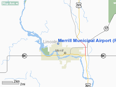
Location & QuickFacts
| FAA Information Effective: | 2008-09-25 |
| Airport Identifier: | RRL |
| Airport Status: | Operational |
| Longitude/Latitude: | 089-42-46.3000W/45-11-56.1000N
-89.712861/45.198917 (Estimated) |
| Elevation: | 1318 ft / 401.73 m (Surveyed) |
| Land: | 361 acres |
| From nearest city: | 1 nautical miles NW of Merrill, WI |
| Location: | Lincoln County, WI |
| Magnetic Variation: | 01W (1995) |
Owner & Manager
| Ownership: | Publicly owned |
| Owner: | City Of Merrill |
| Address: | N2241 Airport Rd
Merrill, WI 54452 |
| Phone number: | 715-536-2024 |
| Manager: | John Miller |
| Address: | N2241 Airport Rd
Merrill, WI 54452 |
| Phone number: | 715-536-2024 |
Airport Operations and Facilities
| Airport Use: | Open to public |
| Wind indicator: | Yes |
| Segmented Circle: | Yes |
| Control Tower: | No |
| Lighting Schedule: | DUSK-DAWN
MIRL RY 07/25 PRESET ON LOW INTST; TO INCR INTST & ACTVT REIL RY 07/25 & MIRL RY 16/34 - CTAF. |
| Beacon Color: | Clear-Green (lighted land airport) |
| Landing fee charge: | No |
| Sectional chart: | Green Bay |
| Region: | AGL - Great Lakes |
| Boundary ARTCC: | ZMP - Minneapolis |
| Tie-in FSS: | GRB - Green Bay |
| FSS on Airport: | No |
| FSS Toll Free: | 1-800-WX-BRIEF |
| NOTAMs Facility: | RRL (NOTAM-d service avaliable) |
| Federal Agreements: | NGY |
Airport Communications
| CTAF: | 122.800 |
| Unicom: | 122.800 |
Airport Services
| Fuel available: | 100LL |
| Airframe Repair: | MAJOR |
| Power Plant Repair: | MINOR |
| Bottled Oxygen: | NONE |
| Bulk Oxygen: | NONE |
Runway Information
Runway 07/25
| Dimension: | 5100 x 75 ft / 1554.5 x 22.9 m |
| Surface: | ASPH, Good Condition |
| Weight Limit: | Single wheel: 45000 lbs.
Dual wheel: 65000 lbs.
Dual tandem wheel: 100000 lbs. |
| Edge Lights: | Medium |
| |
Runway 07 |
Runway 25 |
| Longitude: | 089-43-30.6099W | 089-42-24.3128W |
| Latitude: | 45-11-44.6796N | 45-12-03.0684N |
| Elevation: | 1318.00 ft | 1306.00 ft |
| Alignment: | 69 | 127 |
| Traffic Pattern: | Left | Left |
| Markings: | Non-precision instrument, Good Condition | Non-precision instrument, Good Condition |
| Crossing Height: | 40.00 ft | 40.00 ft |
| VASI: | 2-light PAPI on left side | 2-light PAPI on left side |
| Visual Glide Angle: | 3.00° | 3.00° |
| Runway End Identifier: | Yes | Yes |
| Obstruction: | 36 ft trees, 1600.0 ft from runway, 375 ft right of centerline, 38:1 slope to clear | 58 ft trees, 2200.0 ft from runway, 100 ft right of centerline, 34:1 slope to clear |
|
Runway 16/34
| Dimension: | 2997 x 75 ft / 913.5 x 22.9 m |
| Surface: | ASPH, Good Condition |
| Weight Limit: | Single wheel: 26000 lbs. |
| Edge Lights: | Medium |
| |
Runway 16 |
Runway 34 |
| Longitude: | 089-42-35.5512W | 089-42-18.9019W |
| Latitude: | 45-12-13.4545N | 45-11-46.3124N |
| Elevation: | 1318.00 ft | 1303.00 ft |
| Alignment: | 127 | 127 |
| Traffic Pattern: | Left | Left |
| Markings: | Basic, Good Condition | Basic, Good Condition |
| Runway End Identifier: | No | No |
| Centerline Lights: | No | No |
| Touchdown Lights: | No | No |
| Obstruction: | 58 ft trees, 1400.0 ft from runway, 300 ft right of centerline, 20:1 slope to clear
+3 FT BRUSH 100-200 FT FM THLD 0B OF EXTNDD CNTRLN. | 75 ft trees, 1700.0 ft from runway, 120 ft right of centerline, 20:1 slope to clear |
|
Radio Navigation Aids
| ID |
Type |
Name |
Ch |
Freq |
Var |
Dist |
| RRL | NDB | Merrill | | 257.00 | 01W | 0.4 nm |
| FZK | NDB | Wausau | | 243.00 | 01E | 16.7 nm |
| AIG | NDB | Antigo | | 347.00 | 02W | 25.5 nm |
| MDZ | NDB | Medford | | 335.00 | 00E | 25.9 nm |
| DO | NDB | Dougy | | 236.00 | 01W | 38.2 nm |
| MFI | NDB | Marshfield | | 391.00 | 00E | 39.2 nm |
| PBH | NDB | Phillips | | 263.00 | 00E | 42.3 nm |
| ARV | NDB | Arbor Vitae | | 221.00 | 01W | 43.7 nm |
| EGV | NDB | Eagle River | | 341.00 | 02W | 48.0 nm |
| AUW | VORTAC | Wausau | 053X | 111.60 | 02E | 21.8 nm |
| RHI | VORTAC | Rhinelander | 029X | 109.20 | 02E | 28.3 nm |
| STE | VORTAC | Stevens Point | 043X | 110.60 | 01W | 40.2 nm |
Remarks
- DEER ON & INVOF OF ARPT.
- ULTRALIGHT ACTIVITY ON & INVOF ARPT.
- GCO AVBL ON FREQ 121.725 THRU FLT SVCS.
Images and information placed above are from
http://www.airport-data.com/airport/RRL/
We thank them for the data!
| General Info
|
| Country |
United States
|
| State |
WISCONSIN
|
| FAA ID |
RRL
|
| Latitude |
45-11-57.375N
|
| Longitude |
089-42-41.162W
|
| Elevation |
1317 feet
|
| Near City |
MERRILL
|
We don't guarantee the information is fresh and accurate. The data may
be wrong or outdated.
For more up-to-date information please refer to other sources.
|
|


