 |
|
Location & QuickFacts
| FAA Information Effective: | 2008-09-25 |
| Airport Identifier: | WI93 |
| Airport Status: | Operational |
| Longitude/Latitude: | 089-24-06.4290W/43-03-55.9860N
-89.401786/43.065552 (Estimated) |
| Elevation: | 891 ft / 271.58 m (Estimated) |
| Land: | 0 acres |
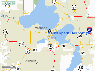
| From nearest city: | 0 nautical miles N of Madison, WI |
| Location: | Dane County, WI |
| Magnetic Variation: | 00E (1985) |
Owner & Manager
| Ownership: | Privately owned |
| Owner: | Meriter Hosp/park |
| Address: | 202 S Park St
Madison, WI 53715 |
| Phone number: | 608-267-6000 |
| Manager: | Alan Meyer, Engineering |
| Address: | 202 S Park St
Madison, WI 53715 |
| Phone number: | 608-267-6376 |
Airport Operations and Facilities
| Airport Use: | Private
MEDICAL USE. |
| Wind indicator: | Yes |
| Segmented Circle: | No |
| Control Tower: | No |
| Landing fee charge: | No |
| Sectional chart: | Chicago |
| Region: | AGL - Great Lakes |
| Boundary ARTCC: | ZAU - Chicago |
| Tie-in FSS: | GRB - Green Bay |
| FSS on Airport: | No |
| FSS Toll Free: | 1-800-WX-BRIEF |
Airport Services
| Airframe Repair: | NONE |
| Power Plant Repair: | NONE |
Runway Information
Helipad H1
| Dimension: | 108 x 79 ft / 32.9 x 24.1 m |
| Surface: | CONC, |
| |
Runway H1 |
Runway |
| Traffic Pattern: | Left | Left |
|
Radio Navigation Aids
| ID |
Type |
Name |
Ch |
Freq |
Var |
Dist |
| MS | NDB | Monah | | 400.00 | 00E | 2.5 nm |
| RYV | NDB | Rock River | | 371.00 | 01W | 30.4 nm |
| JVL | NDB | Janesville | | 375.00 | 03E | 31.4 nm |
| UNU | NDB | Juneau | | 344.00 | 01W | 37.6 nm |
| MRJ | NDB | Mineral Point | | 365.00 | 00W | 37.8 nm |
| LVV | NDB | Lake Lawn | | 404.00 | 00W | 41.9 nm |
| HXF | NDB | Hartford | | 200.00 | 00E | 47.2 nm |
| FEP | NDB | Freeport | | 335.00 | 00E | 50.0 nm |
| JVL | VOR/DME | Janesville | 090X | 114.30 | 03E | 33.2 nm |
| LNR | VOR/DME | Lone Rock | 075X | 112.80 | 00E | 34.9 nm |
| MSN | VORTAC | Madison | 023X | 108.60 | 03E | 5.5 nm |
| DLL | VORTAC | Dells | 117X | 117.00 | 03E | 33.2 nm |
| BAE | VORTAC | Badger | 111X | 116.40 | 02E | 49.1 nm |
Remarks
- HELIPORT LOCATED ON TOP OF HOSPITAL ELEVATED AUTO PARKING RAMP.
- INGRESS/EGRESS ROUTES ARE RESTRICTED TO THE SOUTHWEST, NORTH, NORTHEAST, OR EAST. DAYLIGHT OPERATIONS ONLY.
Images and information placed above are from
http://www.airport-data.com/airport/WI93/
We thank them for the data!
| General Info
|
| Country |
United States
|
| State |
WISCONSIN
|
| FAA ID |
WI93
|
| Latitude |
43-03-55.986N
|
| Longitude |
089-24-06.429W
|
| Elevation |
891 feet
|
| Near City |
MADISON
|
We don't guarantee the information is fresh and accurate. The data may
be wrong or outdated.
For more up-to-date information please refer to other sources.
|
|


