|
|
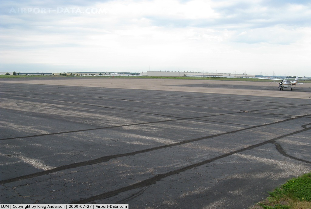
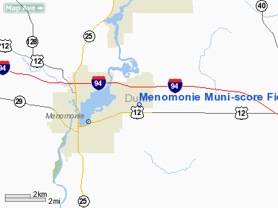
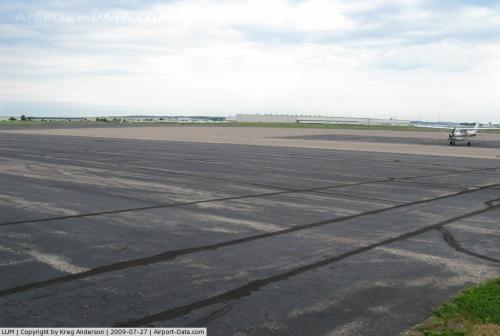
Menomonie Muni-score Field Airport |
 |
(Click on the photo to enlarge) |
Location & QuickFacts
| FAA Information Effective: | 2008-09-25 |
| Airport Identifier: | LUM |
| Airport Status: | Operational |
| Longitude/Latitude: | 091-52-04.1000W/44-53-32.4000N
-91.867806/44.892333 (Estimated) |
| Elevation: | 895 ft / 272.80 m (Surveyed) |
| Land: | 277 acres |
| From nearest city: | 3 nautical miles E of Menomonie, WI |
| Location: | Dunn County, WI |
| Magnetic Variation: | 01E (2000) |
Owner & Manager
| Ownership: | Publicly owned |
| Owner: | City Of Menomonie |
| Address: | 800 Wilson Ave
Menomonie, WI 54751-2795 |
| Phone number: | 715-232-2187 |
| Manager: | Louis Pfaffel |
| Address: | 1400 Indianhead Dr.
Menomonie, WI 54751 |
| Phone number: | 715-233-5636 |
Airport Operations and Facilities
| Airport Use: | Open to public |
| Wind indicator: | Yes |
| Segmented Circle: | No |
| Control Tower: | No |
| Lighting Schedule: | DUSK-DAWN
ACTVT MIRL RYS 09/27 & 18/36; PAPI RYS 09; 27; 18 & 36; REIL RYS 09; 27 & 18 - CTAF. |
| Beacon Color: | Clear-Green (lighted land airport) |
| Sectional chart: | Green Bay |
| Region: | AGL - Great Lakes |
| Boundary ARTCC: | ZMP - Minneapolis |
| Tie-in FSS: | GRB - Green Bay |
| FSS Toll Free: | 1-800-WX-BRIEF |
| NOTAMs Facility: | GRB (NOTAM-d service avaliable) |
| Federal Agreements: | N |
Airport Communications
| CTAF: | 122.700 |
| Unicom: | 122.700 |
Airport Services
| Fuel available: | 100LLA |
| Airframe Repair: | MAJOR |
| Power Plant Repair: | MAJOR |
| Bottled Oxygen: | NONE |
Runway Information
Runway 09/27
| Dimension: | 5074 x 75 ft / 1546.6 x 22.9 m |
| Surface: | ASPH, Good Condition |
| Edge Lights: | Medium |
| |
Runway 09 |
Runway 27 |
| Longitude: | 091-52-36.8852W | 091-51-26.4081W |
| Latitude: | 44-53-26.9590N | 44-53-27.5232N |
| Elevation: | 892.00 ft | 893.00 ft |
| Alignment: | 89 | 127 |
| Traffic Pattern: | Left | Left |
| Markings: | Non-precision instrument, Good Condition | Non-precision instrument, Good Condition |
| Crossing Height: | 43.00 ft | 40.00 ft |
| VASI: | 2-light PAPI on left side | 2-light PAPI on left side |
| Visual Glide Angle: | 3.00° | 3.00° |
| Runway End Identifier: | Yes | Yes |
| Obstruction: | 75 ft trees, 2785.0 ft from runway, 600 ft right of centerline, 34:1 slope to clear | 15 ft road, 710.0 ft from runway, 34:1 slope to clear |
|
Runway 18/36
| Dimension: | 3470 x 75 ft / 1057.7 x 22.9 m |
| Surface: | ASPH, Good Condition |
| Edge Lights: | Medium |
| |
Runway 18 |
Runway 36 |
| Longitude: | 091-52-08.7307W | 091-52-06.3882W |
| Latitude: | 44-53-57.1577N | 44-53-22.9329N |
| Elevation: | 895.00 ft | 893.00 ft |
| Alignment: | 127 | 127 |
| Traffic Pattern: | Left | Left |
| Markings: | Non-precision instrument, Good Condition | Non-precision instrument, Good Condition |
| Crossing Height: | 40.00 ft | 40.00 ft |
| VASI: | 2-light PAPI on left side | 2-light PAPI on right side |
| Visual Glide Angle: | 3.00° | 3.00° |
| Runway End Identifier: | Yes | |
| Obstruction: | 19 ft road, 660.0 ft from runway, 24:1 slope to clear | 98 ft ground, 2600.0 ft from runway, 550 ft left of centerline, 24:1 slope to clear |
|
Radio Navigation Aids
| ID |
Type |
Name |
Ch |
Freq |
Var |
Dist |
| AHH | NDB | Ameron | | 278.00 | 01E | 31.7 nm |
| RNH | NDB | New Richmond | | 257.00 | 02E | 32.2 nm |
| UBE | NDB | Cumberland | | 375.00 | 01E | 37.4 nm |
| OEO | NDB | Osceola | | 233.00 | 01E | 42.9 nm |
| PPI | NDB | Hopey | | 400.00 | 03E | 45.8 nm |
| RPD | VOR/DME | Rice Lake | 037X | 110.00 | 01E | 31.7 nm |
| ONA | VOR/DME | Winona | 051X | 111.40 | 01E | 49.5 nm |
| EAU | VORTAC | Eau Claire | 076X | 112.90 | 04E | 16.6 nm |
Remarks
- GCO AVBL ON FREQ 121.725 THRU FLT SVCS.
Images and information placed above are from
http://www.airport-data.com/airport/LUM/
We thank them for the data!
| General Info
|
| Country |
United States
|
| State |
WISCONSIN
|
| FAA ID |
LUM
|
| Latitude |
44.892278
44° 53' 32.20" N
|
| Longitude |
-91.867867
091° 52' 04.32" W
|
| Elevation |
895 feet
273 meters
|
| Magnetic Variation |
000° E (01/06)
|
| Beacon |
Yes
|
| Operating Agency |
U.S.CIVIL AIRPORT WHEREIN PERMIT COVERS USE BY TRANSIT MILITARY AIRCRAFT
|
| Daylight Saving Time |
Second Sunday in March at 0200 to first Sunday in November at 0200 local time (Exception Arizona and that portion of Indiana in the Eastern Time Zone)
|
We don't guarantee the information is fresh and accurate. The data may
be wrong or outdated.
For more up-to-date information please refer to other sources.
|
|