 |
|
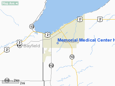
Memorial Medical Center Heliport |
Location & QuickFacts
| FAA Information Effective: | 2008-09-25 |
| Airport Identifier: | WS63 |
| Airport Status: | Operational |
| Longitude/Latitude: | 090-53-25.4760W/46-34-04.1980N
-90.890410/46.567833 (Estimated) |
| Elevation: | 690 ft / 210.31 m (Estimated) |
| Land: | 0 acres |
| From nearest city: | 2 nautical miles N of Ashland, WI |
| Location: | Ashland County, WI |
| Magnetic Variation: | 00W (1995) |
Owner & Manager
| Ownership: | Privately owned |
| Owner: | Memorial Medical Center |
| Address: | 1615 Maple Lane
Ashland, WI 54806 |
| Phone number: | 715-682-1190 |
| Manager: | M. James Nemec |
| Address: | 1615 Maple Lane
Ashland, WI 54806 |
| Phone number: | 715-682-1190 |
Airport Operations and Facilities
| Airport Use: | Private
MEDICAL USE. |
| Wind indicator: | Yes |
| Segmented Circle: | No |
| Control Tower: | No |
| Lighting Schedule: | PHONE REQ
FOR ROTG BCN CALL (715) 682-1190. |
| Beacon Color: | Clear-Green-Yellow (heliport) |
| Sectional chart: | Green Bay |
| Region: | AGL - Great Lakes |
| Boundary ARTCC: | ZMP - Minneapolis |
| Tie-in FSS: | GRB - Green Bay |
| FSS on Airport: | No |
| FSS Toll Free: | 1-800-WX-BRIEF |
Runway Information
Helipad H1
| Dimension: | 60 x 60 ft / 18.3 x 18.3 m |
| Surface: | ASPH, |
| |
Runway H1 |
Runway |
| Traffic Pattern: | Left | Left |
|
Radio Navigation Aids
| ID |
Type |
Name |
Ch |
Freq |
Var |
Dist |
| ENY | NDB | Kennedy | | 254.00 | 02E | 1.3 nm |
| SLY | NDB | Seeley | | 344.00 | 01E | 34.2 nm |
| OLG | NDB | Solon Springs | | 388.00 | 01E | 41.1 nm |
| PKF | NDB | Park Falls | | 371.00 | 01W | 41.7 nm |
| TWM | NDB | Two Harbors | | 243.00 | 01E | 45.6 nm |
| BFW | NDB | Silver Bay | | 350.00 | 00E | 46.3 nm |
| MHA | NDB | Manitowish | | 364.00 | 01W | 49.6 nm |
| ASX | VOR/DME | Ashland | 039X | 110.20 | 02E | 1.6 nm |
| HYR | VOR/DME | Hayward | 081X | 113.40 | 03E | 40.3 nm |
| IWD | VORTAC | Ironwood | 025X | 108.80 | 01E | 31.7 nm |
Remarks
- PRVDD APCH/DEP 260-350 CLKWS; AREA IS MKD; NON-OBSTRUCTING WIND INDICATOR ADJ TO LNDG AREA.
Images and information placed above are from
http://www.airport-data.com/airport/WS63/
We thank them for the data!
| General Info
|
| Country |
United States
|
| State |
WISCONSIN
|
| FAA ID |
WS63
|
| Latitude |
46-34-04.198N
|
| Longitude |
090-53-25.476W
|
| Elevation |
690 feet
|
| Near City |
ASHLAND
|
We don't guarantee the information is fresh and accurate. The data may
be wrong or outdated.
For more up-to-date information please refer to other sources.
|
|


