 |
|
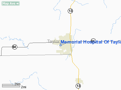
Memorial Hospital Of Taylor County Heliport |
Location & QuickFacts
| FAA Information Effective: | 2008-09-25 |
| Airport Identifier: | 12WI |
| Airport Status: | Operational |
| Longitude/Latitude: | 090-21-22.5050W/45-08-09.3880N
-90.356251/45.135941 (Estimated) |
| Elevation: | 1435 ft / 437.39 m (Estimated) |
| Land: | 0 acres |
| From nearest city: | 0 nautical miles N of Medford, WI |
| Location: | Taylor County, WI |
| Magnetic Variation: | 00W (1995) |
Owner & Manager
| Ownership: | Privately owned |
| Owner: | Memorial Hosp. Of Taylor Co. |
| Address: | 135 South Gibson
Medford, WI 54451 |
| Phone number: | 715-748-8100 |
| Manager: | Memorial Hosp. Of Taylor Co. |
| Address: | 135 South Gibson
Medford, WI 54451 |
| Phone number: | 715-748-8100 |
Airport Operations and Facilities
| Airport Use: | Private
MEDICAL USE. |
| Wind indicator: | Yes |
| Segmented Circle: | No |
| Control Tower: | No |
| Sectional chart: | Green Bay |
| Region: | AGL - Great Lakes |
| Boundary ARTCC: | ZMP - Minneapolis |
| Tie-in FSS: | GRB - Green Bay |
| FSS on Airport: | No |
| FSS Toll Free: | 1-800-WX-BRIEF |
Runway Information
Helipad H1
| Dimension: | 60 x 50 ft / 18.3 x 15.2 m |
| Surface: | ASPH, |
| |
Runway H1 |
Runway |
| Traffic Pattern: | Left | Left |
|
Radio Navigation Aids
| ID |
Type |
Name |
Ch |
Freq |
Var |
Dist |
| MDZ | NDB | Medford | | 335.00 | 00E | 2.7 nm |
| RRL | NDB | Merrill | | 257.00 | 01W | 27.9 nm |
| MFI | NDB | Marshfield | | 391.00 | 00E | 30.6 nm |
| FZK | NDB | Wausau | | 243.00 | 01E | 33.5 nm |
| PBH | NDB | Phillips | | 263.00 | 00E | 34.2 nm |
| RCX | NDB | Rusk County | | 356.00 | 00W | 35.0 nm |
| VIQ | NDB | Neillsville | | 368.00 | 01W | 35.4 nm |
| PKF | NDB | Park Falls | | 371.00 | 01W | 49.2 nm |
| DO | NDB | Dougy | | 236.00 | 01W | 49.6 nm |
| AUW | VORTAC | Wausau | 053X | 111.60 | 02E | 37.0 nm |
| RHI | VORTAC | Rhinelander | 029X | 109.20 | 02E | 48.3 nm |
| EAU | VORTAC | Eau Claire | 076X | 112.90 | 04E | 49.8 nm |
Remarks
- PRVDD APCH/DEP 360-045 CLKWS; APPROPRIATELY MKD WITH NON-SKID PAINT; WIND INDICATOR MAINTAINED.
Images and information placed above are from
http://www.airport-data.com/airport/12WI/
We thank them for the data!
| General Info
|
| Country |
United States
|
| State |
WISCONSIN
|
| FAA ID |
12WI
|
| Latitude |
45-08-09.388N
|
| Longitude |
090-21-22.505W
|
| Elevation |
1435 feet
|
| Near City |
MEDFORD
|
We don't guarantee the information is fresh and accurate. The data may
be wrong or outdated.
For more up-to-date information please refer to other sources.
|
|


