 |
|
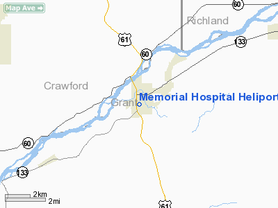
Memorial Hospital Heliport |
Location & QuickFacts
| FAA Information Effective: | 2008-09-25 |
| Airport Identifier: | WS48 |
| Airport Status: | Operational |
| Longitude/Latitude: | 090-42-28.4560W/43-07-59.9430N
-90.707904/43.133317 (Estimated) |
| Elevation: | 684 ft / 208.48 m (Estimated) |
| Land: | 0 acres |
| From nearest city: | 0 nautical miles N of Boscobel, WI |
| Location: | Grant County, WI |
| Magnetic Variation: | 02E (1985) |
Owner & Manager
| Ownership: | Privately owned |
| Owner: | Memorial Hospital Of Boscobel |
| Address: | 205 Parker St
Boscobel, WI 53805 |
| Phone number: | 608-375-4112 |
| Address: |
|
Airport Operations and Facilities
| Airport Use: | Private
MEDICAL USE. |
| Segmented Circle: | No |
| Control Tower: | No |
| Sectional chart: | Chicago |
| Region: | AGL - Great Lakes |
| Boundary ARTCC: | ZAU - Chicago |
| Tie-in FSS: | GRB - Green Bay |
| FSS Toll Free: | 1-800-WX-BRIEF |
Runway Information
Helipad H1
| Dimension: | 44 x 44 ft / 13.4 x 13.4 m |
| Surface: | ASPH, |
| |
Runway H1 |
Runway |
| Traffic Pattern: | Left | Left |
|
Radio Navigation Aids
| ID |
Type |
Name |
Ch |
Freq |
Var |
Dist |
| MRJ | NDB | Mineral Point | | 365.00 | 00W | 25.8 nm |
| PVB | NDB | Platteville | | 203.00 | 01E | 29.3 nm |
| HBW | NDB | Kickapoo | | 251.00 | 03E | 35.4 nm |
| CHU | NDB | Caledonia | | 209.00 | 03E | 43.7 nm |
| DEH | NDB | Decorah | | 236.00 | 01E | 45.9 nm |
| CMY | NDB | Mccoy | | 412.00 | 00E | 48.4 nm |
| XWY | NDB | West Union | | 278.00 | 02E | 48.6 nm |
| LNR | VOR/DME | Lone Rock | 075X | 112.80 | 00E | 27.0 nm |
| UKN | VORTAC | Waukon | 113X | 116.60 | 05E | 37.4 nm |
| DBQ | VORTAC | Dubuque | 105X | 115.80 | 04E | 44.0 nm |
| DLL | VORTAC | Dells | 117X | 117.00 | 03E | 48.3 nm |
Remarks
- PRVDD OPERS ARE COND FM 180 & 360 DEG; AREA IS MKD; WND IND IS MAINT; PAD SHOULD BE INCR IN SIZE; FLOWER BED SHD BE LOWERED; NO NGT OPERS UNLESS PROPER LIGHTING IS INSTALLED; FIRE PROTECTION BE PRVDD.
Images and information placed above are from
http://www.airport-data.com/airport/WS48/
We thank them for the data!
| General Info
|
| Country |
United States
|
| State |
WISCONSIN
|
| FAA ID |
WI44
|
| Latitude |
42-57-07.987N
|
| Longitude |
090-07-46.445W
|
| Elevation |
1213 feet
|
| Near City |
DODGEVILLE
|
We don't guarantee the information is fresh and accurate. The data may
be wrong or outdated.
For more up-to-date information please refer to other sources.
|
|


