 |
|
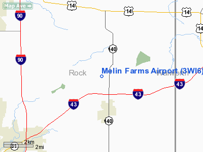
Location & QuickFacts
| FAA Information Effective: | 2008-09-25 |
| Airport Identifier: | 3WI6 |
| Airport Status: | Operational |
| Longitude/Latitude: | 088-52-28.4000W/42-35-24.5000N
-88.874556/42.590139 (Estimated) |
| Elevation: | 885 ft / 269.75 m (Estimated) |
| Land: | 5 acres |
| From nearest city: | 2 nautical miles N of Clinton, WI |
| Location: | Rock County, WI |
| Magnetic Variation: | 01E (1995) |
Owner & Manager
| Ownership: | Privately owned |
| Owner: | Mark G. Melin |
| Address: | 8608 East Rye Drive
Clinton, WI 53525 |
| Phone number: | 608-676-4627 |
| Manager: | Mark G. Melin |
| Address: | 8608 East Rye Drive
Clinton, WI 53525 |
| Phone number: | 608-676-4627 |
Airport Operations and Facilities
| Airport Use: | Private |
| Wind indicator: | Yes |
| Segmented Circle: | No |
| Control Tower: | No |
| Sectional chart: | Chicago |
| Region: | AGL - Great Lakes |
| Boundary ARTCC: | ZAU - Chicago |
| Tie-in FSS: | GRB - Green Bay |
| FSS on Airport: | No |
| FSS Toll Free: | 1-800-WX-BRIEF |
Runway Information
Runway 05/23
| Dimension: | 1500 x 50 ft / 457.2 x 15.2 m |
| Surface: | TURF, |
| |
Runway 05 |
Runway 23 |
| Traffic Pattern: | Left | Left |
|
Runway 09/27
| Dimension: | 1500 x 50 ft / 457.2 x 15.2 m |
| Surface: | TURF, |
| |
Runway 09 |
Runway 27 |
| Traffic Pattern: | Left | Left |
| Obstruction: | 4 ft fence, 80.0 ft from runway | |
|
Radio Navigation Aids
| ID |
Type |
Name |
Ch |
Freq |
Var |
Dist |
| JVL | NDB | Janesville | | 375.00 | 03E | 7.5 nm |
| LVV | NDB | Lake Lawn | | 404.00 | 00W | 14.1 nm |
| MS | NDB | Monah | | 400.00 | 00E | 35.2 nm |
| RYV | NDB | Rock River | | 371.00 | 01W | 35.7 nm |
| FEP | NDB | Freeport | | 335.00 | 00E | 37.8 nm |
| UES | NDB | Waukesha | | 359.00 | 01W | 39.3 nm |
| DKB | NDB | Dekalb | | 209.00 | 02W | 40.1 nm |
| GM | NDB | Teels | | 242.00 | 02W | 41.5 nm |
| RA | NDB | Paser | | 206.00 | 00E | 43.5 nm |
| JVL | VOR/DME | Janesville | 090X | 114.30 | 03E | 10.4 nm |
| BUU | VOR/DME | Burbun | 092X | 114.50 | 01W | 26.0 nm |
| RFD | VOR/DME | Rockford | 045X | 110.80 | 01E | 26.2 nm |
| ENW | VOR/DME | Kenosha | 029X | 109.20 | 02W | 41.7 nm |
| OBK | VOR/DME | Northbrook | 077X | 113.00 | 02W | 46.6 nm |
| PLL | VOR/DME | Polo | 049X | 111.20 | 03E | 47.4 nm |
| HRK | VOR/DME | Horlick | 124X | 117.70 | 02W | 48.0 nm |
| DPA | VOR/DME | Dupage | 021X | 108.40 | 02E | 48.1 nm |
| LJT | VOR/DME | Timmerman | 072X | 112.50 | 02W | 48.3 nm |
| MSN | VORTAC | Madison | 023X | 108.60 | 03E | 39.1 nm |
| BAE | VORTAC | Badger | 111X | 116.40 | 02E | 41.0 nm |
| MKE | VOT | Milwaukee | | 109.00 | | 48.2 nm |
Remarks
- PRVDD OBSTNS ARE LOWERED/REMOVED OR THLD DSPLCD TO PROVIDE CLEAR 20:1 APCH WITH SUFFICIENT RY LENGTH; AREA 125 FT EITHER SIDE OF CNTRLN & 200 FT OFF ENDS ARE CLEAR OF OBSTNS; AREA 60 FT EITHER SIDE OF CNTRLN & 200 FT OFF ENDS ARE CLEAR OF RUTS.
Images and information placed above are from
http://www.airport-data.com/airport/3WI6/
We thank them for the data!
| General Info
|
| Country |
United States
|
| State |
WISCONSIN
|
| FAA ID |
3WI6
|
| Latitude |
42-35-24.500N
|
| Longitude |
088-52-28.400W
|
| Elevation |
885 feet
|
| Near City |
CLINTON
|
We don't guarantee the information is fresh and accurate. The data may
be wrong or outdated.
For more up-to-date information please refer to other sources.
|
|


