 |
|
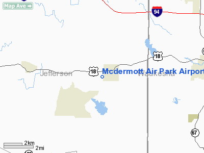
Mcdermott Air Park Airport |
Location & QuickFacts
| FAA Information Effective: | 2008-09-25 |
| Airport Identifier: | 31WI |
| Airport Status: | Operational |
| Longitude/Latitude: | 088-36-07.3620W/43-00-26.0260N
-88.602045/43.007229 (Estimated) |
| Elevation: | 875 ft / 266.70 m (Estimated) |
| Land: | 219 acres |
| From nearest city: | 1 nautical miles SW of Sullivan, WI |
| Location: | Jefferson County, WI |
| Magnetic Variation: | 00W (1985) |
Owner & Manager
| Ownership: | Privately owned |
| Owner: | Wayne E. Mcdermott |
| Address: | 200 Main Street
Sullivan, WI 53178 |
| Phone number: | 414-593-8612 |
| Manager: | Wayne Mcdermott |
| Address: | W1814 Circle Drive
Sullivan, WI 53178 |
| Phone number: | 414-593-8612 |
Airport Operations and Facilities
| Airport Use: | Private |
| Wind indicator: | Yes |
| Segmented Circle: | No |
| Control Tower: | No |
| Lighting Schedule: | PHONE REQ
FOR LIRL RY 06/24 CALL 414-593-8612. |
| Sectional chart: | Chicago |
| Region: | AGL - Great Lakes |
| Boundary ARTCC: | ZAU - Chicago |
| Tie-in FSS: | GRB - Green Bay |
| FSS Toll Free: | 1-800-WX-BRIEF |
Runway Information
Runway 06/24
| Dimension: | 4548 x 50 ft / 1386.2 x 15.2 m |
| Surface: | ASPH, |
| Edge Lights: | Low |
| |
Runway 06 |
Runway 24 |
| Traffic Pattern: | Left | Right |
|
Radio Navigation Aids
| ID |
Type |
Name |
Ch |
Freq |
Var |
Dist |
| RYV | NDB | Rock River | | 371.00 | 01W | 11.4 nm |
| UES | NDB | Waukesha | | 359.00 | 01W | 16.3 nm |
| LVV | NDB | Lake Lawn | | 404.00 | 00W | 18.5 nm |
| HXF | NDB | Hartford | | 200.00 | 00E | 22.4 nm |
| GM | NDB | Teels | | 242.00 | 02W | 25.4 nm |
| UNU | NDB | Juneau | | 344.00 | 01W | 25.7 nm |
| JVL | NDB | Janesville | | 375.00 | 03E | 30.5 nm |
| BL | NDB | Yanks | | 260.00 | 02W | 32.0 nm |
| LLE | NDB | Kettle Moraine | | 329.00 | 01W | 32.6 nm |
| MS | NDB | Monah | | 400.00 | 00E | 32.9 nm |
| RA | NDB | Paser | | 206.00 | 00E | 36.6 nm |
| BJB | VOR | West Bend | | 109.80 | 01W | 32.5 nm |
| BUU | VOR/DME | Burbun | 092X | 114.50 | 01W | 23.2 nm |
| LJT | VOR/DME | Timmerman | 072X | 112.50 | 02W | 25.6 nm |
| JVL | VOR/DME | Janesville | 090X | 114.30 | 03E | 35.0 nm |
| HRK | VOR/DME | Horlick | 124X | 117.70 | 02W | 37.7 nm |
| ENW | VOR/DME | Kenosha | 029X | 109.20 | 02W | 38.4 nm |
| BAE | VORTAC | Badger | 111X | 116.40 | 02E | 15.4 nm |
| MSN | VORTAC | Madison | 023X | 108.60 | 03E | 33.4 nm |
| MKE | VOT | Milwaukee | | 109.00 | | 31.2 nm |
Remarks
- PRVD A 20:1 APCH CLNC OVER OBSTNS; REF BE MADE TO FAA ADVISORY CIRCULAR DURING CONSTRUCTION; AREA 125 FT EITHER SIDE FM CTR & AREA 300 FT OFF EITHER RY BE FREE OF OBSTNS.
Images and information placed above are from
http://www.airport-data.com/airport/31WI/
We thank them for the data!
| General Info
|
| Country |
United States
|
| State |
WISCONSIN
|
| FAA ID |
31WI
|
| Latitude |
43-00-26.026N
|
| Longitude |
088-36-07.362W
|
| Elevation |
875 feet
|
| Near City |
SULLIVAN
|
We don't guarantee the information is fresh and accurate. The data may
be wrong or outdated.
For more up-to-date information please refer to other sources.
|
|


