 |
|
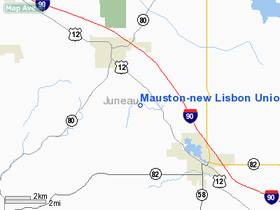
Mauston-new Lisbon Union Airport |
Location & QuickFacts
| FAA Information Effective: | 2008-09-25 |
| Airport Identifier: | 82C |
| Airport Status: | Operational |
| Longitude/Latitude: | 090-08-15.6620W/43-50-19.3980N
-90.137684/43.838722 (Estimated) |
| Elevation: | 906 ft / 276.15 m (Surveyed) |
| Land: | 152 acres |
| From nearest city: | 3 nautical miles SE of New Lisbon, WI |
| Location: | Juneau County, WI |
| Magnetic Variation: | 01W (2000) |
Owner & Manager
| Ownership: | Publicly owned |
| Owner: | Mauston&new Lisbon Union City |
| Address: | City Hall
Mauston, WI 53948 |
| Phone number: | 608-847-6676 |
| Manager: | Doug Wells |
| Address: | 226 W. State Street
Mauston, WI 53948 |
| Phone number: | 608-847-6069
ADDITONAL AMGR PHONE 608-847-4879. |
Airport Operations and Facilities
| Airport Use: | Open to public |
| Wind indicator: | Yes |
| Segmented Circle: | Yes |
| Control Tower: | No |
| Lighting Schedule: | DUSK-DAWN
ACTVT MIRL RY 14/32 - 122.8. |
| Beacon Color: | Clear-Green (lighted land airport) |
| Landing fee charge: | No |
| Sectional chart: | Chicago |
| Region: | AGL - Great Lakes |
| Boundary ARTCC: | ZAU - Chicago |
| Tie-in FSS: | GRB - Green Bay |
| FSS on Airport: | No |
| FSS Toll Free: | 1-800-WX-BRIEF |
| NOTAMs Facility: | GRB (NOTAM-d service avaliable) |
| Federal Agreements: | N |
Airport Communications
Airport Services
| Fuel available: | 100LLA
FOR FUEL AND REPAIRS CONTACT 608-562-3374. |
| Airframe Repair: | MINOR |
| Power Plant Repair: | MINOR |
| Bottled Oxygen: | NONE |
| Bulk Oxygen: | NONE |
Runway Information
Runway 14/32
| Dimension: | 3686 x 75 ft / 1123.5 x 22.9 m
298 FT PAVED STWY SE END. |
| Surface: | ASPH, Good Condition |
| Edge Lights: | Medium |
| |
Runway 14 |
Runway 32 |
| Longitude: | 090-08-32.1370W | 090-07-59.1880W |
| Latitude: | 43-50-33.1480N | 43-50-05.6480N |
| Elevation: | 897.00 ft | 897.00 ft |
| Alignment: | 127 | 127 |
| Traffic Pattern: | Left | Left |
| Markings: | Non-precision instrument, Good Condition | Non-precision instrument, Good Condition |
| Crossing Height: | 30.00 ft | 26.00 ft |
| VASI: | 2-light PAPI on left side
RY 14 PAPI OTS INDEFLY. | 2-light PAPI on left side |
| Visual Glide Angle: | 3.50° | 4.00° |
| Obstruction: | 23 ft road, 420.0 ft from runway, 250 ft left of centerline, 9:1 slope to clear | 30 ft trees, 470.0 ft from runway, 220 ft left of centerline, 9:1 slope to clear |
|
Radio Navigation Aids
| ID |
Type |
Name |
Ch |
Freq |
Var |
Dist |
| HBW | NDB | Kickapoo | | 251.00 | 03E | 13.9 nm |
| CMY | NDB | Mccoy | | 412.00 | 00E | 22.6 nm |
| ISW | NDB | Wisconsin Rapids | | 215.00 | 01W | 34.1 nm |
| BCK | NDB | Black River Falls | | 362.00 | 00E | 39.6 nm |
| VIQ | NDB | Neillsville | | 368.00 | 01W | 46.1 nm |
| MFI | NDB | Marshfield | | 391.00 | 00E | 48.3 nm |
| VOK | TACAN | Volk | 041X | | 00E | 8.2 nm |
| LNR | VOR/DME | Lone Rock | 075X | 112.80 | 00E | 32.7 nm |
| LSE | VOR/DME | La Crosse | 021X | 108.40 | 02E | 48.5 nm |
| DLL | VORTAC | Dells | 117X | 117.00 | 03E | 23.7 nm |
| STE | VORTAC | Stevens Point | 043X | 110.60 | 01W | 49.8 nm |
Remarks
Images and information placed above are from
http://www.airport-data.com/airport/82C/
We thank them for the data!
| General Info
|
| Country |
United States
|
| State |
WISCONSIN
|
| FAA ID |
82C
|
| Latitude |
43-50-19.398N
|
| Longitude |
090-08-15.662W
|
| Elevation |
905 feet
|
| Near City |
NEW LISBON
|
We don't guarantee the information is fresh and accurate. The data may
be wrong or outdated.
For more up-to-date information please refer to other sources.
|
|


