 |
|
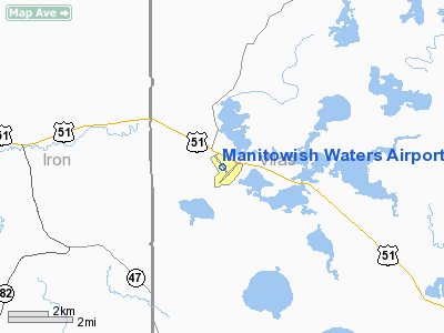
Manitowish Waters Airport |
Location & QuickFacts
| FAA Information Effective: | 2008-09-25 |
| Airport Identifier: | D25 |
| Airport Status: | Operational |
| Longitude/Latitude: | 089-52-56.4000W/46-07-19.1000N
-89.882333/46.121972 (Estimated) |
| Elevation: | 1610 ft / 490.73 m (Surveyed) |
| Land: | 439 acres |
| From nearest city: | 1 nautical miles S of Manitowish Waters, WI |
| Location: | Vilas County, WI |
| Magnetic Variation: | 01W (1995) |
Owner & Manager
| Ownership: | Publicly owned |
| Owner: | Town Of Manitowish Waters
ADDITIONAL AMGR VINCE HOEHN. |
| Address: |
Manitowish Waters, WI 54545 |
| Phone number: | 715-543-8400 |
| Manager: | Ken Eales |
| Address: | P.o. Box 472
Manitowish Waters, WI 54545 |
| Phone number: | 715-543-8320 |
Airport Operations and Facilities
| Airport Use: | Open to public |
| Wind indicator: | Yes |
| Segmented Circle: | Yes |
| Control Tower: | No |
| Lighting Schedule: | DUSK-DAWN
MIRL RY 14/32 PRESET ON LOW INTST; TO INCR INTST& ACTVT PAPI RY 32 - CTAF. |
| Beacon Color: | Clear-Green (lighted land airport) |
| Landing fee charge: | No |
| Sectional chart: | Green Bay |
| Region: | AGL - Great Lakes |
| Boundary ARTCC: | ZMP - Minneapolis |
| Tie-in FSS: | GRB - Green Bay |
| FSS on Airport: | No |
| FSS Toll Free: | 1-800-WX-BRIEF |
| NOTAMs Facility: | GRB (NOTAM-d service avaliable) |
| Federal Agreements: | NGY |
Airport Communications
| CTAF: | 122.800 |
| Unicom: | 122.800 |
Airport Services
| Fuel available: | 100LL
100LL AVBL 24 HRS WITH CREDIT CARD. |
Runway Information
Runway 04/22
| Dimension: | 3299 x 120 ft / 1005.5 x 36.6 m |
| Surface: | TURF, Good Condition |
| |
Runway 04 |
Runway 22 |
| Longitude: | 089-53-04.2500W | 089-52-31.8800W |
| Latitude: | 46-06-55.0500N | 46-07-18.5900N |
| Elevation: | 1607.00 ft | 1610.00 ft |
| Alignment: | 44 | 127 |
| Traffic Pattern: | Left | Left |
| Markings: | None,
04/22 MRKD WITH YELLOW CONES. | None, |
| Runway End Identifier: | No | No |
| Centerline Lights: | No | No |
| Touchdown Lights: | No | No |
| Obstruction: | 51 ft trees, 1500.0 ft from runway, 29:1 slope to clear | 59 ft trees, 1300.0 ft from runway, 22:1 slope to clear |
|
Runway 14/32
| Dimension: | 3500 x 60 ft / 1066.8 x 18.3 m |
| Surface: | ASPH, Good Condition |
| Weight Limit: | Single wheel: 12500 lbs. |
| Edge Lights: | Medium |
| |
Runway 14 |
Runway 32 |
| Longitude: | 089-53-18.8250W | 089-52-47.7530W |
| Latitude: | 46-07-31.2060N | 46-07-04.2660N |
| Elevation: | 1609.00 ft | 1610.00 ft |
| Alignment: | 127 | 127 |
| Traffic Pattern: | Left | Left |
| Markings: | Non-precision instrument, Fair Condition | Non-precision instrument, Fair Condition |
| Crossing Height: | 0.00 ft | 41.00 ft |
| VASI: | | 2-light PAPI on left side |
| Visual Glide Angle: | 0.00° | 3.50° |
| Obstruction: | 50 ft trees, 1350.0 ft from runway, 125 ft right of centerline, 23:1 slope to clear | 46 ft trees, 1400.0 ft from runway, 250 ft left of centerline, 26:1 slope to clear |
|
Radio Navigation Aids
| ID |
Type |
Name |
Ch |
Freq |
Var |
Dist |
| BDJ | NDB | Boulder Junction | | 206.00 | 02E | 9.5 nm |
| ARV | NDB | Arbor Vitae | | 221.00 | 01W | 13.4 nm |
| DO | NDB | Dougy | | 236.00 | 01W | 18.4 nm |
| PKF | NDB | Park Falls | | 371.00 | 01W | 24.9 nm |
| RXW | NDB | Watersmeet | | 407.00 | 01E | 27.0 nm |
| LNL | NDB | Land O Lakes | | 396.00 | 02W | 28.0 nm |
| EGV | NDB | Eagle River | | 341.00 | 02W | 28.2 nm |
| PBH | NDB | Phillips | | 263.00 | 00E | 33.6 nm |
| OGM | NDB | Ontonagon | | 375.00 | 00W | 48.7 nm |
| IWD | VORTAC | Ironwood | 025X | 108.80 | 01E | 26.7 nm |
| RHI | VORTAC | Rhinelander | 029X | 109.20 | 02E | 34.3 nm |
Remarks
- 122'AGL/1737'MSL TWR APRXLY 1000'E OF ARPT.
- DEER; BEARS; WOLVES & COYOTES ON & INVOF ARPT.
- GCO AVBL ON FREQ 121.725 THRU FLT SVCS,
- BIRDS AND MIGRATORY WATERFOWL ON & INVOF ARPT.
Images and information placed above are from
http://www.airport-data.com/airport/D25/
We thank them for the data!
| General Info
|
| Country |
United States
|
| State |
WISCONSIN
|
| FAA ID |
D25
|
| Latitude |
46-07-19.100N
|
| Longitude |
089-52-56.400W
|
| Elevation |
1610 feet
|
| Near City |
MANITOWISH WATERS
|
We don't guarantee the information is fresh and accurate. The data may
be wrong or outdated.
For more up-to-date information please refer to other sources.
|
|


