 |
|
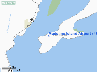
Location & QuickFacts
| FAA Information Effective: | 2008-09-25 |
| Airport Identifier: | 4R5 |
| Airport Status: | Operational |
| Longitude/Latitude: | 090-45-31.4000W/46-47-19.2000N
-90.758722/46.788667 (Estimated) |
| Elevation: | 649 ft / 197.82 m (Surveyed) |
| Land: | 136 acres |
| From nearest city: | 2 nautical miles NE of La Pointe, WI |
| Location: | Ashland County, WI |
| Magnetic Variation: | 00E (1985) |
Owner & Manager
| Ownership: | Publicly owned |
| Owner: | Town Of Lapointe |
| Address: | Po Box 270
La Pointe, WI 54850 |
| Phone number: | 715-747-6913 |
| Manager: | Michael Dalzell |
| Address: | Box 270
La Pointe, WI 54850 |
| Phone number: | 715-747-2785 |
Airport Operations and Facilities
| Airport Use: | Open to public |
| Wind indicator: | Yes |
| Segmented Circle: | No |
| Control Tower: | No |
| Lighting Schedule: | DUSK-DAWN
ACTVT MIRL RY 04/22 & PAPI RYS 04 & 22 - CTAF. |
| Beacon Color: | Clear-Green (lighted land airport) |
| Landing fee charge: | No |
| Sectional chart: | Green Bay |
| Region: | AGL - Great Lakes |
| Boundary ARTCC: | ZMP - Minneapolis |
| Tie-in FSS: | GRB - Green Bay |
| FSS on Airport: | No |
| FSS Toll Free: | 1-800-WX-BRIEF |
| NOTAMs Facility: | GRB (NOTAM-d service avaliable) |
| Federal Agreements: | NGY |
Airport Communications
Airport Services
Runway Information
Runway 04/22
| Dimension: | 3000 x 75 ft / 914.4 x 22.9 m |
| Surface: | ASPH, Fair Condition |
| Weight Limit: | Single wheel: 12500 lbs. |
| Edge Lights: | Medium |
| |
Runway 04 |
Runway 22 |
| Longitude: | 090-45-45.2700W | 090-45-17.5500W |
| Latitude: | 46-47-07.8600N | 46-47-30.5400N |
| Elevation: | 624.00 ft | 649.00 ft |
| Traffic Pattern: | Left | Left |
| Markings: | Non-precision instrument, Good Condition | Non-precision instrument, Good Condition |
| Crossing Height: | 45.00 ft | 38.00 ft |
| VASI: | 2-light PAPI on left side | 2-light PAPI on left side |
| Visual Glide Angle: | 3.45° | 3.45° |
| Runway End Identifier: | No | No |
| Centerline Lights: | No | No |
| Touchdown Lights: | No | No |
| Obstruction: | 78 ft trees, 2250.0 ft from runway, 26:1 slope to clear
+10 FT BRUSH 100 FT FM THR 100 FT L. | 72 ft trees, 1800.0 ft from runway, 150 ft left of centerline, 22:1 slope to clear |
|
Radio Navigation Aids
| ID |
Type |
Name |
Ch |
Freq |
Var |
Dist |
| ENY | NDB | Kennedy | | 254.00 | 02E | 15.6 nm |
| BFW | NDB | Silver Bay | | 350.00 | 00E | 38.6 nm |
| TWM | NDB | Two Harbors | | 243.00 | 01E | 43.5 nm |
| SLY | NDB | Seeley | | 344.00 | 01E | 48.2 nm |
| ASX | VOR/DME | Ashland | 039X | 110.20 | 02E | 15.8 nm |
| IWD | VORTAC | Ironwood | 025X | 108.80 | 01E | 30.3 nm |
Remarks
Images and information placed above are from
http://www.airport-data.com/airport/4R5/
We thank them for the data!
| General Info
|
| Country |
United States
|
| State |
WISCONSIN
|
| FAA ID |
4R5
|
| Latitude |
46-47-19.160N
|
| Longitude |
090-45-31.210W
|
| Elevation |
648 feet
|
| Near City |
LA POINTE
|
We don't guarantee the information is fresh and accurate. The data may
be wrong or outdated.
For more up-to-date information please refer to other sources.
|
|


