 |
|
Location & QuickFacts
| FAA Information Effective: | 2008-09-25 |
| Airport Identifier: | 4WN8 |
| Airport Status: | Operational |
| Longitude/Latitude: | 088-28-14.6900W/43-00-18.7500N
-88.470747/43.005208 (Estimated) |
| Elevation: | 616 ft / 187.76 m (Estimated) |
| Land: | 0 acres |
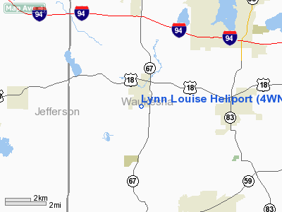
| From nearest city: | 1 nautical miles S of Dousman, WI |
| Location: | Waukesha County, WI |
| Magnetic Variation: | () |
Owner & Manager
| Ownership: | Privately owned |
| Owner: | James Michaels |
| Address: | W364 5226 Mill Pond Rd
Dousman, WI 53118 |
| Phone number: | 262-567-7224 |
| Manager: | James Michaels |
| Address: | W364 5226 Mill Pond Rd
Dousman, WI 53118 |
| Phone number: | 262-567-7224 |
Airport Operations and Facilities
| Airport Use: | Private |
| Wind indicator: | Yes |
| Control Tower: | No |
| Sectional chart: | Chicago |
| Region: | AGL - Great Lakes |
| Boundary ARTCC: | ZMP - Minneapolis |
| Tie-in FSS: | GRB - Green Bay |
| FSS Toll Free: | 1-800-WX-BRIEF |
Runway Information
Helipad H1
| Dimension: | 50 x 59 ft / 15.2 x 18.0 m |
| Surface: | CONC, |
| |
Runway H1 |
Runway |
| Traffic Pattern: | Left | Left |
|
Radio Navigation Aids
| ID |
Type |
Name |
Ch |
Freq |
Var |
Dist |
| UES | NDB | Waukesha | | 359.00 | 01W | 10.6 nm |
| RYV | NDB | Rock River | | 371.00 | 01W | 15.1 nm |
| LVV | NDB | Lake Lawn | | 404.00 | 00W | 19.2 nm |
| GM | NDB | Teels | | 242.00 | 02W | 19.8 nm |
| HXF | NDB | Hartford | | 200.00 | 00E | 20.9 nm |
| BL | NDB | Yanks | | 260.00 | 02W | 26.3 nm |
| UNU | NDB | Juneau | | 344.00 | 01W | 27.4 nm |
| LLE | NDB | Kettle Moraine | | 329.00 | 01W | 29.4 nm |
| RA | NDB | Paser | | 206.00 | 00E | 31.8 nm |
| JVL | NDB | Janesville | | 375.00 | 03E | 34.4 nm |
| MS | NDB | Monah | | 400.00 | 00E | 38.6 nm |
| BJB | VOR | West Bend | | 109.80 | 01W | 29.3 nm |
| LJT | VOR/DME | Timmerman | 072X | 112.50 | 02W | 20.0 nm |
| BUU | VOR/DME | Burbun | 092X | 114.50 | 01W | 20.4 nm |
| HRK | VOR/DME | Horlick | 124X | 117.70 | 02W | 32.4 nm |
| ENW | VOR/DME | Kenosha | 029X | 109.20 | 02W | 34.1 nm |
| JVL | VOR/DME | Janesville | 090X | 114.30 | 03E | 38.8 nm |
| BAE | VORTAC | Badger | 111X | 116.40 | 02E | 10.6 nm |
| MSN | VORTAC | Madison | 023X | 108.60 | 03E | 39.1 nm |
| MKE | VOT | Milwaukee | | 109.00 | | 25.5 nm |
Remarks
- PRVDD HELIPAD MOVED 20 FT SOUTH; ALL APCH/DEP OPNS CONDUCTED ON HEADING 270 DEGREES; TREES LOCATED 50 FT FM PAD AT 275 TO 310 DEGREES BE CUT OR LOWERED; WIND INDICATOR IS MAINYAIHNED; DEVELOPSECURITY MEASURES TO PROTECT THE OPNS AREA.
Images and information placed above are from
http://www.airport-data.com/airport/4WN8/
We thank them for the data!
|
|


