 |
|
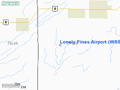
Location & QuickFacts
| FAA Information Effective: | 2008-09-25 |
| Airport Identifier: | WS05 |
| Airport Status: | Operational |
| Longitude/Latitude: | 090-37-30.5180W/45-28-37.8860N
-90.625144/45.477191 (Estimated) |
| Elevation: | 1365 ft / 416.05 m (Estimated) |
| Land: | 40 acres |
| From nearest city: | 4 nautical miles NE of Kennan, WI |
| Location: | Price County, WI |
| Magnetic Variation: | 01E (1985) |
Owner & Manager
| Ownership: | Privately owned |
| Owner: | Jack L Strebig |
| Address: | N3345 Sunset Rd
Medford, WI 54451 |
| Phone number: | 715-748-5235 |
| Manager: | Jack L Strebi |
| Address: | N3345 Sunset Rd
Medford, WI 54451 |
| Phone number: | 715-748-5235 |
Airport Operations and Facilities
| Airport Use: | Private |
| Wind indicator: | No |
| Segmented Circle: | No |
| Control Tower: | No |
| Sectional chart: | Green Bay |
| Region: | AGL - Great Lakes |
| Boundary ARTCC: | ZMP - Minneapolis |
| Tie-in FSS: | GRB - Green Bay |
| FSS on Airport: | No |
| FSS Toll Free: | 1-800-WX-BRIEF |
Runway Information
Runway 13/31
| Dimension: | 1820 x 60 ft / 554.7 x 18.3 m |
| Surface: | TURF, |
| |
Runway 13 |
Runway 31 |
| Traffic Pattern: | Left | Left |
|
Radio Navigation Aids
| ID |
Type |
Name |
Ch |
Freq |
Var |
Dist |
| RCX | NDB | Rusk County | | 356.00 | 00W | 15.9 nm |
| PBH | NDB | Phillips | | 263.00 | 00E | 16.3 nm |
| MDZ | NDB | Medford | | 335.00 | 00E | 26.0 nm |
| PKF | NDB | Park Falls | | 371.00 | 01W | 29.8 nm |
| RRL | NDB | Merrill | | 257.00 | 01W | 42.4 nm |
| DO | NDB | Dougy | | 236.00 | 01W | 43.3 nm |
| ARV | NDB | Arbor Vitae | | 221.00 | 01W | 46.3 nm |
| SLY | NDB | Seeley | | 344.00 | 01E | 49.7 nm |
| MHA | NDB | Manitowish | | 364.00 | 01W | 49.7 nm |
| HYR | VOR/DME | Hayward | 081X | 113.40 | 03E | 47.4 nm |
| RPD | VOR/DME | Rice Lake | 037X | 110.00 | 01E | 48.8 nm |
Images and information placed above are from
http://www.airport-data.com/airport/WS05/
We thank them for the data!
| General Info
|
| Country |
United States
|
| State |
WISCONSIN
|
| FAA ID |
WS05
|
| Latitude |
45-28-37.886N
|
| Longitude |
090-37-30.518W
|
| Elevation |
1365 feet
|
| Near City |
KENNAN
|
We don't guarantee the information is fresh and accurate. The data may
be wrong or outdated.
For more up-to-date information please refer to other sources.
|
|


