 |
|
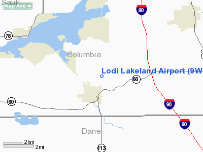
Location & QuickFacts
| FAA Information Effective: | 2008-09-25 |
| Airport Identifier: | 9WN5 |
| Airport Status: | Operational |
| Longitude/Latitude: | 089-31-15.4330W/43-19-59.9580N
-89.520954/43.333322 (Estimated) |
| Elevation: | 844 ft / 257.25 m (Surveyed) |
| Land: | 14 acres |
| From nearest city: | 1 nautical miles NE of Lodi, WI |
| Location: | Columbia County, WI |
| Magnetic Variation: | 00E (1985) |
Owner & Manager
| Ownership: | Publicly owned |
| Owner: | Lodi Lakeland Aero Club
LEASEE. OWNER IS TOWNSHIP OF LODI. |
| Address: | 241 Columbus St
Lodi, WI 53555 |
| Phone number: | 608-592-5541 |
| Manager: | Jerome W. Carncross |
| Address: | 241 Columbus St
Lodi, WI 53555 |
| Phone number: | 608-592-5070 |
Airport Operations and Facilities
| Airport Use: | Private |
| Wind indicator: | Yes |
| Segmented Circle: | No |
| Control Tower: | No |
| Landing fee charge: | No |
| Sectional chart: | Chicago |
| Region: | AGL - Great Lakes |
| Traffic Pattern Alt: | 800 ft |
| Boundary ARTCC: | ZAU - Chicago |
| Tie-in FSS: | GRB - Green Bay |
| FSS on Airport: | No |
| FSS Toll Free: | 1-800-WX-BRIEF |
Airport Services
| Airframe Repair: | NONE |
| Power Plant Repair: | NONE |
| Bottled Oxygen: | NONE |
| Bulk Oxygen: | NONE |
Runway Information
Runway 09/27
| Dimension: | 1875 x 105 ft / 571.5 x 32.0 m |
| Surface: | TURF, Good Condition |
| |
Runway 09 |
Runway 27 |
| Traffic Pattern: | Left | Left |
| Runway End Identifier: | No | No |
| Centerline Lights: | No | No |
| Touchdown Lights: | No | No |
| Obstruction: | 4 ft brush, 75 ft left of centerline | 4 ft brush, 0.0 ft from runway, 70 ft left of centerline |
|
Radio Navigation Aids
| ID |
Type |
Name |
Ch |
Freq |
Var |
Dist |
| MS | NDB | Monah | | 400.00 | 00E | 18.0 nm |
| RYV | NDB | Rock River | | 371.00 | 01W | 36.1 nm |
| UNU | NDB | Juneau | | 344.00 | 01W | 36.2 nm |
| HBW | NDB | Kickapoo | | 251.00 | 03E | 40.4 nm |
| MRJ | NDB | Mineral Point | | 365.00 | 00W | 40.9 nm |
| JVL | NDB | Janesville | | 375.00 | 03E | 48.0 nm |
| HXF | NDB | Hartford | | 200.00 | 00E | 49.2 nm |
| VOK | TACAN | Volk | 041X | | 00E | 48.7 nm |
| LNR | VOR/DME | Lone Rock | 075X | 112.80 | 00E | 26.9 nm |
| MSN | VORTAC | Madison | 023X | 108.60 | 03E | 13.8 nm |
| DLL | VORTAC | Dells | 117X | 117.00 | 03E | 16.8 nm |
Remarks
- RY NOT PLOWED WINTER MONTHS. ARPT CLSD WHEN RY IS SNOW COVERED.
- 8-20 FT BRUSH ALONG N SIDE OF RY.
- E111: PROVIDED THRS ARE LGTD TO PROVIDE 20:1 APCH RATIOS.
Images and information placed above are from
http://www.airport-data.com/airport/9WN5/
We thank them for the data!
| General Info
|
| Country |
United States
|
| State |
WISCONSIN
|
| FAA ID |
9WN5
|
| Latitude |
43-19-59.958N
|
| Longitude |
089-31-15.433W
|
| Elevation |
844 feet
|
| Near City |
LODI
|
We don't guarantee the information is fresh and accurate. The data may
be wrong or outdated.
For more up-to-date information please refer to other sources.
|
|


