 |
|
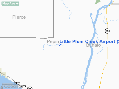
Little Plum Creek Airport |
Location & QuickFacts
| FAA Information Effective: | 2008-09-25 |
| Airport Identifier: | 25WN |
| Airport Status: | Operational |
| Longitude/Latitude: | 092-07-13.2278W/44-31-43.3833N
-92.120341/44.528718 (Estimated) |
| Elevation: | 12 ft / 3.66 m (Estimated) |
| Land: | 12 acres |
| From nearest city: | 7 nautical miles N of Pepin, WI |
| Location: | Pepin County, WI |
| Magnetic Variation: | () |
Owner & Manager
| Ownership: | Privately owned |
| Owner: | Little Plum Creek Airpark Inc. |
| Address: | 11253 St Croix Trail South
Hasting, MN 55033 |
| Phone number: | 651-437-8852 |
| Manager: | Richard G. Freitag |
| Address: | W9257 Plum Valley Rd
Pepin, WI 54759 |
Airport Operations and Facilities
| Airport Use: | Private |
| Wind indicator: | Yes |
| Control Tower: | No |
| Sectional chart: | Great Falls |
| Region: | AGL - Great Lakes |
| Boundary ARTCC: | ZMP - Minneapolis |
| Tie-in FSS: | GRB - Green Bay |
| FSS Toll Free: | 1-800-WX-BRIEF |
Runway Information
Runway 09/27
| Dimension: | 2640 x 100 ft / 804.7 x 30.5 m |
| Surface: | TURF, |
| |
Runway 09 |
Runway 27 |
| Traffic Pattern: | Left | Left |
|
Radio Navigation Aids
| ID |
Type |
Name |
Ch |
Freq |
Var |
Dist |
| PPI | NDB | Hopey | | 400.00 | 03E | 40.8 nm |
| RNH | NDB | New Richmond | | 257.00 | 02E | 41.1 nm |
| MS | NDB | Narco | | 266.00 | 02E | 45.2 nm |
| AHH | NDB | Ameron | | 278.00 | 01E | 46.5 nm |
| ONA | VOR/DME | Winona | 051X | 111.40 | 01E | 32.5 nm |
| RST | VOR/DME | Rochester | 057X | 112.00 | 05E | 49.3 nm |
| EAU | VORTAC | Eau Claire | 076X | 112.90 | 04E | 35.3 nm |
| FGT | VORTAC | Farmington | 104X | 115.70 | 06E | 45.9 nm |
| ODI | VORTAC | Nodine | 126X | 117.90 | 01E | 46.5 nm |
| STP | VOT | St Paul | | 114.40 | | 47.1 nm |
Remarks
- PRVDD CLEAR 20:1 APCHS AND VFR OPNS.
Images and information placed above are from
http://www.airport-data.com/airport/25WN/
We thank them for the data!
|
|


