 |
|
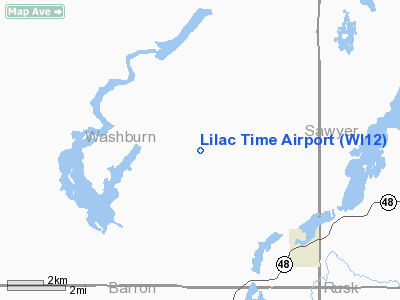
Location & QuickFacts
| FAA Information Effective: | 2008-09-25 |
| Airport Identifier: | WI12 |
| Airport Status: | Operational |
| Longitude/Latitude: | 091-37-29.5990W/45-42-23.8330N
-91.624889/45.706620 (Estimated) |
| Elevation: | 1300 ft / 396.24 m (Estimated) |
| Land: | 10 acres |
| From nearest city: | 6 nautical miles NW of Birchwood, WI |
| Location: | Adams County, WI |
| Magnetic Variation: | 00E () |
Owner & Manager
| Ownership: | Privately owned |
| Owner: | Warren Lewis |
| Address: | N1961 Berry Rd
Birchwood, WI 54817 |
| Phone number: | 715-354-3008 |
| Address: |
|
Airport Operations and Facilities
| Airport Use: | Private |
| Wind indicator: | Yes |
| Segmented Circle: | No |
| Control Tower: | No |
| Sectional chart: | Green Bay |
| Region: | AGL - Great Lakes |
| Boundary ARTCC: | ZMP - Minneapolis |
| Tie-in FSS: | GRB - Green Bay |
| FSS Toll Free: | 1-800-WX-BRIEF |
Runway Information
Runway 18/36
| Dimension: | 2000 x 50 ft / 609.6 x 15.2 m |
| Surface: | TURF, |
| |
Runway 18 |
Runway 36 |
| Traffic Pattern: | Left | Left |
|
Radio Navigation Aids
| ID |
Type |
Name |
Ch |
Freq |
Var |
Dist |
| SSQ | NDB | Shell Lake | | 212.00 | 01E | 12.4 nm |
| UBE | NDB | Cumberland | | 375.00 | 01E | 19.0 nm |
| SLY | NDB | Seeley | | 344.00 | 01E | 26.4 nm |
| RCX | NDB | Rusk County | | 356.00 | 00W | 29.0 nm |
| BXR | NDB | Big Doctor | | 203.00 | 02E | 31.8 nm |
| OLG | NDB | Solon Springs | | 388.00 | 01E | 37.5 nm |
| AHH | NDB | Ameron | | 278.00 | 01E | 40.5 nm |
| RPD | VOR/DME | Rice Lake | 037X | 110.00 | 01E | 18.7 nm |
| HYR | VOR/DME | Hayward | 081X | 113.40 | 03E | 20.2 nm |
| RZN | VOR/DME | Siren | 031X | 109.40 | 02E | 32.2 nm |
| EAU | VORTAC | Eau Claire | 076X | 112.90 | 04E | 49.0 nm |
Remarks
- PRVDD CLEAR 20:1 APCHS, CLEAR OBSTACLE FREE ZONE, & CLEAR RUNWAY SAFETY AREA.
Images and information placed above are from
http://www.airport-data.com/airport/WI12/
We thank them for the data!
| General Info
|
| Country |
United States
|
| State |
WISCONSIN
|
| FAA ID |
WI12
|
| Latitude |
45-42-23.833N
|
| Longitude |
091-37-29.599W
|
| Elevation |
1300 feet
|
| Near City |
BIRCHWOOD
|
We don't guarantee the information is fresh and accurate. The data may
be wrong or outdated.
For more up-to-date information please refer to other sources.
|
|


