 |
|
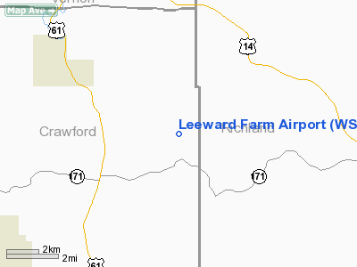
Location & QuickFacts
| FAA Information Effective: | 2008-09-25 |
| Airport Identifier: | WS51 |
| Airport Status: | Operational |
| Longitude/Latitude: | 090-40-51.4610W/43-21-09.9250N
-90.680961/43.352757 (Estimated) |
| Elevation: | 1055 ft / 321.56 m (Estimated) |
| Land: | 80 acres |
| From nearest city: | 6 nautical miles SE of Soldiers Grove, WI |
| Location: | Crawford County, WI |
| Magnetic Variation: | 00E (2000) |
Owner & Manager
| Ownership: | Privately owned |
| Owner: | Gary C Comer |
| Address: | Rte 2 Box 75
Soldiers Grove, WI 54655 |
| Address: |
|
Airport Operations and Facilities
| Airport Use: | Private
PERSONAL USE. |
| Wind indicator: | Yes |
| Segmented Circle: | No |
| Control Tower: | No |
| Sectional chart: | Chicago |
| Region: | AGL - Great Lakes |
| Boundary ARTCC: | ZAU - Chicago |
| Tie-in FSS: | GRB - Green Bay |
| FSS Toll Free: | 1-800-WX-BRIEF |
Runway Information
Runway 11/29
| Dimension: | 3800 x 72 ft / 1158.2 x 21.9 m |
| Surface: | ASPH, |
| Edge Lights: | Medium |
| |
Runway 11 |
Runway 29 |
| Traffic Pattern: | Left | Left |
|
Radio Navigation Aids
| ID |
Type |
Name |
Ch |
Freq |
Var |
Dist |
| HBW | NDB | Kickapoo | | 251.00 | 03E | 23.7 nm |
| MRJ | NDB | Mineral Point | | 365.00 | 00W | 34.3 nm |
| CMY | NDB | Mccoy | | 412.00 | 00E | 35.2 nm |
| CHU | NDB | Caledonia | | 209.00 | 03E | 38.0 nm |
| PVB | NDB | Platteville | | 203.00 | 01E | 41.4 nm |
| DEH | NDB | Decorah | | 236.00 | 01E | 46.4 nm |
| VOK | TACAN | Volk | 041X | | 00E | 39.9 nm |
| LNR | VOR/DME | Lone Rock | 075X | 112.80 | 00E | 24.2 nm |
| LSE | VOR/DME | La Crosse | 021X | 108.40 | 02E | 40.2 nm |
| UKN | VORTAC | Waukon | 113X | 116.60 | 05E | 37.7 nm |
| DLL | VORTAC | Dells | 117X | 117.00 | 03E | 41.8 nm |
| ODI | VORTAC | Nodine | 126X | 117.90 | 01E | 48.0 nm |
Images and information placed above are from
http://www.airport-data.com/airport/WS51/
We thank them for the data!
| General Info
|
| Country |
United States
|
| State |
WISCONSIN
|
| FAA ID |
WS51
|
| Latitude |
43-21-09.925N
|
| Longitude |
090-40-51.461W
|
| Elevation |
1055 feet
|
| Near City |
SOLDIERS GROVE
|
We don't guarantee the information is fresh and accurate. The data may
be wrong or outdated.
For more up-to-date information please refer to other sources.
|
|


