 |
|
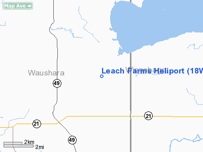
Location & QuickFacts
| FAA Information Effective: | 2008-09-25 |
| Airport Identifier: | 18WI |
| Airport Status: | Operational |
| Longitude/Latitude: | 088-55-31.4100W/44-05-16.9300N
-88.925392/44.088036 (Estimated) |
| Elevation: | 750 ft / 228.60 m (Estimated) |
| Land: | 0 acres |
| From nearest city: | 5 nautical miles NW of Poy Sippi, WI |
| Location: | Waushara County, WI |
| Magnetic Variation: | 01W (1985) |
Owner & Manager
| Ownership: | Privately owned |
| Owner: | E C Leach Jr |
| Address: | Leach Farms Inc Rte 1 Box 190
Berlin, WI 54923 |
| Phone number: | 414-361-1880 |
| Manager: | E C Leach Jr |
| Address: | Leach Farms Inc Rte 1 Box 190
Berlin, WI 54923 |
| Phone number: | 414-361-1880 |
Airport Operations and Facilities
| Airport Use: | Private |
| Segmented Circle: | No |
| Control Tower: | No |
| Sectional chart: | Green Bay |
| Region: | AGL - Great Lakes |
| Boundary ARTCC: | ZAU - Chicago |
| Tie-in FSS: | GRB - Green Bay |
| FSS on Airport: | No |
| FSS Toll Free: | 1-800-WX-BRIEF |
Runway Information
Helipad H1
| Dimension: | 2300 x 100 ft / 701.0 x 30.5 m |
| Surface: | TURF, |
| |
Runway H1 |
Runway |
| Traffic Pattern: | Left | Left |
|
Radio Navigation Aids
| ID |
Type |
Name |
Ch |
Freq |
Var |
Dist |
| PCZ | NDB | Waupaca | | 382.00 | 01W | 15.2 nm |
| AQ | NDB | Kooky | | 407.00 | 02W | 24.0 nm |
| CLI | NDB | Clintonville | | 209.00 | 02W | 33.0 nm |
| SG | NDB | Depre | | 332.00 | 02W | 38.9 nm |
| UNU | NDB | Juneau | | 344.00 | 01W | 40.8 nm |
| ISW | NDB | Wisconsin Rapids | | 215.00 | 01W | 42.7 nm |
| OSH | VORTAC | Oshkosh | 055X | 111.80 | 02E | 17.0 nm |
| STE | VORTAC | Stevens Point | 043X | 110.60 | 01W | 37.8 nm |
| GRB | VORTAC | Green Bay | 102X | 115.50 | 01E | 42.1 nm |
| DLL | VORTAC | Dells | 117X | 117.00 | 03E | 48.6 nm |
Remarks
- FILED FOR RECORD PURPOSES ONLY.
Images and information placed above are from
http://www.airport-data.com/airport/18WI/
We thank them for the data!
| General Info
|
| Country |
United States
|
| State |
WISCONSIN
|
| FAA ID |
WN69
|
| Latitude |
42-38-56.060N
|
| Longitude |
088-11-12.310W
|
| Elevation |
780 feet
|
| Near City |
BURLINGTON
|
We don't guarantee the information is fresh and accurate. The data may
be wrong or outdated.
For more up-to-date information please refer to other sources.
|
|


