|
|
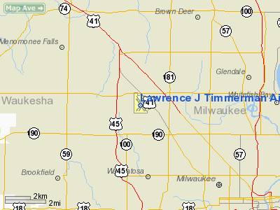
Lawrence J Timmerman Airport |
Coordinates: 43°06′37″N 088°02′04″W / 43.11028°N 88.03444°W / 43.11028; -88.03444
| Lawrence J. Timmerman Airport |
 |
| IATA: MWC – ICAO: KMWC – FAA LID: MWC |
| Summary |
| Airport type |
Public |
| Owner |
Milwaukee County |
| Serves |
Milwaukee, Wisconsin |
| Elevation AMSL |
745 ft / 227 m |
| Runways |
| Direction |
Length |
Surface |
| ft |
m |
| 4L/22R |
3,202 |
976 |
Asphalt |
| 4R/22L |
2,862 |
872 |
Turf |
| 15L/33R |
4,106 |
1,252 |
Asphalt |
| 15R/33L |
3,251 |
991 |
Turf |
| Statistics (2004) |
| Aircraft operations |
69,134 |
| Based aircraft |
104 |
| Source: Federal Aviation Administration |
Lawrence J. Timmerman Airport (IATA: MWC, ICAO: KMWC, FAA LID: MWC), known locally as Timmerman Field, is an airport in Milwaukee, Wisconsin, United States, owned by Milwaukee County. Located 5 mi (8 km) northwest of the city center, it is used mainly for general or private aviation.
The airport was built in 1929 and dedicated on July 6, 1930, one of 25 such projects in U.S. cities by the newly-incorporated airplane manufacturer Curtiss-Wright. The airport was originally known as Curtiss-Wright Field, hence the letters "WC" in its airport codes. In 1945, Curtiss-Wright sold it to Fliteways, Inc., the airport's property manager since 1936. Milwaukee County purchased the airport from Fliteways in July 1947, when it was 131 acres (53 ha) in size. It was host to the Experimental Aircraft Association's earliest Fly-In Conventions from 1953 to 1958. The airport was renamed in July 1959 for Lawrence J. Timmerman (1878–1959), chairman of the Milwaukee County Board of Supervisors from 1936 to 1959. Current Users
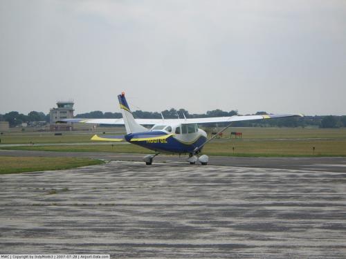
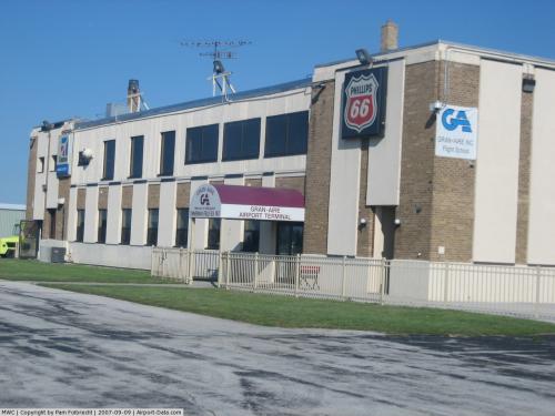
Lawrence J. Timmerman Airport currently serves various general aviation groups. The current fixed base operator is Gran Aire. The airport is home to the Milwaukee chapter of Youth and Aviation, as well as two Civil Air Patrol squadrons; the Timmerman Composite Squadron, and Milwaukee Senior Support Squadron 10. The airport also serves many private and public users.
Facilities and aircraft
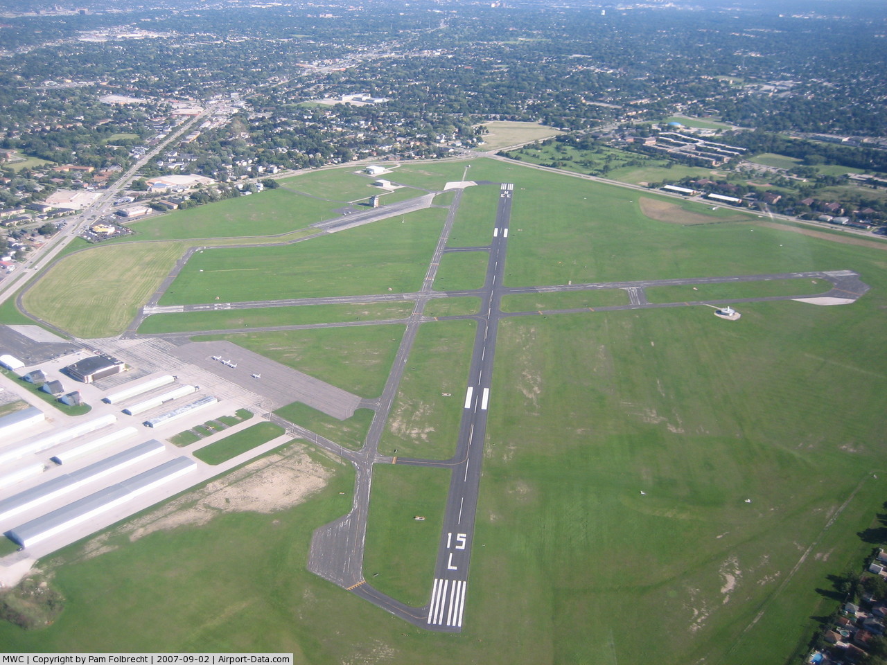
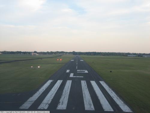
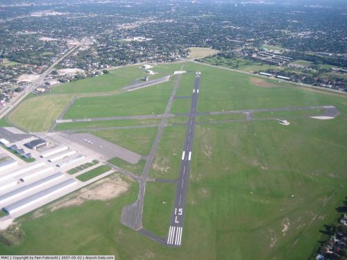
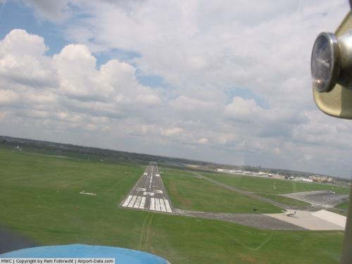
Lawrence J. Timmerman Airport covers an area of 420 acres (170 ha) which contains two asphalt paved runways: 4L/22R measuring 3,202 x 75 ft (976 x 23 m) and 15L/33R measuring 4,106 x 75 ft (1,252 x 23 m). It also has two turf runways: 4R/22L measuring 2,862 x 275 ft (872 x 84 m) and 15R/33L measuring 3,251 x 275 ft (991 x 84 m).
For the 12-month period ending December 31, 2004, the airport had 69,134 aircraft operations, an average of 189 per day: 99% general aviation, 1% air taxi and <1% military. There are 104 aircraft based at this airport: 74% single-engine, 21% multi-engine, 3% jet and 2% helicopter.
The above content comes from Wikipedia and is published under free licenses – click here to read more.
 |
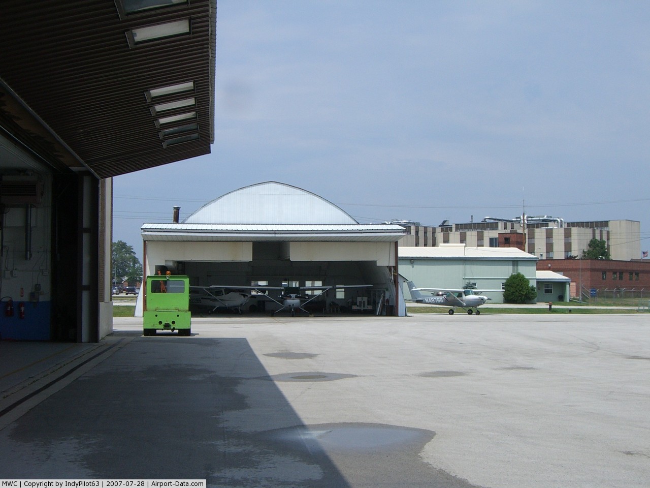
(Click on the photo to enlarge) |
 |
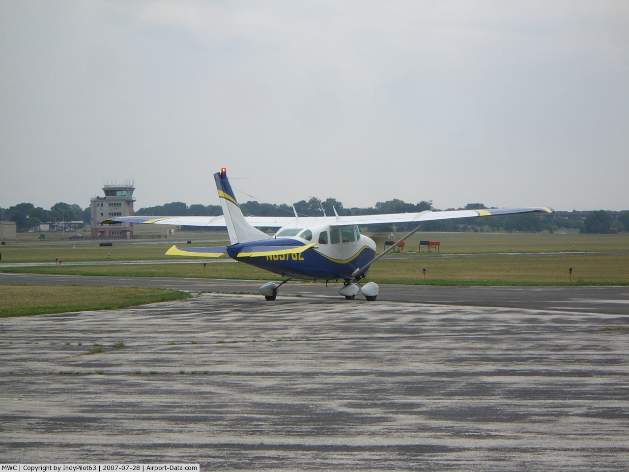
(Click on the photo to enlarge) |
 |
(Click on the photo to enlarge) |
 |
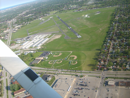
(Click on the photo to enlarge) |
 |
(Click on the photo to enlarge) |
 |
(Click on the photo to enlarge) |
 |
(Click on the photo to enlarge) |
Location & QuickFacts
| FAA Information Effective: | 2008-09-25 |
| Airport Identifier: | MWC |
| Airport Status: | Operational |
| Longitude/Latitude: | 088-02-03.9190W/43-06-37.4000N
-88.034422/43.110389 (Estimated) |
| Elevation: | 745 ft / 227.08 m (Surveyed) |
| Land: | 420 acres |
| From nearest city: | 5 nautical miles NW of Milwaukee, WI |
| Location: | Milwaukee County, WI |
| Magnetic Variation: | 01W (1985) |
Owner & Manager
| Ownership: | Publicly owned |
| Owner: | Milwaukee County |
| Address: | County Courthouse
Milwaukee, WI 53233 |
| Phone number: | 414-747-5300 |
| Manager: | C. Barry Bateman
ARPT OPNS MGR GREG HETZL 414-747-5575. |
| Address: | 5300 S Howell
Milwaukee, WI 53207 |
| Phone number: | 414-747-5300 |
Airport Operations and Facilities
| Airport Use: | Open to public |
| Wind indicator: | Yes |
| Segmented Circle: | No |
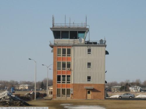
| Control Tower: | Yes |
| Lighting Schedule: | DUSK-DAWN
WHEN ATCT CLSD ACTVT MIRL RY 04L/22R VASI & REIL RYS 04L & 22R; MIRL RY 15L/33R; VASI RYS 15L & 33R & REIL RY 15L - CTAF. |
| Beacon Color: | Clear-Green (lighted land airport) |
| Landing fee charge: | No |
| Sectional chart: | Chicago |
| Region: | AGL - Great Lakes |
| Traffic Pattern Alt: | 1000 ft |
| Boundary ARTCC: | ZAU - Chicago |
| Tie-in FSS: | GRB - Green Bay |
| FSS on Airport: | No |
| FSS Toll Free: | 1-800-WX-BRIEF |
| NOTAMs Facility: | MWC (NOTAM-d service avaliable) |
| Federal Agreements: | NGY |
Airport Communications
| CTAF: | 120.500 |
| Unicom: | 122.950 |
Airport Services
| Fuel available: | 100 A |
| Airframe Repair: | MAJOR |
| Power Plant Repair: | MAJOR |
| Bottled Oxygen: | HIGH/LOW |
| Bulk Oxygen: | HIGH/LOW |
Runway Information
Runway 04L/22R
| Dimension: | 3202 x 75 ft / 976.0 x 22.9 m |
| Surface: | ASPH, Fair Condition |
| Weight Limit: | Single wheel: 30000 lbs. |
| Edge Lights: | Medium |
| |
Runway 04L |
Runway 22R |
| Longitude: | 088-02-17.2230W | 088-01-51.7520W |
| Latitude: | 43-06-25.5648N | 43-06-51.0928N |
| Elevation: | 737.00 ft | 738.00 ft |
| Alignment: | 36 | 127 |
| Traffic Pattern: | Left | Left |
| Markings: | Non-precision instrument, Fair Condition | Non-precision instrument, Fair Condition |
| Crossing Height: | 44.00 ft | 36.00 ft |
| VASI: | 4-box on left side | 4-box on left side |
| Visual Glide Angle: | 4.00° | 3.00° |
| Runway End Identifier: | Yes | Yes |
| Centerline Lights: | No | No |
| Touchdown Lights: | No | No |
| Obstruction: | 62 ft tree, 1200.0 ft from runway, 100 ft left of centerline, 16:1 slope to clear | 70 ft tree, 1460.0 ft from runway, 230 ft left of centerline, 18:1 slope to clear
ROAD AT 190' 245'R, +4'SIGN AT 150' 240'R. |
|
Runway 04R/22L
| Dimension: | 2862 x 275 ft / 872.3 x 83.8 m |
| Surface: | TURF, Good Condition |
| |
Runway 04R |
Runway 22L |
| Longitude: | 088-02-09.8615W | 088-01-47.0776W |
| Latitude: | 43-06-22.9027N | 43-06-45.7200N |
| Elevation: | 732.00 ft | 736.00 ft |
| Alignment: | 35 | 127 |
| Traffic Pattern: | Left | Left |
| Runway End Identifier: | No | No |
| Centerline Lights: | No | No |
| Touchdown Lights: | No | No |
| Obstruction: | 66 ft tree, 870.0 ft from runway, 50 ft left of centerline, 13:1 slope to clear | 54 ft trees, 820.0 ft from runway, 150 ft left of centerline, 15:1 slope to clear |
|
Runway 15L/33R
| Dimension: | 4106 x 75 ft / 1251.5 x 22.9 m |
| Surface: | ASPH, Fair Condition |
| Weight Limit: | Single wheel: 30000 lbs. |
| Edge Lights: | Medium |
| |
Runway 15L |
Runway 33R |
| Longitude: | 088-02-19.0344W | 088-01-47.7547W |
| Latitude: | 43-06-56.9535N | 43-06-23.4937N |
| Elevation: | 744.00 ft | 744.00 ft |
| Alignment: | 127 | 127 |
| ILS Type: | LOCALIZER
| |
| Traffic Pattern: | Left | Left |
| Markings: | Non-precision instrument, Fair Condition | Non-precision instrument, Fair Condition |
| Crossing Height: | 41.00 ft | 26.00 ft |
| VASI: | 4-box on left side | 4-box on left side |
| Visual Glide Angle: | 3.00° | 3.00° |
| Runway End Identifier: | Yes | No |
| Centerline Lights: | No | No |
| Touchdown Lights: | No | No |
| Obstruction: | 31 ft tree, 830.0 ft from runway, 150 ft left of centerline, 20:1 slope to clear | 32 ft tree, 850.0 ft from runway, 75 ft right of centerline, 20:1 slope to clear |
|
Runway 15R/33L
| Dimension: | 3251 x 275 ft / 990.9 x 83.8 m |
| Surface: | TURF, Good Condition |
| |
Runway 15R |
Runway 33L |
| Longitude: | 088-02-21.1539W | 088-01-56.3730W |
| Latitude: | 43-06-48.7401N | 43-06-22.2221N |
| Elevation: | 742.00 ft | 733.00 ft |
| Alignment: | 127 | 127 |
| Traffic Pattern: | Left | Left |
| Runway End Identifier: | No | No |
| Centerline Lights: | No | No |
| Touchdown Lights: | No | No |
| Obstruction: | 31 ft tree, 630.0 ft from runway, 100 ft right of centerline, 20:1 slope to clear | 91 ft tree, 1650.0 ft from runway, 200 ft right of centerline, 18:1 slope to clear |
|
Radio Navigation Aids
| ID |
Type |
Name |
Ch |
Freq |
Var |
Dist |
| BL | NDB | Yanks | | 260.00 | 02W | 7.6 nm |
| UES | NDB | Waukesha | | 359.00 | 01W | 9.7 nm |
| GM | NDB | Teels | | 242.00 | 02W | 12.1 nm |
| LLE | NDB | Kettle Moraine | | 329.00 | 01W | 19.3 nm |
| HXF | NDB | Hartford | | 200.00 | 00E | 21.3 nm |
| RA | NDB | Paser | | 206.00 | 00E | 26.4 nm |
| RYV | NDB | Rock River | | 371.00 | 01W | 30.5 nm |
| LVV | NDB | Lake Lawn | | 404.00 | 00W | 34.9 nm |
| UNU | NDB | Juneau | | 344.00 | 01W | 34.9 nm |
| BJB | VOR | West Bend | | 109.80 | 01W | 19.1 nm |
| LJT | VOR/DME | Timmerman | 072X | 112.50 | 02W | 0.1 nm |
| HRK | VOR/DME | Horlick | 124X | 117.70 | 02W | 23.1 nm |
| BUU | VOR/DME | Burbun | 092X | 114.50 | 01W | 27.9 nm |
| ENW | VOR/DME | Kenosha | 029X | 109.20 | 02W | 31.1 nm |
| FAH | VOR/DME | Falls | 37X | 110.00 | 02W | 40.4 nm |
| BAE | VORTAC | Badger | 111X | 116.40 | 02E | 11.0 nm |
| MKE | VOT | Milwaukee | | 109.00 | | 11.5 nm |
Remarks
- ARPT CLSD TO JET ACFT - PPR CALL 414-747-5325.
- BCN ELEV 797' MSL.
- TURF RYS 04R/22L & 15R/33L & ALL TURF TWYS CLSD 1 NOV - 1 MAY.
- BIRDS ON & INVOF ARPT.
Images and information placed above are from
http://www.airport-data.com/airport/MWC/
We thank them for the data!
| General Info
|
| Country |
United States
|
| State |
WISCONSIN
|
| FAA ID |
MWC
|
| Latitude |
43-06-37.400N
|
| Longitude |
088-02-03.919W
|
| Elevation |
745 feet
|
| Near City |
MILWAUKEE
|
We don't guarantee the information is fresh and accurate. The data may
be wrong or outdated.
For more up-to-date information please refer to other sources.
|
|