 |
|
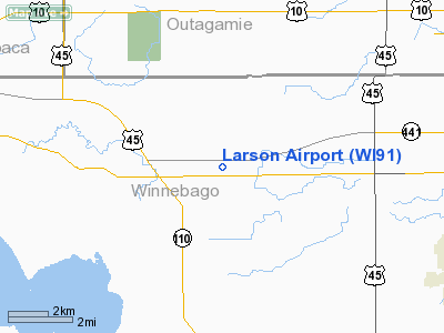
Location & QuickFacts
| FAA Information Effective: | 2008-09-25 |
| Airport Identifier: | WI91 |
| Airport Status: | Operational |
| Longitude/Latitude: | 088-38-22.3960W/44-12-09.9390N
-88.639554/44.202761 (Estimated) |
| Elevation: | 800 ft / 243.84 m (Estimated) |
| Land: | 0 acres |
| From nearest city: | 1 nautical miles NW of Larsen, WI |
| Location: | Winnebago County, WI |
| Magnetic Variation: | 01W (1985) |
Owner & Manager
| Ownership: | Privately owned |
| Owner: | Abe & Theda Eckstein |
| Address: | 8654 County Road M
Larsen, WI 54947 |
| Phone number: | 920-836-2886 |
| Manager: | Abe Eckstein |
| Address: | 8654 County Road M
Larsen, WI 54947 |
| Phone number: | 920-836-2886 |
Airport Operations and Facilities
| Airport Use: | Private |
| Wind indicator: | Yes |
| Segmented Circle: | No |
| Control Tower: | No |
| Landing fee charge: | No |
| Sectional chart: | Green Bay |
| Region: | AGL - Great Lakes |
| Boundary ARTCC: | ZAU - Chicago |
| Tie-in FSS: | GRB - Green Bay |
| FSS on Airport: | No |
| FSS Toll Free: | 1-800-WX-BRIEF |
Airport Services
| Airframe Repair: | NONE |
| Power Plant Repair: | NONE |
Runway Information
Runway 18/36
| Dimension: | 2300 x 100 ft / 701.0 x 30.5 m |
| Surface: | TURF, |
| |
Runway 18 |
Runway 36 |
| Traffic Pattern: | Left | Left |
| Obstruction: | 75 ft pline, 1500.0 ft from runway, 20:1 slope to clear | |
|
Radio Navigation Aids
| ID |
Type |
Name |
Ch |
Freq |
Var |
Dist |
| AQ | NDB | Kooky | | 407.00 | 02W | 10.4 nm |
| PCZ | NDB | Waupaca | | 382.00 | 01W | 18.0 nm |
| SG | NDB | Depre | | 332.00 | 02W | 24.8 nm |
| CLI | NDB | Clintonville | | 209.00 | 02W | 25.3 nm |
| UNU | NDB | Juneau | | 344.00 | 01W | 46.6 nm |
| MTW | VOR/DME | Manitowoc | 047X | 111.00 | 02W | 41.6 nm |
| FAH | VOR/DME | Falls | 37X | 110.00 | 02W | 43.0 nm |
| OSH | VORTAC | Oshkosh | 055X | 111.80 | 02E | 13.3 nm |
| GRB | VORTAC | Green Bay | 102X | 115.50 | 01E | 28.5 nm |
| STE | VORTAC | Stevens Point | 043X | 110.60 | 01W | 43.4 nm |
Remarks
- BASED ON PLINE WHICH CROSSES RWY.
Images and information placed above are from
http://www.airport-data.com/airport/WI91/
We thank them for the data!
| General Info
|
| Country |
United States
|
| State |
WISCONSIN
|
| FAA ID |
5WI4
|
| Latitude |
45-04-52.946N
|
| Longitude |
087-40-45.382W
|
| Elevation |
615 feet
|
| Near City |
MARINETTE
|
We don't guarantee the information is fresh and accurate. The data may
be wrong or outdated.
For more up-to-date information please refer to other sources.
|
|


