 |
|
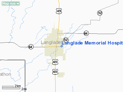
Langlade Memorial Hospital Heliport |
Location & QuickFacts
| FAA Information Effective: | 2008-09-25 |
| Airport Identifier: | WI45 |
| Airport Status: | Operational |
| Longitude/Latitude: | 089-08-21.4060W/45-08-29.3820N
-89.139279/45.141495 (Estimated) |
| Elevation: | 1500 ft / 457.20 m (Estimated) |
| Land: | 0 acres |
| From nearest city: | 0 nautical miles N of Antigo, WI |
| Location: | Langlade County, WI |
| Magnetic Variation: | 01W (1995) |
Owner & Manager
| Ownership: | Privately owned |
| Owner: | Religious Hosp. Of St. Joseph
RELIGIOUS HOSPITALLERS OF ST. JOSEPH; HOTEL DIEU. |
| Address: | 112 East 5th Avenue
Antigo, WI 54409 |
| Phone number: | 715-623-2331 |
| Manager: | Gerald A. Bonfigt |
| Address: | 112 East 5th Avenue
Antigo, WI 54409 |
| Phone number: | 715-623-9214 |
Airport Operations and Facilities
| Airport Use: | Private
MEDICAL USE. |
| Wind indicator: | Yes |
| Segmented Circle: | No |
| Control Tower: | No |
| Lighting Schedule: | PHONE REQ
FOR PERIMETER LGTS CTC AMGR 715-623-2331. |
| Sectional chart: | Green Bay |
| Region: | AGL - Great Lakes |
| Boundary ARTCC: | ZMP - Minneapolis |
| Tie-in FSS: | GRB - Green Bay |
| FSS on Airport: | No |
| FSS Toll Free: | 1-800-WX-BRIEF |
Runway Information
Helipad H1
| Dimension: | 30 x 30 ft / 9.1 x 9.1 m |
| Surface: | ASPH, |
| |
Runway H1 |
Runway |
| Traffic Pattern: | Left | Left |
| Markings: | Basic, | , |
|
Radio Navigation Aids
| ID |
Type |
Name |
Ch |
Freq |
Var |
Dist |
| AIG | NDB | Antigo | | 347.00 | 02W | 1.5 nm |
| RRL | NDB | Merrill | | 257.00 | 01W | 24.2 nm |
| FZK | NDB | Wausau | | 243.00 | 01E | 24.3 nm |
| CLI | NDB | Clintonville | | 209.00 | 02W | 35.9 nm |
| EGV | NDB | Eagle River | | 341.00 | 02W | 47.8 nm |
| DO | NDB | Dougy | | 236.00 | 01W | 48.5 nm |
| PCZ | NDB | Waupaca | | 382.00 | 01W | 48.9 nm |
| MDZ | NDB | Medford | | 335.00 | 00E | 49.6 nm |
| AUW | VORTAC | Wausau | 053X | 111.60 | 02E | 26.0 nm |
| RHI | VORTAC | Rhinelander | 029X | 109.20 | 02E | 32.5 nm |
| STE | VORTAC | Stevens Point | 043X | 110.60 | 01W | 39.6 nm |
Remarks
- PRVDD APCH/DEP 120-210 AND 300-030; AREA IS MKD; COMPLY WITH FAR PART 91.126(B)(2).
Images and information placed above are from
http://www.airport-data.com/airport/WI45/
We thank them for the data!
| General Info
|
| Country |
United States
|
| State |
WISCONSIN
|
| FAA ID |
WI45
|
| Latitude |
45-08-29.382N
|
| Longitude |
089-08-21.406W
|
| Elevation |
1500 feet
|
| Near City |
ANTIGO
|
We don't guarantee the information is fresh and accurate. The data may
be wrong or outdated.
For more up-to-date information please refer to other sources.
|
|


