|
 |
|
||||
|
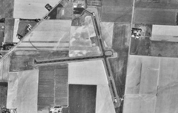
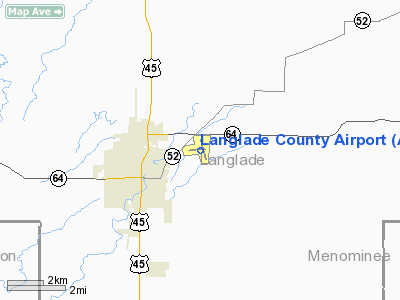
Langlade County Airport (ICAO: KAIG, FAA LID: AIG) is a county-owned public-use airport located two nautical miles (4 km) northeast of the central business district of Antigo, a city in Langlade County, Wisconsin, United States. Although most U.S. airports use the same three-letter location identifier for the FAA and IATA, this airport is assigned AIG by the FAA but has no designation from the IATA (which assigned AIG to Yalinga in the Central African Republic). Facilities and aircraftLanglade County Airport covers an area of 440 acres (178 ha) at an elevation of 1,521 feet (464 m) above mean sea level. It has two asphalt paved runways: 16/34 is 4,001 by 75 feet (1,220 x 23 m); 8/26 is 3,400 by 75 feet (1,036 x 23 m). For the 12-month period ending September 27, 2005, the airport had 8,250 aircraft operations, an average of 22 per day: 97% general aviation, 2% air taxi and 1% military. ANTIGO (AIG) Non-directional beacon, 347 kHz, is located at the field. Antigo Air LLC is the Fixed base operator. In March 2008, the Governor of Wisconsin approved plans to construct a new T-hangar for nearly $400,000 with the Federal Aviation Administration providing the bulk of the funding. Incidents
History
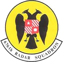
During 1943 and 1944 was used by the United States Army Air Forces as a contract glider training airfield. Known as Antigo Airport. Anderson Air Activities provided instruction. Used primarily C-47 Skytrains and Waco CG-4 unpowered Gliders. The mission of the school was to train glider pilot students in proficiency in operation of gliders in various types of towed and soaring flight, both day and night, and in servicing of gliders in the field. I believe the above to be inaccurate in that the Antigo glider training was Preliminary training, not Advanced, large glider (CG-4A) training. The school was one of 18 private operator contract schools that ran for 90 days beginning approximately July 6, 1942. There were but a few two place soaring gliders available for training. The Army delivered a few single engine, L type aircraft to be used by these schools and these were not as plentiful as was promised and necessary. The primary training in these aircraft involved so called "dead-stick" landings. The student and instructor flew to various prescribed altitudes up to 5,000 feet (1,500 m) and the engine was shut off. The student then landed the plane as a glider. By September 1942 the Southeast Air Forces Training Command has been instructed to shut down these schools in North Dakota, Wisconsin and Minnesota. The shortage of gliders and single engine aircraft did not allow these contract schools to train and produce the number of students required by the USAAF. The schools were shut, the Army flew the planes out and the land was returned to the local farmers. In the meantime, Training Command was opening its glider pilot training schools. The first CG-4A gliders were not delivered until the first part of September 1942. these went to Lockbourne near Columbus, Ohio. They were used there until early October when the gliders and students were sent to Smyrna, Tennessee, then to Stuttgart, Arkansas. Inactivated on 8 September 1944 with the drawdown of AAFTC's pilot training program. Declared surplus and turned over to the Army Corps of Engineers on 30 September 1945. Eventually discharged to the War Assets Administration (WAA) and returned to being a civil airport. During the Cold War was used jointly by the United States Air Force as a Air Defense Command RADAR station (Antigo Air Force Station (P-19)) beginning in June 1952 Hosted 676th Aircraft Control and Warning Squadron under ADC 4706th Air Defense Wing; 23d Air Division. Operated an AN/FPS-3 search radar and an AN/FPS-4 height-finder radar. At the end of 1958 this site was operating an AN/FPS-20 search radar and an AN/FPS-6 height-finder radar. A second AN/FPS-6B height-finder radar was added in 1959. Antigo joined the SAGE system in 1960. During 1962 an AN/FPS-35 replaced the AN/FPS-20 set. The AN/FPS-6B was modified to an AN/FPS-90 in 1964. The AN/FPS-6 was also modified to an AN/FPS-90 in 1966. One AN/FPS-90 was retired in 1969 Closed on 11 March 1977. The above content comes from Wikipedia and is published under free licenses – click here to read more.
Location & QuickFacts
Owner & Manager
Airport Operations and Facilities
Airport Communications
Airport Services
Runway InformationRunway 08/26
Runway 16/34
Radio Navigation Aids
Images and information placed above are from We thank them for the data!
We don't guarantee the information is fresh and accurate. The data may
be wrong or outdated.
|
|||||||||||||||||||||||||||||||||||||||||||||||||||||||||||||||||||||||||||||||||||||||||||||||||||||||||||||||||||||||||||||||||||||||||||||||||||||||||||||||||||||||||||||||||||||||||||||||||||||||||||||||||||||||||||||||||||||||||||||||||||||||||||||||||||||||||||||||||||||||||||||||||||||||||||||||||||||||||||||||||||||||||||||||||||||||||||||||||||||||||||||||||||||||||

 |
|
Copyright 2004-2026 © by Airports-Worldwide.com, Vyshenskoho st. 36, Lviv 79010, Ukraine Legal Disclaimer |