|
|
 |
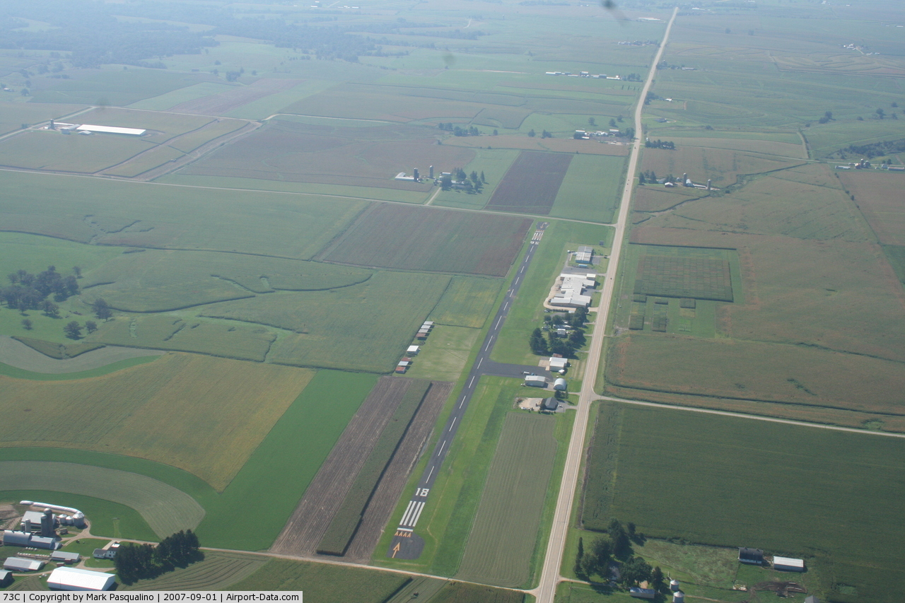
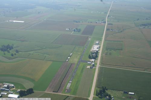
(Click on the photo to enlarge) |
 |
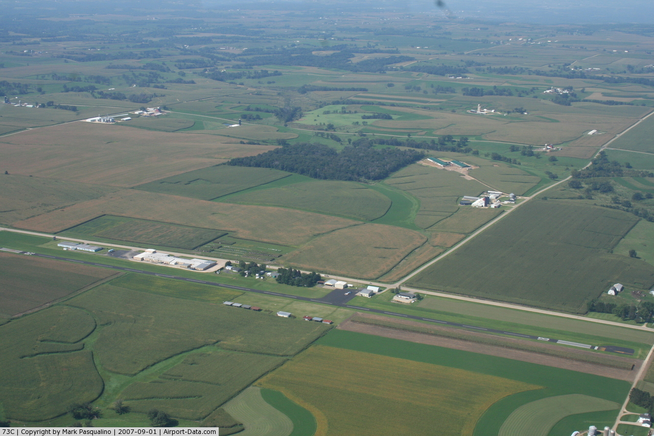
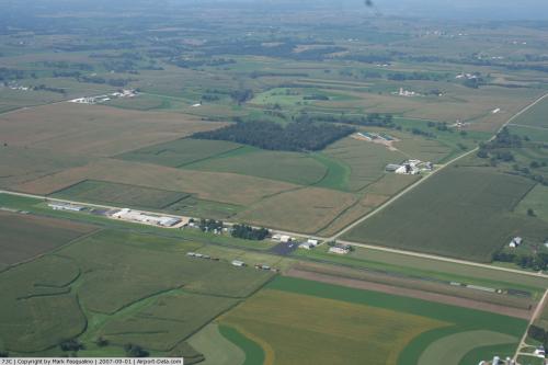
(Click on the photo to enlarge) |
 |
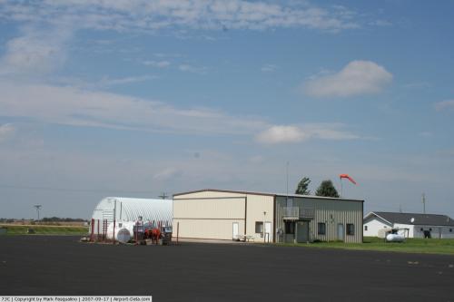
(Click on the photo to enlarge) |
Location & QuickFacts
| FAA Information Effective: | 2008-09-25 |
| Airport Identifier: | 73C |
| Airport Status: | Operational |
| Longitude/Latitude: | 090-40-51.4570W/42-46-49.9700N
-90.680960/42.780547 (Estimated) |
| Elevation: | 1008 ft / 307.24 m (Estimated) |
| Land: | 27 acres |
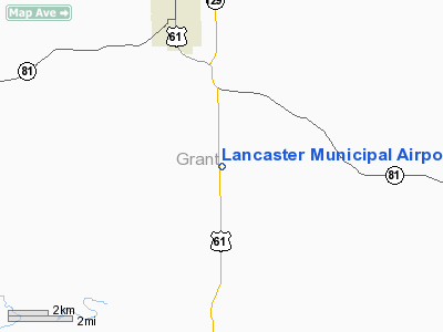
| From nearest city: | 4 nautical miles S of Lancaster, WI |
| Location: | Grant County, WI |
| Magnetic Variation: | 01E (1985) |
Owner & Manager
| Ownership: | Publicly owned |
| Owner: | City Of Lancaster |
| Address: | City Hall, 206 S Madison Street
Lancaster, WI 53813 |
| Phone number: | 608-723-5196 |
| Manager: | Jerry Carroll |
| Address: | 206 S Madison Street
Lancaster, WI 53813 |
| Phone number: | 608-723-7543 |
Airport Operations and Facilities
| Airport Use: | Open to public |
| Wind indicator: | Yes |
| Segmented Circle: | No |
| Control Tower: | No |
| Lighting Schedule: | DUSK-DAWN |
| Beacon Color: | Clear-Green (lighted land airport) |
| Landing fee charge: | No |
| Sectional chart: | Chicago |
| Region: | AGL - Great Lakes |
| Traffic Pattern Alt: | 800 ft |
| Boundary ARTCC: | ZAU - Chicago |
| Tie-in FSS: | GRB - Green Bay |
| FSS on Airport: | No |
| FSS Toll Free: | 1-800-WX-BRIEF |
| NOTAMs Facility: | GRB (NOTAM-d service avaliable) |
| Federal Agreements: | N |
Airport Communications
| CTAF: | 122.800 |
| Unicom: | 122.800 |
Airport Services
| Fuel available: | 100LLMOGAS |
Runway Information
Runway 18/36
| Dimension: | 3850 x 45 ft / 1173.5 x 13.7 m |
| Surface: | ASPH, Fair Condition |
| Weight Limit: | Single wheel: 13000 lbs. |
| Edge Lights: | Low |
| |
Runway 18 |
Runway 36 |
| Longitude: | 090-40-51.4700W | 090-40-50.4400W |
| Latitude: | 42-47-16.4300N | 42-46-38.5100N |
| Elevation: | 1010.00 ft | 1005.00 ft |
| Traffic Pattern: | Left | Left |
| Markings: | Basic, Fair Condition | Basic, Fair Condition |
| Displaced threshold: | 155.00 ft | 220.00 ft |
| Runway End Identifier: | No | No |
| Centerline Lights: | No | No |
| Touchdown Lights: | No | No |
| Obstruction: | 38 ft tree, 1360.0 ft from runway, 220 ft right of centerline, 30:1 slope to clear
ROAD 50 FT FM THR. | , 50:1 slope to clear
RD 93 FT FM THR. |
|
Radio Navigation Aids
| ID |
Type |
Name |
Ch |
Freq |
Var |
Dist |
| PVB | NDB | Platteville | | 203.00 | 01E | 12.1 nm |
| MRJ | NDB | Mineral Point | | 365.00 | 00W | 21.0 nm |
| MXO | NDB | Monticello | | 397.00 | 01E | 40.3 nm |
| OQW | NDB | Maquoketa | | 386.00 | 02E | 43.9 nm |
| XWY | NDB | West Union | | 278.00 | 02E | 49.5 nm |
| LNR | VOR/DME | Lone Rock | 075X | 112.80 | 00E | 39.2 nm |
| DBQ | VORTAC | Dubuque | 105X | 115.80 | 04E | 22.8 nm |
| UKN | VORTAC | Waukon | 113X | 116.60 | 05E | 48.1 nm |
Remarks
- ULTRALIGHT & SKYDIVING ACTIVITY ON & INVOF ARPT.
- CAUTION: OCNL VEHICLES/PEOPLE CROSSING RWY TO REACH HGR AREA ON EAST SIDE OF RWY.
- RY 18/36 35 FT PLINE PARALLELS W SIDE 365 FT FM CNTRLN.
- DETERMINATION PENDING.
Images and information placed above are from
http://www.airport-data.com/airport/73C/
We thank them for the data!
| General Info
|
| Country |
United States
|
| State |
WISCONSIN
|
| FAA ID |
73C
|
| Latitude |
42-46-49.970N
|
| Longitude |
090-40-51.457W
|
| Elevation |
1008 feet
|
| Near City |
LANCASTER
|
We don't guarantee the information is fresh and accurate. The data may
be wrong or outdated.
For more up-to-date information please refer to other sources.
|
|