 |
|
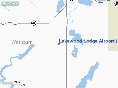
Location & QuickFacts
| FAA Information Effective: | 2008-09-25 |
| Airport Identifier: | 14WS |
| Airport Status: | Operational |
| Longitude/Latitude: | 091-33-30.6000W/45-46-40.8300N
-91.558500/45.778008 (Estimated) |
| Elevation: | 1365 ft / 416.05 m () |
| Land: | 15 acres |
| From nearest city: | 5 nautical miles S of Stone Lake, WI |
| Location: | Washburn County, WI |
| Magnetic Variation: | 01E (1995) |
Owner & Manager
| Ownership: | Privately owned |
| Address: |
|
| Phone number: | 715-865-2902 |
| Manager: | Robert C. & Judith K Gillette |
| Address: | 78 Rivo Alto Canal
Long Beach, CA 90803 |
| Phone number: | 562-434-4712 |
Airport Operations and Facilities
| Airport Use: | Private |
| Wind indicator: | Yes |
| Segmented Circle: | No |
| Control Tower: | No |
| Sectional chart: | Green Bay |
| Region: | AGL - Great Lakes |
| Boundary ARTCC: | ZMP - Minneapolis |
| Tie-in FSS: | GRB - Green Bay |
| FSS Toll Free: | 1-800-WX-BRIEF |
Runway Information
Runway 15/33
| Dimension: | 2450 x 60 ft / 746.8 x 18.3 m |
| Surface: | TURF, |
| |
Runway 15 |
Runway 33 |
| Traffic Pattern: | Left | Left |
| Obstruction: | 30 ft trees, 400.0 ft from runway | 45 ft trees, 700.0 ft from runway |
|
Radio Navigation Aids
| ID |
Type |
Name |
Ch |
Freq |
Var |
Dist |
| SSQ | NDB | Shell Lake | | 212.00 | 01E | 15.4 nm |
| SLY | NDB | Seeley | | 344.00 | 01E | 21.4 nm |
| UBE | NDB | Cumberland | | 375.00 | 01E | 23.9 nm |
| RCX | NDB | Rusk County | | 356.00 | 00W | 28.7 nm |
| BXR | NDB | Big Doctor | | 203.00 | 02E | 34.0 nm |
| OLG | NDB | Solon Springs | | 388.00 | 01E | 34.1 nm |
| AHH | NDB | Ameron | | 278.00 | 01E | 45.4 nm |
| PBH | NDB | Phillips | | 263.00 | 00E | 48.3 nm |
| PKF | NDB | Park Falls | | 371.00 | 01W | 48.6 nm |
| HYR | VOR/DME | Hayward | 081X | 113.40 | 03E | 15.2 nm |
| RPD | VOR/DME | Rice Lake | 037X | 110.00 | 01E | 23.7 nm |
| RZN | VOR/DME | Siren | 031X | 109.40 | 02E | 34.3 nm |
Remarks
- SEE AIRSPACE CASE 95-AGL-1269-NRA
Images and information placed above are from
http://www.airport-data.com/airport/14WS/
We thank them for the data!
| General Info
|
| Country |
United States
|
| State |
WISCONSIN
|
| FAA ID |
14WS
|
| Latitude |
45-46-40.830N
|
| Longitude |
091-33-30.600W
|
| Elevation |
1365 feet
|
| Near City |
STONE LAKE
|
We don't guarantee the information is fresh and accurate. The data may
be wrong or outdated.
For more up-to-date information please refer to other sources.
|
|


