 |
|
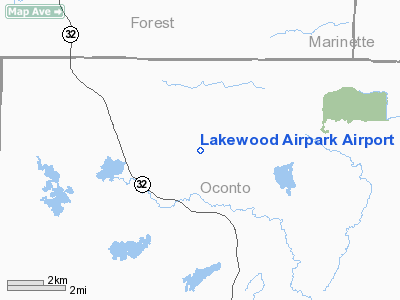
Location & QuickFacts
| FAA Information Effective: | 2008-09-25 |
| Airport Identifier: | 4WN3 |
| Airport Status: | Operational |
| Longitude/Latitude: | 088-32-09.5858W/45-19-55.3867N
-88.535996/45.332052 (Estimated) |
| Elevation: | 1300 ft / 396.24 m (Estimated) |
| Land: | 80 acres |
| From nearest city: | 2 nautical miles NN of Lakewood, WI |
| Location: | Oconto County, WI |
| Magnetic Variation: | () |
Owner & Manager
| Ownership: | Privately owned |
| Owner: | Lakewood Airpark Llc |
| Address: | Box 298
Lakewood, WI 54138 |
| Manager: | Phil Hartman |
| Address: | 15605 Maiden Lake Rd
Mountain, WI 54149 |
| Phone number: | 715-276-6511 |
Airport Operations and Facilities
| Airport Use: | Private |
| Wind indicator: | Yes |
| Control Tower: | No |
| Sectional chart: | Green Bay |
| Region: | AGL - Great Lakes |
| Boundary ARTCC: | ZMP - Minneapolis |
| Tie-in FSS: | GRB - Green Bay |
| FSS Toll Free: | 1-800-WX-BRIEF |
Runway Information
Runway 09/27
| Dimension: | 2500 x 150 ft / 762.0 x 45.7 m |
| Surface: | TURF, |
| |
Runway 09 |
Runway 27 |
| Traffic Pattern: | Left | Left |
|
Radio Navigation Aids
| ID |
Type |
Name |
Ch |
Freq |
Var |
Dist |
| AIG | NDB | Antigo | | 347.00 | 02W | 26.6 nm |
| OCQ | NDB | Oconto | | 388.00 | 03W | 38.1 nm |
| CLI | NDB | Clintonville | | 209.00 | 02W | 43.7 nm |
| EGV | NDB | Eagle River | | 341.00 | 02W | 47.3 nm |
| IMT | VOR/DME | Iron Mountain | 049X | 111.20 | 02W | 34.1 nm |
| MNM | VOR/DME | Menominee | 033X | 109.60 | 00E | 38.7 nm |
| RHI | VORTAC | Rhinelander | 029X | 109.20 | 02E | 42.9 nm |
| GRB | VORTAC | Green Bay | 102X | 115.50 | 01E | 48.9 nm |
Remarks
- PRVDD CLEAR 20:1 APCHS, CLEAR OBSTACLE FREE ZONE, AND CLEAR RY SAFETY AREAS.
Images and information placed above are from
http://www.airport-data.com/airport/4WN3/
We thank them for the data!
|
|


