 |
|
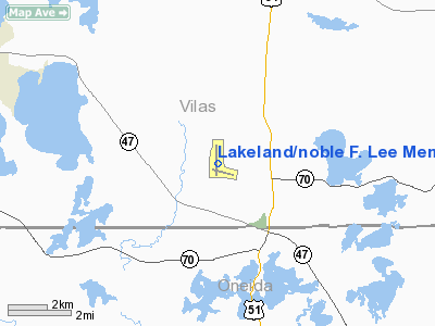
Lakeland/noble F. Lee Memorial Field Airport |
Lakeland Airport
Noble F. Lee Memorial Field |
| IATA: ARV – ICAO: KARV – FAA LID: ARV |
| Summary |
| Airport type |
Public |
| Owner |
Lakeland Airport Commission |
| Serves |
Minocqua / Woodruff, Wisconsin |
| Location |
Arbor Vitae, Wisconsin |
| Elevation AMSL |
1,629 ft / 497 m |
| Coordinates |
45°55′40″N 089°43′51″W / 45.92778°N 89.73083°W / 45.92778; -89.73083Coordinates: 45°55′40″N 089°43′51″W / 45.92778°N 89.73083°W / 45.92778; -89.73083 |
| Runways |
| Direction |
Length |
Surface |
| ft |
m |
| 18/36 |
5,150 |
1,570 |
Asphalt |
| 10/28 |
3,602 |
1,098 |
Asphalt |
| Statistics (2005) |
| Aircraft operations |
27,190 |
| Based aircraft |
48 |
| Source: Federal Aviation Administration |
Lakeland Airport (IATA: ARV, ICAO: KARV, FAA LID: ARV), also known as Noble F. Lee Memorial Field, is a public airport near Arbor Vitae, a town in Vilas County, Wisconsin, United States. The airport is three miles (5 km) northwest of the central business district of Minocqua and northwest of Woodruff, both cities in Oneida County, just south of the Vilas County border. It is owned by the Lakeland Airport Commission. Facilities and aircraft
Lakeland Airport covers an area of 520 acres (210 ha) which contains two asphalt paved runways: 18/36 measuring 5,150 x 100 ft (1,570 x 30 m) and 10/28 measuring 3,602 x 75 ft (1,098 x 23 m).
For the 12-month period ending September 20, 2005, the airport had 27,190 aircraft operations, an average of 74 per day: 88% general aviation, 12% air taxi and <1% military. At that time there were 48 aircraft based at this airport: 90% single-engine and 10% multi-engine.
Incidents
On September 12th a Cirrus SR22 arriving from General Mitchell International Airport crashed about a half a mile southwest of the Airport. All three people on board died.
The above content comes from Wikipedia and is published under free licenses – click here to read more.
Location & QuickFacts
| FAA Information Effective: | 2008-09-25 |
| Airport Identifier: | ARV |
| Airport Status: | Operational |
| Longitude/Latitude: | 089-43-51.4000W/45-55-40.5000N
-89.730944/45.927917 (Estimated) |
| Elevation: | 1629 ft / 496.52 m (Surveyed) |
| Land: | 520 acres |
| From nearest city: | 3 nautical miles NW of Minocqua-woodruff, WI |
| Location: | Vilas County, WI |
| Magnetic Variation: | 01W (1990) |
Owner & Manager
| Ownership: | Publicly owned |
| Owner: | Lakeland Airport Commission
TOWNS OF ARBOR VITAE, LAC DU FLAMBEAU, MINOCQUA, WOODRUFF. |
| Address: | 1545 N. Farming Rd.
Woodruff, WI 54568 |
| Phone number: | 715-356-3891 |
| Manager: | Brenda Borger |
| Address: | 1545 N. Farming Rd
Woodruff, WI 54568 |
| Phone number: | 715-356-4340
AFT HRS CALL 715-356-2972. |
Airport Operations and Facilities
| Airport Use: | Open to public |
| Wind indicator: | Yes |
| Segmented Circle: | No |
| Control Tower: | No |
| Lighting Schedule: | DUSK-DAWN
HIRL RY 18/36 PRESET ON LOW INTST; TO INCR INTST & ACTVT MIRL RY 10/28; REIL RYS 18, 28 & 36; VASI RYS 18 & 36; PAPI RY 28 & MALSR RY 36 - CTAF. |
| Beacon Color: | Clear-Green (lighted land airport) |
| Landing fee charge: | No |
| Sectional chart: | Green Bay |
| Region: | AGL - Great Lakes |
| Traffic Pattern Alt: | 1000 ft |
| Boundary ARTCC: | ZMP - Minneapolis |
| Tie-in FSS: | GRB - Green Bay |
| FSS on Airport: | No |
| FSS Toll Free: | 1-800-WX-BRIEF |
| NOTAMs Facility: | ARV (NOTAM-d service avaliable) |
| Federal Agreements: | NGY |
Airport Communications
| CTAF: | 122.700 |
| Unicom: | 122.700 |
Airport Services
| Fuel available: | 100LLA1+ |
| Airframe Repair: | MINOR |
| Power Plant Repair: | MINOR |
| Bottled Oxygen: | NONE |
Runway Information
Runway 10/28
| Dimension: | 3602 x 75 ft / 1097.9 x 22.9 m |
| Surface: | ASPH, Poor Condition |
| Weight Limit: | Single wheel: 35000 lbs. |
| Edge Lights: | Medium
NSTD HIRL; NSTD THLD LGTS MALS TYPE THLD LGT BAR IN ADDITION TO STD LGTG. |
| |
Runway 10 |
Runway 28 |
| Longitude: | 089-44-06.7048W | 089-43-16.6072W |
| Latitude: | 45-55-29.6861N | 45-55-23.1845N |
| Elevation: | 1622.00 ft | 1623.00 ft |
| Alignment: | 101 | 127 |
| Traffic Pattern: | Left | Left |
| Markings: | Non-precision instrument, Good Condition | Non-precision instrument, Good Condition |
| Crossing Height: | 0.00 ft | 37.00 ft |
| VASI: | | 2-light PAPI on left side |
| Visual Glide Angle: | 0.00° | 3.00° |
| Runway End Identifier: | No | Yes |
| Centerline Lights: | No | No |
| Touchdown Lights: | No | No |
| Obstruction: | 35 ft trees, 900.0 ft from runway, 20:1 slope to clear | 54 ft trees, 1450.0 ft from runway, 430L/ ft right of centerline, 23:1 slope to clear |
|
Runway 18/36
| Dimension: | 5150 x 100 ft / 1569.7 x 30.5 m |
| Surface: | ASPH, Good Condition |
| Weight Limit: | Single wheel: 90000 lbs.
Dual wheel: 150000 lbs. |
| Edge Lights: | Non-standard lighting system
NSTD HIRL; NSTD THLD LGTS MALS TYPE THLD LGT BAR IN ADDITION TO STD LGTG. |
| |
Runway 18 |
Runway 36 |
| Longitude: | 089-43-58.9007W | 089-43-57.5448W |
| Latitude: | 45-56-15.8112N | 45-55-24.9799N |
| Elevation: | 1629.00 ft | 1624.00 ft |
| Alignment: | 127 | 127 |
| ILS Type: | | LOC/DME
|
| Traffic Pattern: | Left | Left |
| Markings: | Non-precision instrument, Good Condition | Non-precision instrument, Good Condition |
| Crossing Height: | 44.00 ft | 45.00 ft |
| VASI: | 4-box on left side | 4-box on left side |
| Visual Glide Angle: | 3.00° | 3.00° |
| Approach lights: | | MALSR |
| Runway End Identifier: | Yes | Yes |
| Centerline Lights: | No | No |
| Touchdown Lights: | No | No |
| Obstruction: | 64 ft tree, 2900.0 ft from runway, 42:1 slope to clear | 55 ft trees, 2100.0 ft from runway, 500 ft left of centerline, 34:1 slope to clear |
|
Radio Navigation Aids
| ID |
Type |
Name |
Ch |
Freq |
Var |
Dist |
| ARV | NDB | Arbor Vitae | | 221.00 | 01W | 0.1 nm |
| DO | NDB | Dougy | | 236.00 | 01W | 5.6 nm |
| BDJ | NDB | Boulder Junction | | 206.00 | 02E | 12.8 nm |
| MHA | NDB | Manitowish | | 364.00 | 01W | 13.3 nm |
| EGV | NDB | Eagle River | | 341.00 | 02W | 19.6 nm |
| LNL | NDB | Land O Lakes | | 396.00 | 02W | 25.5 nm |
| RXW | NDB | Watersmeet | | 407.00 | 01E | 28.7 nm |
| PKF | NDB | Park Falls | | 371.00 | 01W | 29.1 nm |
| PBH | NDB | Phillips | | 263.00 | 00E | 31.6 nm |
| RRL | NDB | Merrill | | 257.00 | 01W | 43.9 nm |
| RHI | VORTAC | Rhinelander | 029X | 109.20 | 02E | 21.1 nm |
| IWD | VORTAC | Ironwood | 025X | 108.80 | 01E | 39.9 nm |
Remarks
Images and information placed above are from
http://www.airport-data.com/airport/ARV/
We thank them for the data!
| General Info
|
| Country |
United States
|
| State |
WISCONSIN
|
| FAA ID |
ARV
|
| Latitude |
45-55-40.532N
|
| Longitude |
089-43-51.394W
|
| Elevation |
1630 feet
|
| Near City |
MINOCQUA-WOODRUFF
|
We don't guarantee the information is fresh and accurate. The data may
be wrong or outdated.
For more up-to-date information please refer to other sources.
|
|


