|
|
 |
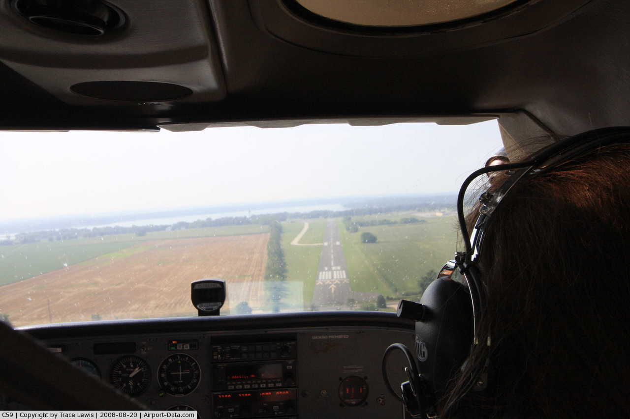
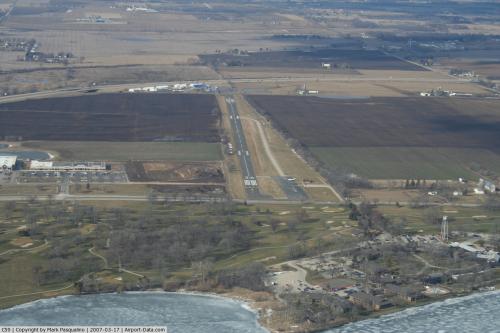
(Click on the photo to enlarge) |
 |
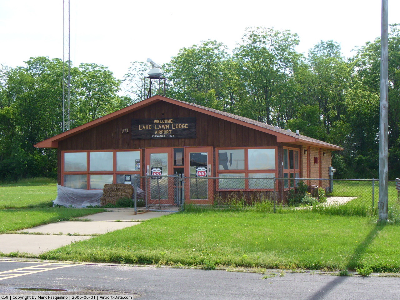
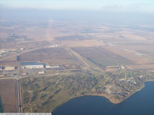
(Click on the photo to enlarge) |
 |
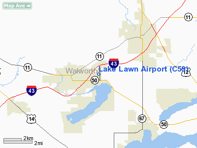
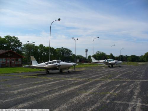
(Click on the photo to enlarge) |
 |
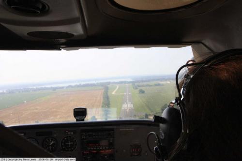
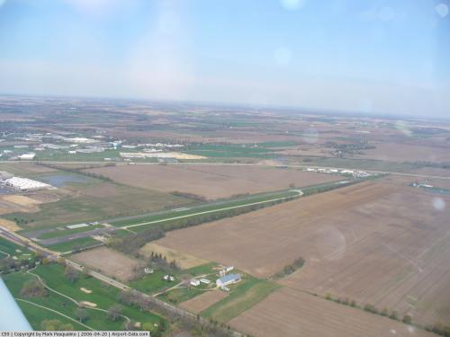
(Click on the photo to enlarge) |
 |
(Click on the photo to enlarge) |
 |
(Click on the photo to enlarge) |
Location & QuickFacts
| FAA Information Effective: | 2008-09-25 |
| Airport Identifier: | C59 |
| Airport Status: | Operational |
| Longitude/Latitude: | 088-36-04.0650W/42-38-02.8540N
-88.601129/42.634126 (Estimated) |
| Elevation: | 981 ft / 299.01 m (Estimated) |
| Land: | 40 acres |
| From nearest city: | 2 nautical miles E of Delavan, WI |
| Location: | Walworth County, WI |
| Magnetic Variation: | 02W (2005) |
Owner & Manager
| Ownership: | Privately owned |
| Owner: | Delevan Resort Airfield Llc |
| Address: | 2400 East Geneva St
Delavan, WI 53115 |
| Phone number: | 262-728-7950 |
| Manager: | Steve Carson |
| Address: | 2400 East Geneva St
Delavan, WI 53115 |
| Phone number: | 262-728-7950
EXT 756. |
Airport Operations and Facilities
| Airport Use: | Open to public |
| Wind indicator: | Yes |
| Segmented Circle: | No |
| Control Tower: | No |
| Lighting Schedule: | DUSK-DAWN |
| Beacon Color: | Clear-Green (lighted land airport) |
| Landing fee charge: | No |
| Sectional chart: | Chicago |
| Region: | AGL - Great Lakes |
| Boundary ARTCC: | ZAU - Chicago |
| Tie-in FSS: | GRB - Green Bay |
| FSS on Airport: | No |
| FSS Toll Free: | 1-800-WX-BRIEF |
| NOTAMs Facility: | GRB (NOTAM-d service avaliable) |
Airport Communications
Airport Services
| Airframe Repair: | NONE |
| Power Plant Repair: | NONE |
| Bottled Oxygen: | NONE |
| Bulk Oxygen: | NONE |
Runway Information
Runway 18/36
| Dimension: | 4423 x 80 ft / 1348.1 x 24.4 m |
| Surface: | ASPH, Poor Condition
RY 18/36 NUMEROUS LARGE CRACKS, SOUTH 600' & VEGATATION GROWING THROUGH PAVEMENT. |
| Edge Lights: | Medium
OTS INDEFLY |
| |
Runway 18 |
Runway 36 |
| Longitude: | 088-36-01.5470W | 088-36-06.5330W |
| Latitude: | 42-38-24.6410N | 42-37-41.1120N |
| Elevation: | 979.00 ft | 967.00 ft |
| Alignment: | 127 | 5 |
| Traffic Pattern: | Left | Left |
| Markings: | Non-precision instrument, Good Condition | Non-precision instrument, Good Condition |
| Displaced threshold: | 320.00 ft | 300.00 ft |
| Runway End Identifier: | Yes
OTS INDEFLY. | |
| Centerline Lights: | No | No |
| Touchdown Lights: | No | No |
| Obstruction: | 30 ft tree, 200.0 ft from runway, 180 ft left of centerline
+25 FT TREE AT DSPLCD THLD; 0:1 BASED ON DSPLCD THLD; APCH RATIO 18:1 TO DSPLCD THLD.
+4 FT FENCE 12 FT FM THLD; RD 40 FT FM THLD; +60 FT POLE 90 FT FM THLD 240 FT L & 85 FT FM THLD 170 FT R; +4 FT FENCE AT THLD 120 FT L; +66 FT TREE 90 FT FM THLD 175 FT R. | 60 ft tree, 200.0 ft from runway, 200 ft left of centerline
APCH RATIO 9:1 TO DSPLCD THLD.
RD 50 FT FM THLD; +56 FT TREES 150 FM THLD 200 FT L. |
|
Radio Navigation Aids
| ID |
Type |
Name |
Ch |
Freq |
Var |
Dist |
| LVV | NDB | Lake Lawn | | 404.00 | 00W | 3.9 nm |
| JVL | NDB | Janesville | | 375.00 | 03E | 19.5 nm |
| UES | NDB | Waukesha | | 359.00 | 01W | 29.5 nm |
| GM | NDB | Teels | | 242.00 | 02W | 29.7 nm |
| RA | NDB | Paser | | 206.00 | 00E | 31.2 nm |
| RYV | NDB | Rock River | | 371.00 | 01W | 32.9 nm |
| BL | NDB | Yanks | | 260.00 | 02W | 40.9 nm |
| MS | NDB | Monah | | 400.00 | 00E | 41.7 nm |
| DKB | NDB | Dekalb | | 209.00 | 02W | 42.3 nm |
| HXF | NDB | Hartford | | 200.00 | 00E | 43.8 nm |
| ME | NDB | Deana | | 350.00 | 00E | 47.5 nm |
| UNU | NDB | Juneau | | 344.00 | 01W | 48.0 nm |
| FEP | NDB | Freeport | | 335.00 | 00E | 49.5 nm |
| BUU | VOR/DME | Burbun | 092X | 114.50 | 01W | 13.6 nm |
| JVL | VOR/DME | Janesville | 090X | 114.30 | 03E | 22.8 nm |
| ENW | VOR/DME | Kenosha | 029X | 109.20 | 02W | 29.7 nm |
| HRK | VOR/DME | Horlick | 124X | 117.70 | 02W | 35.6 nm |
| RFD | VOR/DME | Rockford | 045X | 110.80 | 01E | 36.2 nm |
| LJT | VOR/DME | Timmerman | 072X | 112.50 | 02W | 37.9 nm |
| OBK | VOR/DME | Northbrook | 077X | 113.00 | 02W | 38.0 nm |
| DPA | VOR/DME | Dupage | 021X | 108.40 | 02E | 46.1 nm |
| ORD | VOR/DME | Chicago O'hare | 086X | 113.90 | 02E | 49.7 nm |
| BAE | VORTAC | Badger | 111X | 116.40 | 02E | 32.2 nm |
| MSN | VORTAC | Madison | 023X | 108.60 | 03E | 44.7 nm |
| MKE | VOT | Milwaukee | | 109.00 | | 36.4 nm |
| ORD | VOT | Chicago O'hare Intl | | 112.00 | | 49.9 nm |
Remarks
- RY 18 & 36 DITCH BTWN RY ENDS & ROADS.
- ARPT CLSD FOR NIGHT OPNS.
- TFC PTN OPER TO W OF DELAVAN LAKE BTWN ARPT & TWIST ARPT 1 1/2 NM SE.
Images and information placed above are from
http://www.airport-data.com/airport/C59/
We thank them for the data!
| General Info
|
| Country |
United States
|
| State |
WISCONSIN
|
| FAA ID |
C59
|
| Latitude |
42-38-02.854N
|
| Longitude |
088-36-04.065W
|
| Elevation |
981 feet
|
| Near City |
DELAVAN
|
We don't guarantee the information is fresh and accurate. The data may
be wrong or outdated.
For more up-to-date information please refer to other sources.
|
|