 |
|
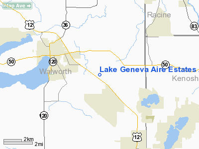
Lake Geneva Aire Estates Airport |
Location & QuickFacts
| FAA Information Effective: | 2008-09-25 |
| Airport Identifier: | WI89 |
| Airport Status: | Operational |
| Longitude/Latitude: | 088-22-02.3400W/42-34-20.0620N
-88.367317/42.572239 (Estimated) |
| Elevation: | 880 ft / 268.22 m (Estimated) |
| Land: | 134 acres |
| From nearest city: | 3 nautical miles SE of Lake Geneva, WI |
| Location: | Walworth County, WI |
| Magnetic Variation: | 01W (1985) |
Owner & Manager
| Ownership: | Privately owned |
| Owner: | Lk Geneva Aire Prop Owners |
| Address: | Rt 3, Box 600-26
Lake Geneva, WI 53147 |
| Phone number: | 414-248-2976 |
| Manager: | John H. Stark |
| Address: | Rt 3, Box 600-26
Lake Geneva, WI 53147 |
| Phone number: | 414-248-2976 |
Airport Operations and Facilities
| Airport Use: | Private |
| Wind indicator: | Yes |
| Segmented Circle: | No |
| Control Tower: | No |
| Lighting Schedule: | DUSK-2300
ACTVT MIRL RY 04/22 - UNICOM. |
| Landing fee charge: | No |
| Sectional chart: | Chicago |
| Region: | AGL - Great Lakes |
| Boundary ARTCC: | ZAU - Chicago |
| Tie-in FSS: | GRB - Green Bay |
| FSS on Airport: | No |
| FSS Toll Free: | 1-800-WX-BRIEF |
Airport Communications
Runway Information
Runway 04/22
| Dimension: | 2300 x 40 ft / 701.0 x 12.2 m |
| Surface: | ASPH, |
| Edge Lights: | Medium |
| |
Runway 04 |
Runway 22 |
| Traffic Pattern: | Left | Left |
|
Radio Navigation Aids
| ID |
Type |
Name |
Ch |
Freq |
Var |
Dist |
| LVV | NDB | Lake Lawn | | 404.00 | 00W | 12.6 nm |
| RA | NDB | Paser | | 206.00 | 00E | 21.7 nm |
| GM | NDB | Teels | | 242.00 | 02W | 24.8 nm |
| UES | NDB | Waukesha | | 359.00 | 01W | 29.0 nm |
| JVL | NDB | Janesville | | 375.00 | 03E | 29.9 nm |
| BL | NDB | Yanks | | 260.00 | 02W | 36.4 nm |
| ME | NDB | Deana | | 350.00 | 00E | 39.4 nm |
| RYV | NDB | Rock River | | 371.00 | 01W | 39.4 nm |
| DKB | NDB | Dekalb | | 209.00 | 02W | 41.2 nm |
| HXF | NDB | Hartford | | 200.00 | 00E | 46.7 nm |
| BUU | VOR/DME | Burbun | 092X | 114.50 | 01W | 7.6 nm |
| ENW | VOR/DME | Kenosha | 029X | 109.20 | 02W | 19.3 nm |
| HRK | VOR/DME | Horlick | 124X | 117.70 | 02W | 27.0 nm |
| OBK | VOR/DME | Northbrook | 077X | 113.00 | 02W | 28.0 nm |
| JVL | VOR/DME | Janesville | 090X | 114.30 | 03E | 32.7 nm |
| LJT | VOR/DME | Timmerman | 072X | 112.50 | 02W | 35.4 nm |
| ORD | VOR/DME | Chicago O'hare | 086X | 113.90 | 02E | 40.7 nm |
| DPA | VOR/DME | Dupage | 021X | 108.40 | 02E | 41.0 nm |
| RFD | VOR/DME | Rockford | 045X | 110.80 | 01E | 42.4 nm |
| BAE | VORTAC | Badger | 111X | 116.40 | 02E | 32.9 nm |
| MKE | VOT | Milwaukee | | 109.00 | | 30.7 nm |
| ORD | VOT | Chicago O'hare Intl | | 112.00 | | 40.9 nm |
Images and information placed above are from
http://www.airport-data.com/airport/WI89/
We thank them for the data!
| General Info
|
| Country |
United States
|
| State |
WISCONSIN
|
| FAA ID |
WI89
|
| Latitude |
42-34-20.062N
|
| Longitude |
088-22-02.340W
|
| Elevation |
880 feet
|
| Near City |
LAKE GENEVA
|
We don't guarantee the information is fresh and accurate. The data may
be wrong or outdated.
For more up-to-date information please refer to other sources.
|
|


