 |
|
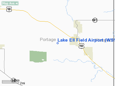
Location & QuickFacts
| FAA Information Effective: | 2008-09-25 |
| Airport Identifier: | WS14 |
| Airport Status: | Operational |
| Longitude/Latitude: | 089-21-31.4120W/44-27-50.9020N
-89.358726/44.464139 (Estimated) |
| Elevation: | 1113 ft / 339.24 m (Estimated) |
| Land: | 20 acres |
| From nearest city: | 3 nautical miles NW of Amherst, WI |
| Location: | Portage County, WI |
| Magnetic Variation: | 00W (1985) |
Owner & Manager
| Ownership: | Privately owned |
| Owner: | Bert E Glodowski |
| Address: | 4095 Town Line Road
Amherst, WI 54406 |
| Phone number: | 715-824-5603 |
| Manager: | Bert Glodowski |
| Address: | 4095 Town Line Road
Amherst, WI 54406 |
| Phone number: | 715-824-5603 |
Airport Operations and Facilities
| Airport Use: | Private |
| Wind indicator: | Yes |
| Segmented Circle: | No |
| Control Tower: | No |
| Sectional chart: | Green Bay |
| Region: | AGL - Great Lakes |
| Boundary ARTCC: | ZMP - Minneapolis |
| Tie-in FSS: | GRB - Green Bay |
| FSS on Airport: | No |
| FSS Toll Free: | 1-800-WX-BRIEF |
Runway Information
Runway 08/26
| Dimension: | 1200 x 50 ft / 365.8 x 15.2 m
600' STWY ON WEST END. |
| Surface: | TURF, |
| |
Runway 08 |
Runway 26 |
| Traffic Pattern: | Left | Left |
| Obstruction: | 30 ft pline, 1200.0 ft from runway | |
|
Runway 18/36
| Dimension: | 1000 x 40 ft / 304.8 x 12.2 m
600' STWY ON WEST END. |
| Surface: | TURF, |
| |
Runway 18 |
Runway 36 |
| Traffic Pattern: | Left | Left |
| Displaced threshold: | 0.00 ft | 460.00 ft |
|
Radio Navigation Aids
| ID |
Type |
Name |
Ch |
Freq |
Var |
Dist |
| PCZ | NDB | Waupaca | | 382.00 | 01W | 16.7 nm |
| ISW | NDB | Wisconsin Rapids | | 215.00 | 01W | 21.5 nm |
| CLI | NDB | Clintonville | | 209.00 | 02W | 28.4 nm |
| FZK | NDB | Wausau | | 243.00 | 01E | 30.1 nm |
| MFI | NDB | Marshfield | | 391.00 | 00E | 37.1 nm |
| AIG | NDB | Antigo | | 347.00 | 02W | 43.0 nm |
| AQ | NDB | Kooky | | 407.00 | 02W | 43.9 nm |
| RRL | NDB | Merrill | | 257.00 | 01W | 46.5 nm |
| VIQ | NDB | Neillsville | | 368.00 | 01W | 49.9 nm |
| VOK | TACAN | Volk | 041X | | 00E | 49.9 nm |
| STE | VORTAC | Stevens Point | 043X | 110.60 | 01W | 8.8 nm |
| AUW | VORTAC | Wausau | 053X | 111.60 | 02E | 25.0 nm |
| OSH | VORTAC | Oshkosh | 055X | 111.80 | 02E | 44.8 nm |
Images and information placed above are from
http://www.airport-data.com/airport/WS14/
We thank them for the data!
| General Info
|
| Country |
United States
|
| State |
WISCONSIN
|
| FAA ID |
WS14
|
| Latitude |
44-27-50.902N
|
| Longitude |
089-21-31.412W
|
| Elevation |
1113 feet
|
| Near City |
AMHERST
|
We don't guarantee the information is fresh and accurate. The data may
be wrong or outdated.
For more up-to-date information please refer to other sources.
|
|


