 |
|
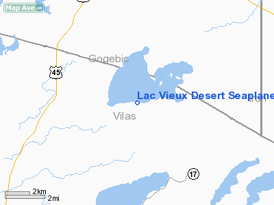
Lac Vieux Desert Seaplane Base Airport |
Location & QuickFacts
| FAA Information Effective: | 2008-09-25 |
| Airport Identifier: | 16WI |
| Airport Status: | Operational |
| Longitude/Latitude: | 089-07-15.4870W/46-07-17.8270N
-89.120969/46.121619 (Estimated) |
| Elevation: | 1690 ft / 515.11 m (Estimated) |
| Land: | 4400 acres |
| From nearest city: | 4 nautical miles N of Phelps, WI |
| Location: | Vilas County, WI |
| Magnetic Variation: | 01W (1990) |
Owner & Manager
| Ownership: | Privately owned |
| Owner: | Karl Kerscher
SEAPLANE BASE. |
| Address: | P.o. Box 507
Land O Lakes, WI 54540 |
| Phone number: | 715-547-3868 |
| Manager: | Karl Kerscher |
| Address: | P.o. Box 507
Land O'lakes, WI 54540 |
Airport Operations and Facilities
| Airport Use: | Private |
| Segmented Circle: | No |
| Control Tower: | No |
| Sectional chart: | Green Bay |
| Region: | AGL - Great Lakes |
| Boundary ARTCC: | ZMP - Minneapolis |
| Tie-in FSS: | GRB - Green Bay |
| FSS Toll Free: | 1-800-WX-BRIEF |
Runway Information
Runway 11/29
| Dimension: | 10000 x 4000 ft / 3048.0 x 1219.2 m |
| Surface: | WATER, |
| |
Runway 11 |
Runway 29 |
| Traffic Pattern: | Left | Left |
|
Runway 17/35
| Dimension: | 10000 x 4000 ft / 3048.0 x 1219.2 m |
| Surface: | WATER, |
| |
Runway 17 |
Runway 35 |
| Traffic Pattern: | Left | Left |
|
Radio Navigation Aids
| ID |
Type |
Name |
Ch |
Freq |
Var |
Dist |
| LNL | NDB | Land O Lakes | | 396.00 | 02W | 4.1 nm |
| RXW | NDB | Watersmeet | | 407.00 | 01E | 12.0 nm |
| EGV | NDB | Eagle River | | 341.00 | 02W | 12.8 nm |
| BDJ | NDB | Boulder Junction | | 206.00 | 02E | 22.3 nm |
| ARV | NDB | Arbor Vitae | | 221.00 | 01W | 28.0 nm |
| DO | NDB | Dougy | | 236.00 | 01W | 30.8 nm |
| MHA | NDB | Manitowish | | 364.00 | 01W | 31.7 nm |
| OGM | NDB | Ontonagon | | 375.00 | 00W | 44.9 nm |
| IMT | VOR/DME | Iron Mountain | 049X | 111.20 | 02W | 46.0 nm |
| RHI | VORTAC | Rhinelander | 029X | 109.20 | 02E | 32.5 nm |
| IWD | VORTAC | Ironwood | 025X | 108.80 | 01E | 48.5 nm |
Remarks
Images and information placed above are from
http://www.airport-data.com/airport/16WI/
We thank them for the data!
| General Info
|
| Country |
United States
|
| State |
WISCONSIN
|
| FAA ID |
16WI
|
| Latitude |
46-07-17.827N
|
| Longitude |
089-07-15.487W
|
| Elevation |
1690 feet
|
| Near City |
PHELPS
|
We don't guarantee the information is fresh and accurate. The data may
be wrong or outdated.
For more up-to-date information please refer to other sources.
|
|


